

This Issue: Roman Road, Hawes, Yorkshire Dales & Rivington Pike, West Pennies
Roman Road, Hawes, Yorkshire Dales
As more trails are documented in the magazine it is becoming possible to link several together to form a great riding loop.

In this issue we have detailed a 5.25-mile Roman road in the Yorkshire Dales which can be linked with a few other previously documented lanes, namely, Stalling Busk (issue 20), The Highway (issue 21), Settle Trails (issue 32), Settle Trails Part Two (issue 33) and Masham Moor (issue 34). Linked together these will give you the best part of a full day’s riding.
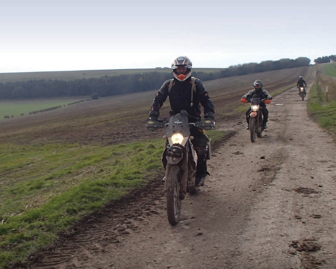
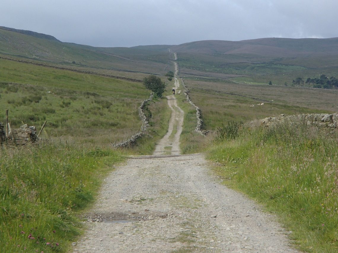
The Roman road (also known as Cam High Road) is fairly straightforward and should be OK for novice trail riders. I rode the lane with my dad recently and this was only his third trail riding outing. He managed it with no problems and really enjoyed it, especially the views as you ride up.
Towards the top there are a few rocks and slabs to make the lane more interesting, but nothing that will worry most riders. As stated, the views are amazing in virtually all directions (depending where on the lane you are). You ride from approximately 230m to the highest point at 586m. On a bad weather day, the trail is fairly exposed to the elements, especially towards the top.
The trail can be attempted in both directions and the difficulty rating is the same either way. If you ride to the top, and then turn right and ride down the single tarmac road back to Hawes you will eventually get to an optional ford. Be warned, this ford is deceiving.
It looks simple and nice and shallow, but it is actually difficult to negotiate. The bottom is very slippery and, as the crossing is on a slight angle, it’s all too easy to lose balance. I’ve seen a few people come off here, and I have to say my bike was all over the place whilst crossing.
The Route
1-2
The trail starts on the outskirts of Bainbridge, which was the site of an old Roman fort. As you start, you can see the trail heading off uphill for miles in the distance. It’s signposted ‘Byway Beggermans Hill 5.5 miles’.
To begin with it’s virtually a straight road, that’s the way the Romans made them! The track is in between stone walls a car width apart. It’s mainly a coarse gravel/graded route, though as you proceed the middle of the track gives way to grass.
Easy going for all skill levels
The going is easy, and the views of the valley down to the right are fantastic. Heading towards the lone tree in the distance there are a few jumps along the way for the more adventurous to get some air from. Proceed to the road.
2-3
Head over the road and continue straight on. There’s much of the same in the way of track conditions including an occasional puddle, but for the most part it’s a hardcore base with lots of loose stones, progressing upwards along a gentle slope. Eventually, you will reach a right-hand bend.
Well Graded Surface
3-4
Distance: 5.5 miles
Nearest Town: Hawes
Maps: Wensleydale and Upper Wharfdale, OL98
Difficulty Rating: 2
Wow Factor: 4
Other Trails: Several Good long trails in the local area, see previous issues of ABR for details in the green lane sections
Proceed to the right and immediately left. I’m not sure why the Romans put a slight kink in their road. I’m only thinking about it now as I type but I’ll be having a look next time I do the trail. The views now change to the left of the trail down into the next valley.
The going gets slightly more difficult than what you’ve done so far, but nothing too taxing. More rocky slabs to ride up and over loose stones. Proceed to the next left-hand bend.
4-5
Continue uphill but on more rock slabs/embedded rocks in the ground. You can get air off a few of the slabs as you proceed along. Head to the gate. You are now virtually at the highest point of the trail.
5-6
The trail is pretty much flat from here on. The views are down to the left into the valley. The wall starts to disappear to the right and opens up to moorland. Stay on track. As it’s flat there are a few puddles along this section. Head to the next gate.
The Old Roman Road
6-7
Proceed to the road where this trail ends. Turn right to head back down to Hawes. Look at a map as there’s another trail if you head left that also leads back to Hawes, but this trail is only for the more experienced riders (will be detailed in a future issue of ABR!).
Rivington Pike, West Pennines

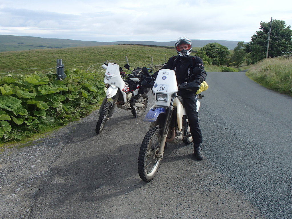
This is probably the nearest trail to where I live, being just 35-miles away from my house, but I have never ridden it before. This is only because there are virtually no other trails in the surrounding area, but after seeing a recent post on the ABR forum by Minkyhead with a video clip of the ride, I’ve been itching to get over and have a look. It is definitely worth the trip and it proves that sometimes it’s worth the extra effort to visit those lonely trails.
You have a couple of options when riding the trail, either north to south the hard way, or south to north, which is slightly easier as it’s downhill. In fact, a good proportion of the trail can be ridden by novices, but the steep final part is definitely off-limits unless you are a confident trail rider.
The trail documented here is the easier way, but don’t misunderstand, the final descent is not easy at all. You start by effectively riding down a flowing river, followed by football-sized rocks, then some steep rock steps to bounce down before even more football-sized rocks to the car park at the end. The views from the top (363m) are some of the best I’ve seen in a long time. On a clear day you can see Blackpool Tower, Snowdonia and even the Isle of Man.
At the top is Pike Tower and, although you cannot ride to the very top (there is a padlocked gate due to irresponsible 4×4 damage in 2011), it is well worth the short uphill detour on foot to view the grade two listed building. Even more impressive was the Pigeon Tower that you pass on the trail. Well worth a few minutes walking around its base and the terraced gardens. Take it steady on this trail, it is very popular with walkers and mountain bikers.
The Route
1-2
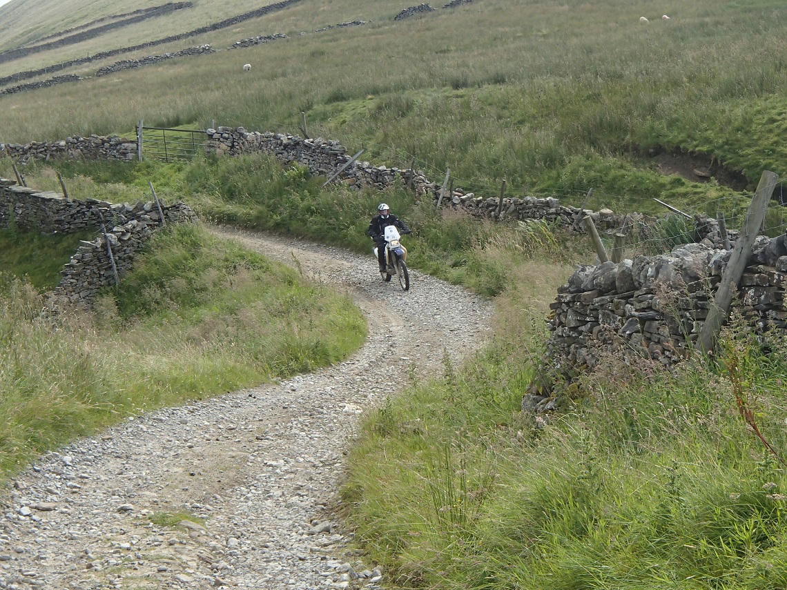
The trail starts at the car park and begins as a deteriorating tarmac road. It has a hard compact base that’s a couple of car widths wide. As you proceed, moorland will become visible to the right and you pass another busy car layby. This is when the views to the left open up.
There are lots of puddles but none of them are deep. Continue to the house and imagine what it must be like having a view like that straight out of your front door.

Deteriorating Tarmac
2-3
You can now see Pike Tower in the distance. The trail gives way to lots of stones embedded in the ground acting like cobbles. As you approach the mount with the tower on you will skirt round the edge. There’s a large washout in the middle, nothing difficult but something to be aware of if you have picked some speed up.
There’s a locked gate which leads to the tower on the right and evidence of off-piste activity. Stay on track. It’s worth parking your bike and walking uphill to the tower.
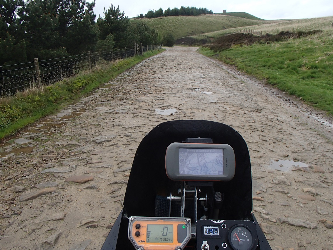
Embedded Stones
3-4
Distance: 2.5 miles
Nearest Town: Horwich
Maps: West Pennine Moors OS287
Difficulty Rating: 1 to Tower, 4 after
Wow Factor: 5
Other Trails: Nothing legal in the local area. You would have to venture south into the Peaks or north into the Yorkshire Dales.
As you proceed the conditions are pretty much the same with fantastic views off to the left. Expect to be pretty exposed in bad weather, especially if it’s blowing from the west. A few puddles to negotiate as you get closer to the Pigeon Tower.
It’s time to park up and have a wander around the terraced gardens of the Pigeon Tower. I couldn’t help think what a fantastic renovation project it would make.
4-5
If you are a beginner now is the time to turn around (or continue another hundred metres and take a look at what you could be attempting with more practice. There’s still enough space to turn around before the difficult bit starts). Stay on the left-hand track.
You will know when the hard bit is about to start as there’s a large drop to the water below. This is where all the runoff water from the moors spit out onto the trail. As you proceed, you are literally riding down the river. This will obviously be worse after rain.
There are lots of loose rocks and stones, though these provided a lot more grip than I expected. The easiest line for me was to ride straight down the middle, ignoring the fact I couldn’t see the trail due to ‘white water’.
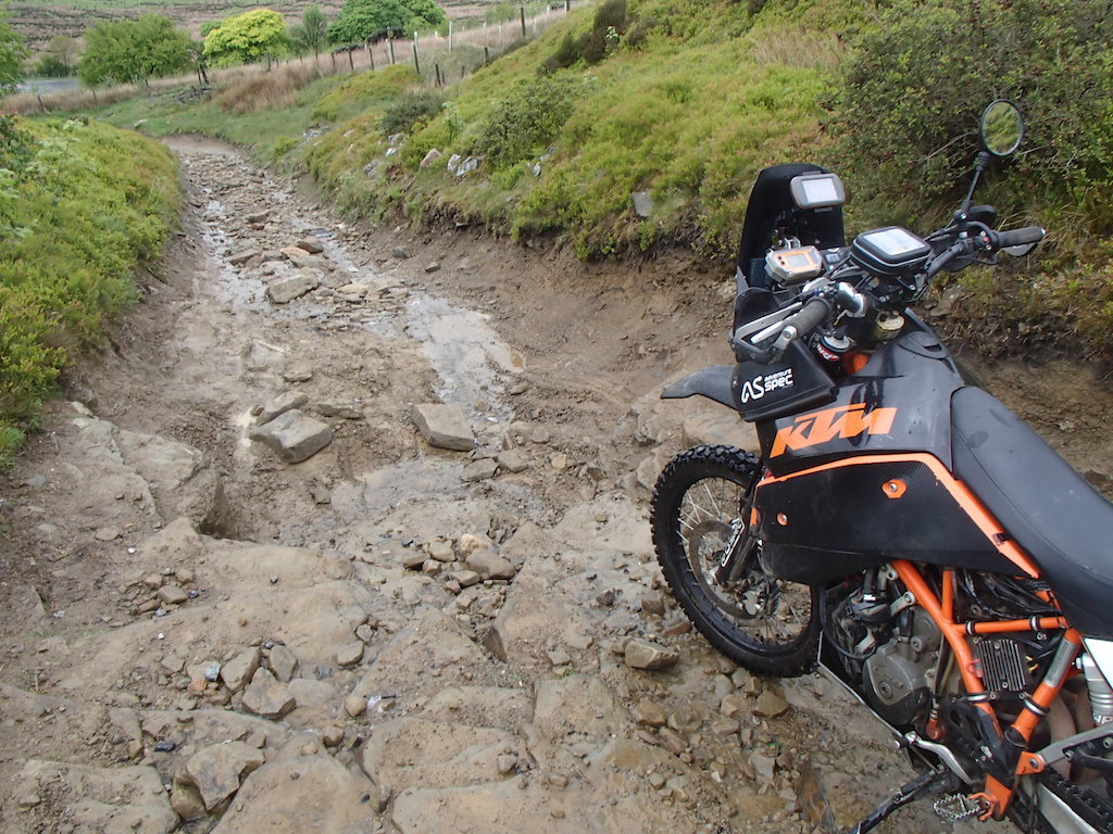
Steep rock steps on the final descent
Continue down the trail until you see a cheat section heading off above the trail to the left. Stay on the main track. If you’ve made it this far you should not be phased by the rock step you will have to launch off. It’s more daunting than it actually is. Don’t stop and you will be down it in no time.
Now continue along the trail riding over a lot of fist-sized stones. Not the easiest to ride down. Continue to the car park at the bottom where the trail ends. Now, for the brave only, turn around and do it in reverse.
