
ABR’s green lane expert Mike Beddows details a further two enjoyable lanes in North Yorkshire and the Yorkshire Dales
Settle Trails (part 2)
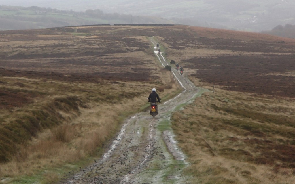
This issue’s trail follows on from Issue 32 of ABR where I detailed two routes around the Yorkshire Dales. Here, two further trails are documented offering a fantastic ride for those passing close to the market town of Settle.
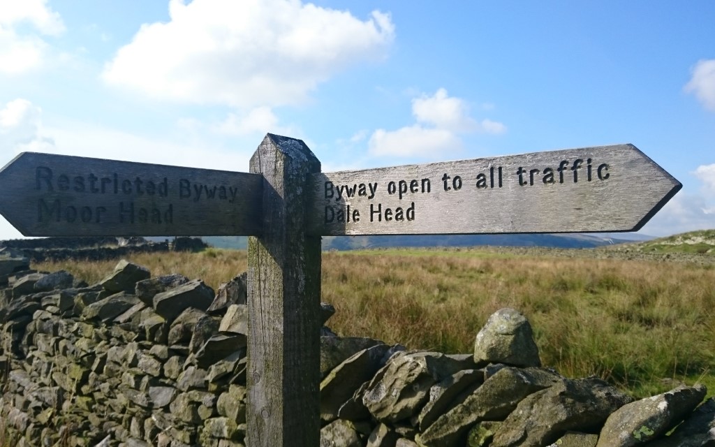
The first trail has two entrances. The first (marked A on the map) has a ‘byway’ sign pointing along the trail. However, at the other end (point B) there’s another sign pointing back along the trail stating ‘restricted byway’. At no point along the trail is there a sign stating that the original byway ends.
Checking on Trailwise it does appear that the byway only proceeds halfway along the track between A and B. As there are doubts about the legality of this section it is better to bypass and complete the trail as detailed in here e.g. skip the trail marked A-B.
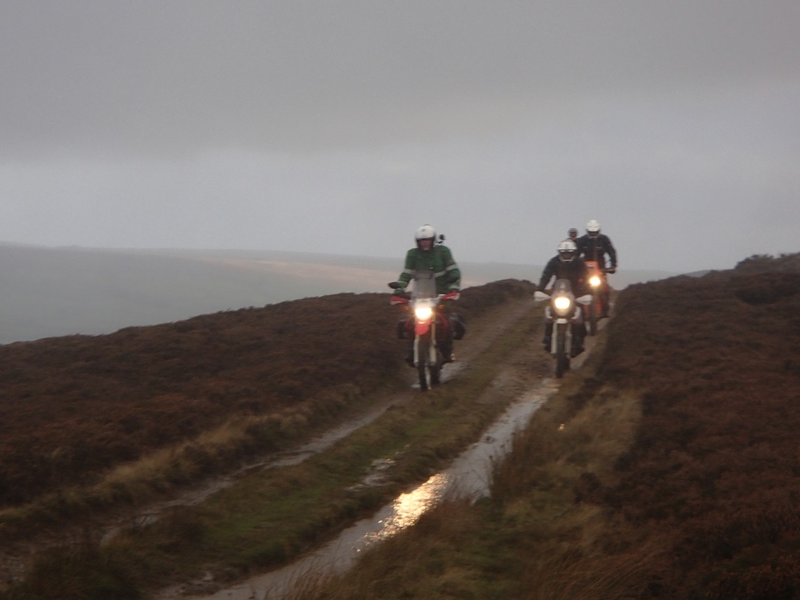
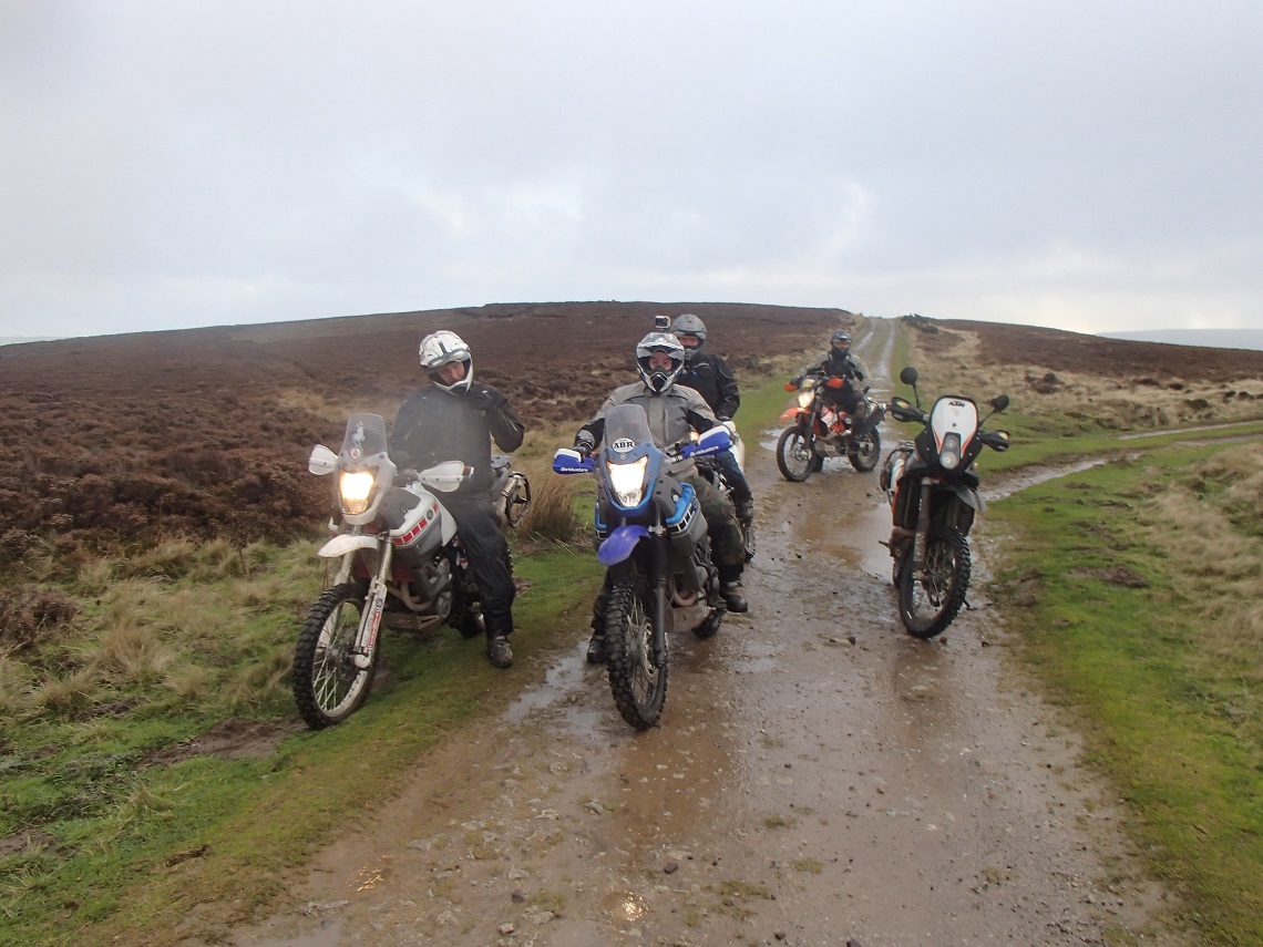
The second trail, ‘Dawson’s Close’, is pretty remote but does lead through some fantastic countryside towards some really picturesque villages. At the end of the trail turn right and after a few hundred metres there’s a pub on the left called The Queens Arms, an ideal place for a drink and a bite to eat.
If you are looking for somewhere to camp ask at the pub. If you turn left at the end of the trail, head down the road to some stone pillars on the left. The farmer lets you semi-wild camp (no facilities) in the field before the river for a few quid (ask at the pub for current status as it is private land).
Myself and my two daughters had a great night camping here after a day 4x4ing, with a small fire going next to the river and toasting marshmallows under the stars. A fantastic location.
The Route
1-2
Easy start to the trail. Hard compact base to point two. At point two the Ribble Way joins the trail from the right. This is signposted as a restricted byway. Veer left and stay on the legal trail, following the byway sign to Dale Head.
2-3
This section starts fairly easy and you proceed slightly uphill along a rocky, solid base. Continue halfway up the hill to a gate. Look left and you will see Arcow quarry across the valley, a huge blot on the landscape. Just before the gate the ruts get slightly deeper, be warned.
3-4
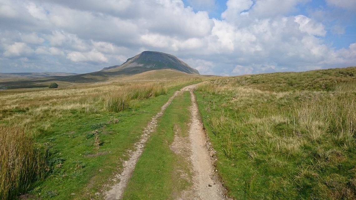
This is the best bit, the going gets slightly harder. Continue uphill, but there’s now lots of loose rocks to keep the going interesting. Continue to the gate at the top. There is now a chance to take in the sights, straight ahead is the view of the 694-metre mountain, Pen-y-ghent. (you are currently at approximately 400 metres high now).
4-5
Through the gate and slightly to the right and continue uphill to another gate. Another good short rocky section.
5-6
At the gate, turn left and start heading downhill.
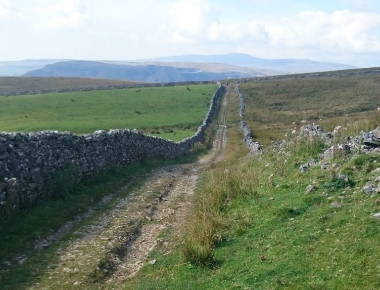
6-7
It’s worth a quick stop to see the large ‘holes’ on the right. Take care though, you don’t want to end up at the bottom of these. Keep heading downhill, through a couple of gates and past a house at the final one. Continue to the tarmac road. Turn left and head along the tarmac single track road to the start of Dawson’s Close trail.
7-8
You will see the trail heading off through the fields to the right as you approach. There’s also a byway sign to ‘New Bridge, 3 miles’ marking the start of the trail. Head along a four-wheel-drive track with a solid stone base and a few puddles in the wet. It’s pretty bleak and remote here. Pass through a couple of gates and the trail turns more to grass.
8-9
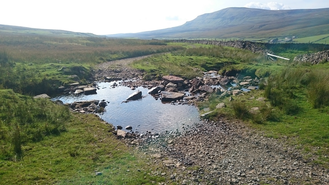
At approximately a mile into the trail, there is a small rocky ford. It’s not difficult or deep so should prove no trouble for most. Through another gate and grass covers the rocky hard compact trail below.
9-10
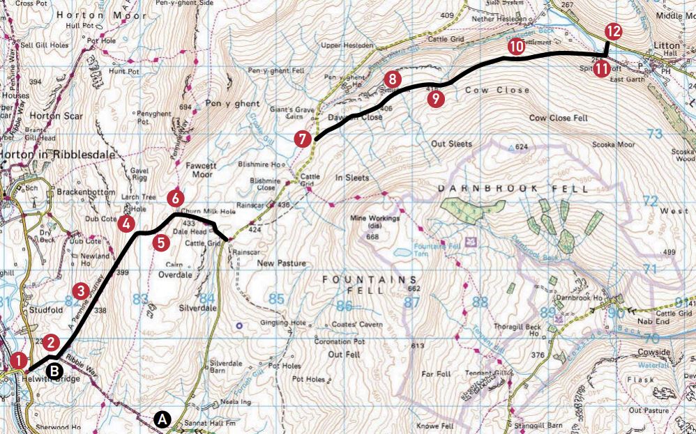
Distance: 5.75 miles of trails
Nearest Town: Settle
Maps: OS Explorer OL2 Yorkshire Dales
Start/End grid reference: SD814695 / SD899744
Difficulty Rating: 2-3
Wow Factor: 4
Other Trails: Combine these trails with last issue’s and you have 11.25 miles of trails in a relatively short distance.
At approximately 1.3 miles there is another small rocky ford. Continue to the next gate. There are now steep drops to the left. There’s a lot of grass now and it becomes very slippery in the wet.
10-11
You now start to head downhill between walls. The trail becomes fairly rocky. Proceed past the rocks back onto another grassy section. This soon turns back to loose rocks and is fairly steep as you head down the valley side. Through a couple more gates and to a humpback bridge. Follow the trail to the tarmac road. Camping is left, pub is right
Did you know
A few miles east of Settle are some fantastic locations all within easy reach of each other, and all worth visiting. there’s Malham tarn, a glacial lake 377 metres above sea level, making it the highest lake in England. Malham Cove is a limestone formation that was formed by a waterfall carrying meltwater at the end of the last ice age (towards the end of 2014 significant rainfall resulted in water cascading off the top of Malham Cove making the highest unbroken veil of water in the UK, albeit temporarily).
Gordale Scar is a limestone ravine and contains two waterfalls and cliffs over 100 metres high (excellent campsite here as well). Janet’s foss is an enchanting waterfall hidden away in an ancient wooded area. These are all fantastic locations to visit. It’s a shame the two long-distance trails heading from Settle to these areas have long-standing trail regulation Orders (trO) on them. I have walked them and the route looks fantastic.
Glaisdale Rigg, North York Moors
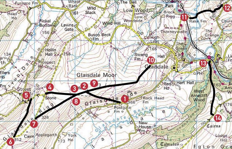
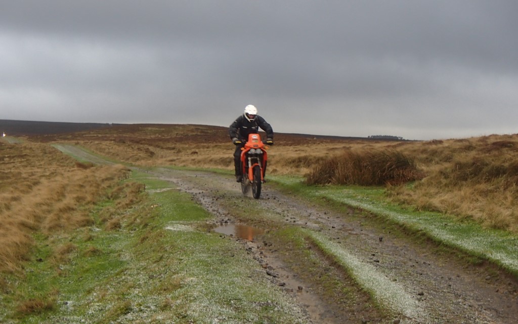
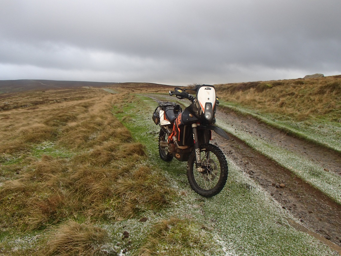
North Yorkshire is home to some very good long trails, most are fairly straightforward but there’s also a few extremely difficult ones (see Farm Trails, ABR issue 16 as an example). This issue’s lane crosses the bleak Glaisdale Moor which is part of the Danby Moors Estate. In the dry I’d grade it a two, increasing to a three in the wet.
The track virtually crosses the moor from south to north, then back from west to east. This trail has it all, a stony graded section, a fast wide section, an uphill rutty more technical bit, and a section with many deep puddles. The views along the way are fantastic.
Pick your day carefully, Glaisdale Moor can be very bleak in bad weather. At 270 metres at its highest point it is very exposed and takes the brunt of any bad weather. Pick a good day and this is a fantastic trail and it’s well worth stopping several times along the route to take in the sights. Why not ride the route, and then for added variety turn round and do it all in reverse.
As well as including Glaisdale Rigg I’ve detailed a couple more trails. These should be left to more advanced riders. The trail from points 13 to 14 is a muddy, slippery, rutted uphill section. You don’t want to get stuck on here as gaining momentum again will be tricky. The ford crossing between points 11 to 12 is very deep, ignore the ford depth signs, this ford gets deeper than they show. Combine all three trails and you have 5.3 miles of fantastic and legal trails in a small area.
The Route
1-2
The trail starts as a tarmac road for a short distance to a gate. Proceed through the gate onto the moor. Head uphill on a graded section where you gain 80 metres of height in a short distance. There are small to fist-sized graded stones and rocks, you’ll need to keep the throttle open and bounce to the top. This section used to be pretty rutted before the grading. Grade three uphill.
2-3
At the middle turn left onto a wide trail. Then take the right-hand fork heading up the moor.
3-4
There are a few puddles and you head uphill following a sandy, shallow rutted four-wheel drive track. This section has deteriorated over time and it is great fun picking your line as you climb to the top. There are a few sections where you can get air off a few bumps. Grade two-three.
4-5
At the tarmac road, head straight over and follow the tarmac downhill to next section.
5-6
Proceed past the houses and head up the hill along trail with grassy ruts, then hardpacked ruts to top. There are a few puddles along the way, especially towards the top. Grade two.
6-7
Turn left and follow the road to the start of the next section.
7-8
This is a wide trail crossing the moor from one end to the other. It’s fairly straightforward but be careful. Speed can increase and as you crest the hill and at approximately 300 metres there are a few washouts. Head downhill all the way to the middle section. If you are not prepared and are travelling too quick it could end in disaster. There are a few rocks but it’s mainly a hardpacked sandy gravel base with some shallow ruts. The views to the right down to the valley are fantastic on a clear day. Grade two.
8-9
Reverse of two-three
9-10
After the meeting with the cross over in the middle the trail starts to hold water in the way of deep puddles. Beware, some are wide and deep, thigh deep in places, and if you hit them at speed you will end up wet through. I’ve had bow waves over the top of my bike’s screen resulting in my helmet soaked in water. Take care. Continue to the gate at the end. Grade two.
10-11
Road section
11-12
Distance: 5.3 miles of trails
Nearest Town: Glaisdale
Maps: OL Explorer 27, North York Moors
Start/End grid reference: NZ761045 / NZ784041
Difficulty Rating: 2-4
Wow Factor: 4
Other Trails: Plenty of long distance trails around the North York Moors.
Ford. Take care. It’s deeper than the depth markers suggest. Only proceed if you are confident with river crossings. And only if the river isn’t flowing fast. It has a rocky bottom with a few large stones. Then proceed uphill along a farm track to exit. Grade four.
12-13
Road section.
13-14
Start with a small ford crossing. It shouldn’t be too much trouble even if it is flowing fast as it’s fairly shallow (one two-foot deep normally). There’s a solid base but it will be slippery. Then continue uphill along a muddy, rutted track and scramble all the way to the top. Don’t stop. Your arms will be pumped, it’s tight and narrow in the ruts. Some are deep as well. Challenge yourself and make it to the top without dabbing! Grade four.