

UK GREEN LANING
Route 22: Yorkshire Dales
This is a fantastic long trail through the heart of the Yorkshire Dales. Unfortunately a lot of byways and legal routes have become restricted over time in the Yorkshire Dales and this means that you may have a lot of tarmac riding to form a decent loop/route. Do not let this put you off however, as the Dales has a few cracking trails, and many are a decent length.
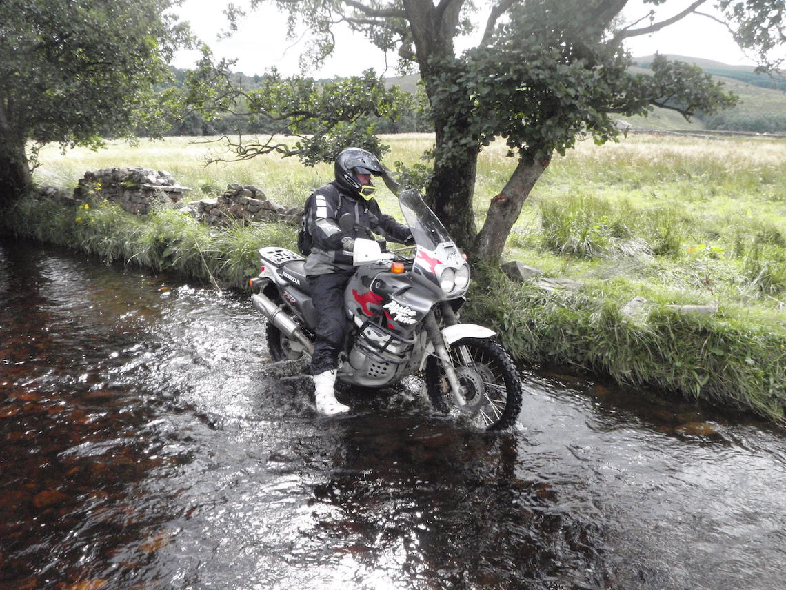
Stalling Busk is one of these longer routes and offers a 10.3 mile ride off tarmac (assuming you ride the intersection part detailed below). I’d grade it as fairly straightforward (grade 2) in the dry and a bit more difficult in the wet (grade 2-3) with the final part heading to Marsett a definite grade 3 (don’t be misled by any of the photos of a rider with a Varadero 1000. This rider (Mudwiz) is extremely competent and owns his own ‘Ride any Road’ business, he knows what he is doing off road.
Be aware that this is a high mountain track that will take the brunt of any bad weather passing through the area. There is a real sense of remoteness as you ride the trail. Be careful.
PLEASE NOTE: There have been recent complaints by farmers of riders deviating from the main route. The main trail is often through the water, the grass verges to the side are not part of the trail.
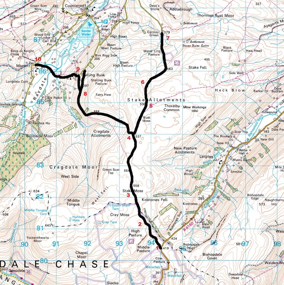
Stalling Busk 10.3 miles
Route Facts
Distance: 10.3 miles (assuming you ride the intersection bit). Or 6 miles (approx.) from one end to the other
Nearest town: Hawes (North West)
Maps: OL30 Yorkshire Dales, Northern and Central Area
Start/End grid reference: SD943804 / SD903862 (Marsett)
Difficulty rating: 2 dry, 3 wet. Optional end route 3-4
Wow factor: 4
Other trails: A lot of trails have now been TRO’d or declassified to restricted byways. There are still plenty of legal ones left, but many require a few miles of tarmac to tie them together,
The Route
1-2 Start at Kidstones Scar, which is at the South end of the route. Proceed through the gate and the trail can be seen winding up the hill in the distance. It is signposted ‘Byway Stalling Busk 4.5 miles’. It is a hard compact gravel track. As you progress up the hill there are some tight bends to negotiate and they have large fist sized rocks to ride over, as well as a few rock slabs to bounce over. Take it steady, but it’s not too technical. It is better keeping momentum as it may be tricky to get moving again if you stop on a larger bike.
2-3 At the top of the hill the trail becomes easier with two definite four-wheel drive tracks with a grassy central piece. The going is easy along hard compact stone. The views are fantastic over the moorland surrounding you. Proceed through the gate at approx. 1.1 miles. Continue slightly uphill to the highest point on the trail at 558 meters. There were several long deep-ish (1-2 foot) puddles to ride through (after significant rainfall).
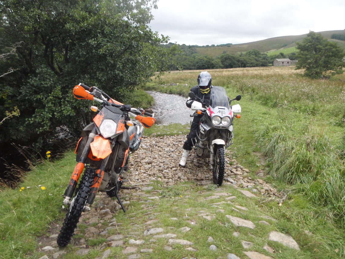
Photo: Mike Beddows
3-4 The trail now becomes easier with no ruts, just a wide (car width) hard compact stone track crossing the moorland. Proceed through another gate at approximately two miles and continue to the byway intersection (2.5 miles). There is a byway sign pointing in three directions. ‘Byway Kidstonne 2.5 miles’ leading back from where you have come from, ‘Byway Stalling 2 miles’ leading straight on and ‘Byway Carpley Green 2.5 miles’ turning off to the right.
4-5 Turn right and head to Carpley Green. After approximately 100 meters proceed straight on through a gate. This is an easy track, with a large grassy section in between hard compact four-wheel drive shallow ruts.
5-6 At three miles proceed through another gate. The ruts become a bit deeper now so take care. The trail can be seen heading off into the distance with a broken dry stone wall on either side of the byway. Take care for the many sheep that are roaming the open moorland. And watch for suicidal rabbits darting out in front of your wheels.
6-7 At 3.5 miles there is another gate. After a lot of rainfall there was a ford crossing (not sure if this will be here in the dry) The water had swamped the trail as it found its way to the other side. At 4.1 miles and 4.3 miles there are more gates. Proceed downhill on a slippy rocky grassy bend (take care). As you go round the bend you will see the end of the trail in the distance. Proceed down the farm access track, through a gate and onto the farm at Carpley Green. Take it steady past the farm.
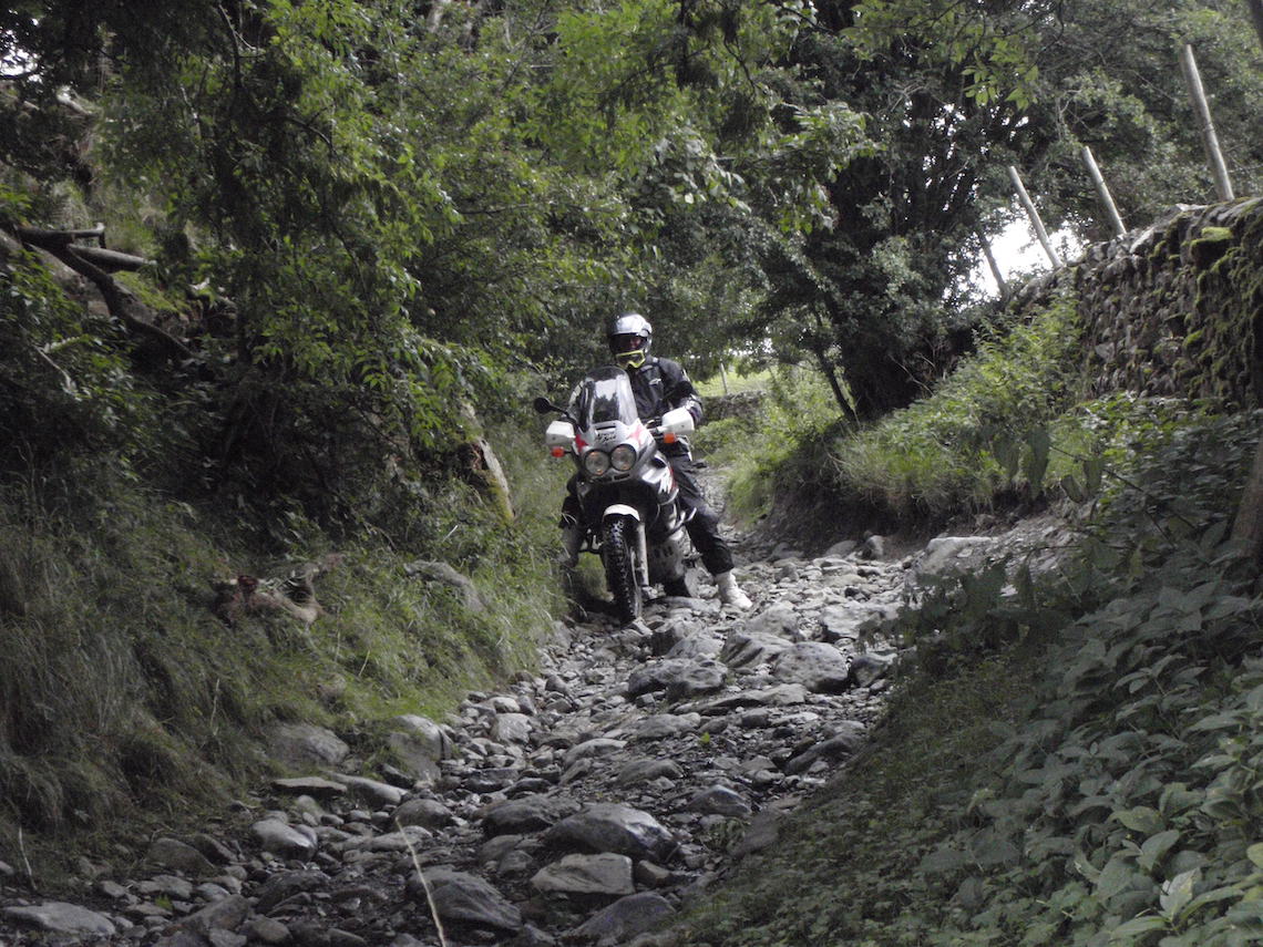
Photo: Mike Beddows
4-8 (back at the Byway intersection) Proceed to the next gate following a similar section to the previous. The track is very straightforward. As you level out the views to the left are stunning looking down 200 meters to the valley below and back behind you to Cragdale Moors.
8-9 At point 8 you can turn left and head down a very rocky steep descent towards the small hamlet of Stalling Busk (grade 3), or continue straight on to the end of the trail where it meets tarmac.
Turn left and head into the hamlet of Stalling Busk. Take care when passing through the hamlet.
9-10 This next section is a short trail signposted to Marsett. This is for competent riders only. Do not attempt this trail if you are a beginner. The trail leads down a tight rocky track that is a lot more difficult going up. And if there has been significant rainfall the ford at the bottom will not be passable (meaning the only way out is back up the trail).
Head downhill on a rocky technical track. At the bottom there is a ford. The water had flooded the access trail to the ford. The next day however the water levels had dropped three feet and I was able to cross a solid base ford (river flowing under the concrete). The track then heads back into the river (approx. two foot deep) on a cobble base. This is very slippery. The long ford section is about 100 meters and there is no way round (and looking to the left the area is a swamp so don’t even consider it). Proceed on and ford the river again, over a small packhorse bridge, through a couple of gates and end at Marsett (Grade 3-4)
Did you know?
This trail is not too far from the ABR Boil Rally location in Kirkby Stephen, held at Takoda camping (http://takodacamping.webs.com/kirkbystephen.htm), a very biker friendly campsite and if you’ve done the trail ride at the Boil the chances are that this trail has been covered in the route. Also close by is the highest pub in England, the Tan Hill Inn (www.tanhillinn.co.uk).
At 528 meters the weather can change dramatically at the Inn. It is a fantastic place to visit and has semi wild camping outside the pub. With no light pollution this is a great location for star gazing, and was a hotspot for ‘aurora borealis’ (Northern Lights) spotting back in 2012.
21: Somerset – Conclusion…
Fosse Way 1.7 miles
Last month’s Trail Special followed a section of the Fosse Way leading to Bath as part of a 29 mile route, including about 13 miles of rough stuff. Road sections linking the trail sections took us along some fantastic back roads with scenic countryside, eventually passing through the historic city of Bath, which is where we pick up the trail and take it to its conclusion south of this famous city.
From point 15 (please see ABR issue 19 for the route from its start up to point 15) continue on the road through Bath. This road section is approximately 14.5 miles and for the most part will follow the old route of the Fosse Way. The section south of Bath is slightly more difficult, so if anyone has had any issues before this point it would be wise to miss out this section altogether.
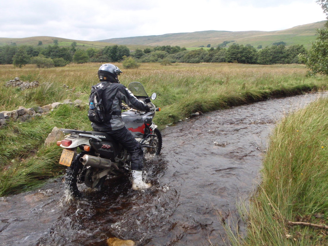
Photo: Mike Beddows
The Route
16-17 This section has a tricky entrance from a very busy fast road. Try and bounce up the curb at a right angle to the road. The curb has a 45 degree angle (slope), and it would be very easy to come off here if the bike slips on the angle. Head down through a wood to the next road. (0.4 miles).
17-18 Proceed along a tarmac road leading to gravel. Head down a steep downhill section. Go carefully past the house on the left. Continue to tarmac. There’s a sharp left hand bend at the bottom. (0.6 miles)
18-19 Continue along short road section (0.2 miles)
19-20 Take a right turn on a bend. Be careful as the bend isn’t the best place to be turning on. This is a harder section. There are three gates in a row. Head uphill along a muddy part. Proceed through more gates. Continue to the next gate. Through a farmer’s field which is overgrown. (0.5 miles) Grade 2-3 mud.
Route Facts
Distance (this section): 1.7 miles
Nearest town: Bath
Maps: Start/End grid reference: ST725610 / ST711586 (South of Bath)
Difficulty rating: 2-3 (South of Bath)
Wow factor: 4
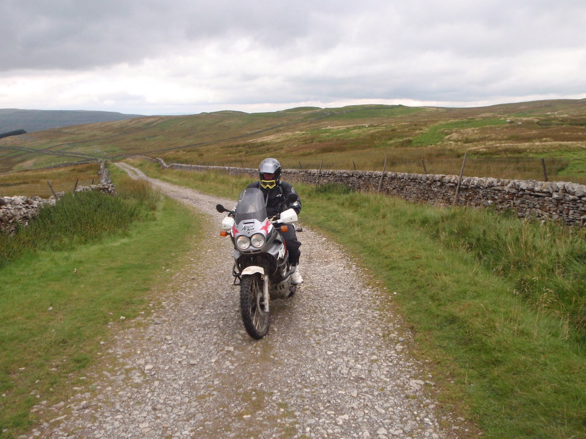
Photo: Mike Beddows
