This Issue: Houndkirk Moor, Peak District and Malpas Lanes, Cheshire.
Houndkirk Moor, Peak District
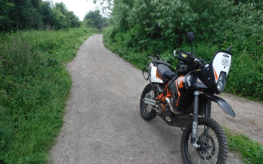
There’s always that one trail that sticks in a person’s mind. Mine is Houndkirk Moor and probably not for the reasons you may think. It was back in January 2001, New Year’s Day to be precise. My wife was nine months pregnant with our first daughter (she gave birth on the 10 January).
I was under strict orders not to drink on New Year’s Eve due to the fact it was possible for her to go into labour any day, so, being sober on New Year’s Day (a rarity!), we decided to go for a drive in the country (yes, a drive).
I had a Vauxhall Frontera 4×4 and we enjoyed a few country roads in Yorkshire and then I came across Houndkirk Moor purely by chance. I’d never taken the 4×4 off-road, and this was before I got into trail riding.
I don’t know why, but I decided to drive along the trail. My wife, being nine months pregnant, was obviously not happy about bouncing around, but I loved it. I was hooked, but it didn’t take long for my inexperience to show.
We were soon stuck and alone in the middle of Houndkirk Moor on New Year’s Day, with a heavily pregnant woman in hysterics. I eventually managed to get free and it all worked out in the end. But as I said, I was hooked, and I wanted more.
I didn’t like how expensive the 4×4 was, and if I got it stuck on my own I’d probably end up in trouble, and this is why I got into trail riding, all because of Houndkirk Moor. My logic was that a bike would be easier to free on my own if I got stuck, and not as expensive if I damaged it!
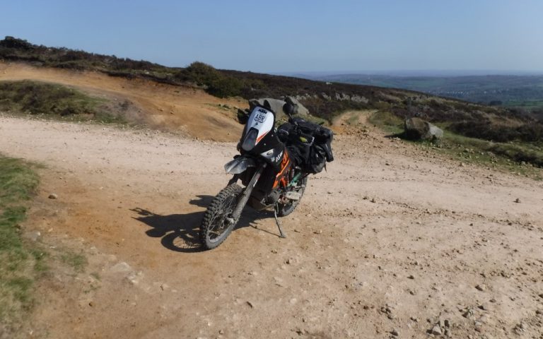
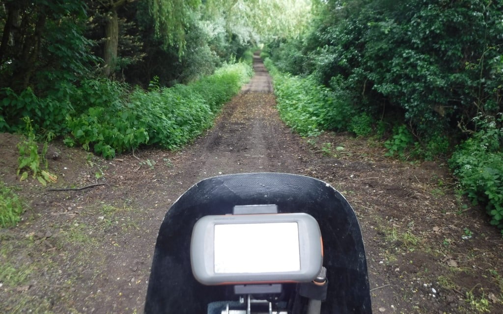
Houndkirk Moor is a fantastic, longish trail and has altered a lot over the years. It’s more graded now than it was when I first attempted it back in 2001, and it can be attempted by novice riders if care is taken (bar the section A-B on the map, which is only really suitable for competent riders).
The Route
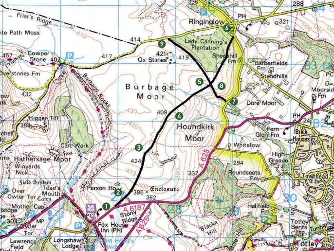
1-2
Short section leading away from the main road. Proceed along a wide, well-graded track. Take care as you approach the gate as a left to right track crosses in front and may have vehicular traffic that is obscured by the wall.
2-3
Continue through the gate. You are still on a wide graded track with lots of small, loose stones. Proceed through the next gate, which is only a few metres after the first one. You are heading slightly uphill until you reach the moorland on either side. You will see a parking area off to the right when you crest the hill. It’s worth stopping here to take in the distant views across Sheffield to the right.
3-4
When you leave the car park you will head slightly right, and you can see the track heading out across the moor. It’s still wide and well graded, with lots of small stones but nothing too troublesome. The track seems to go on for miles.
Being so close to Sheffield, it does get a lot of traffic from motorbikes, 4x4s, pushbikes, horses and plenty of walkers and their dogs, so take care. As you head into the distance, be on the lookout for the sandy washouts that may catch you unaware, especially if you’ve built up some speed. Be wary of other trail users.
4-5
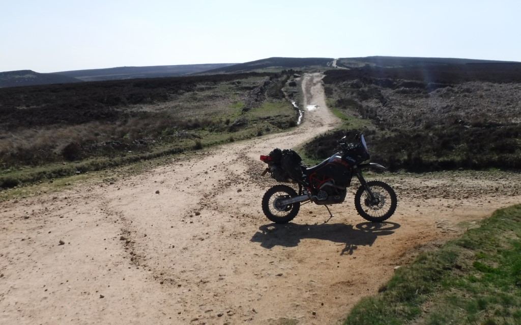
As you head uphill and to the right there are a few rocks on the trail to contend with, but nothing too difficult. There are strategically placed boulders to try and keep traffic to the left. e original track used to run to the right and is now washed out in places. The original track used to be great fun here as it was more technical. e replacement is still well graded. Proceed to the cross roads.
5-6
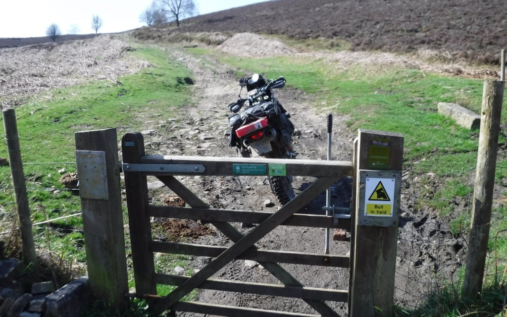
Head straight on. You can now exit the trail by continuing on or heading to the left towards point nine on the map. For the more advanced, head straight on and at the end go right and enter the moor again at the next stage. Continue through a gate and head downhill until you meet the road.
6-7
Short road section.
7-8
Distance: 4.3 miles
Nearest Town: Sheffield
Maps: OS Explorer 278, Sheffield and Barnsley
Start/End grid reference: SK270805/ SK279834
Difficulty: 2-4
Wow Factor: 5
Other Trails: Head south to access the Peak District.
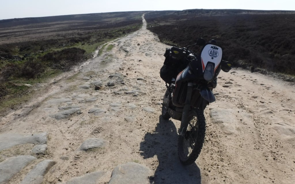
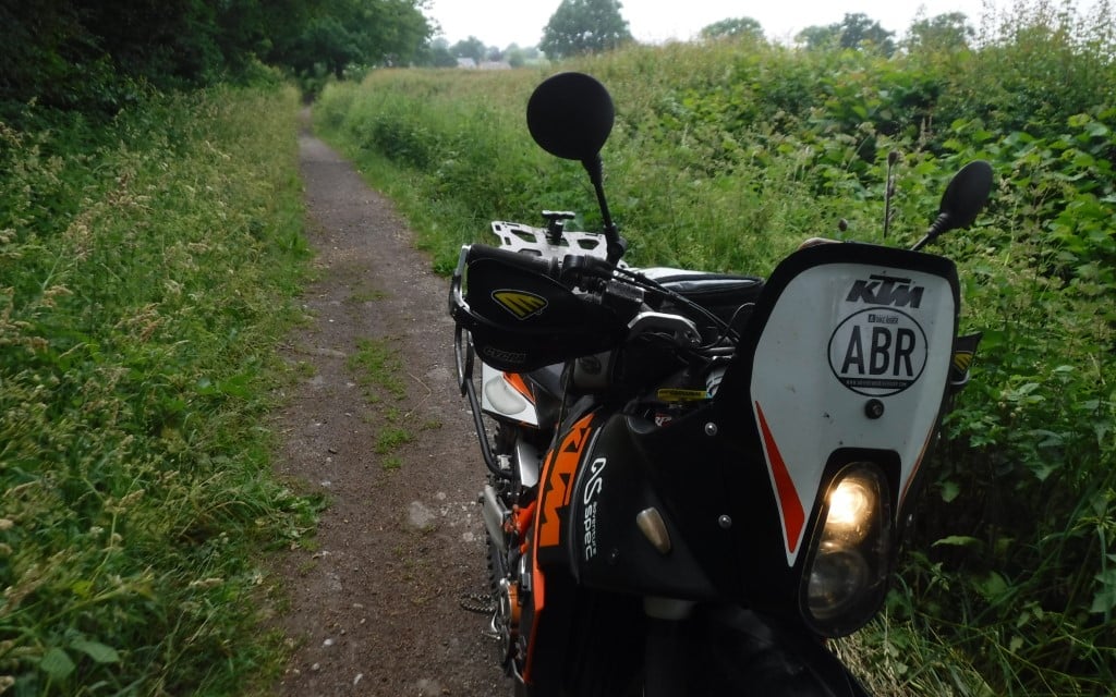
This section isn’t for novice riders or four-wheel drive vehicles, and this can be seen from the small gate you use to access the trail. Immediately, the going is a lot tougher than what you’ve just done. The trail is narrower and covered in rocks. Some loose, some well and truly embedded in the ground.
Your suspension will take a beating here. Always look ahead and try and choose the best line. Try not to stop, getting going again is tiresome. In the wet, this section can be even trickier, but it is my favourite part of the trail. Continue to the crossroads and head straight on.
8-9
The trail is again graded for a while and narrower than the first section. As you approach the wood (on your right) you will go through another gate. e track from here loses its newish grading but is still fairly straightforward. There may be a few puddles on this section but nothing deep. Continue to the gate and the exit onto tarmac.
Did you know
The Peak District is a fantastic place to ride, both on and off-road. Unfortunately, a lot of trails are suffering pressure from people who don’t want to see or hear bikes and 4x4s, and lanes are closing (Traffic Regulation Orders) at a fast rate.
It’s a sad thing to happen when these lanes close and there’s very little we as riders can do. There are certain groups that fight for the lanes but unfortunately, they tend to lose more cases than they win.
Stepping back and looking at the bigger picture, all it means is that there are less legal trails for us to enjoy on bikes, and due to others closing it just adds more pressure to what we are allowed to ride legally. In time, I feel these will be lost as well. It really is a shame.
My philosophy is ride them while you can. Enjoy them now as they may not be here tomorrow. I’ve seen so many good trails lost over the years. In the Peaks alone, fantastic trails such as Chapel Gate, Roych Clough, Stanage Edge, Cherpit Lane to name but a few… all lost.
Malpas Lanes, Cheshire
There is very little in the way of legal lanes in Cheshire, though there are a handful around the village of Malpas, and these are detailed here. All are bitty lanes and only really worth making the effort for if you happen to be passing.
But if you are riding through Cheshire en-route to somewhere else (the Peaks or North Wales perhaps, depending on your direction) then they are worth knowing as they do break up a lengthy section of tarmac between these two fantastic trail riding areas.
These lanes are also available on the Trans Euro Trail website, but be warned, if you are following this route (TET) there is a showstopper of a lane for beginners. This will be covered in the next issue of ABR. So just be wary of routes obtained from the web, not all lanes are suitable for all.
For info, the lane is mud heaven, if you like that kind of thing. For most riding the TET in its entirety, it will be done on larger adventure bikes, possibly with camping gear. The lane in question is far from ideal for this kind of setup.
A couple of lanes in this issue are actually marked on the Ordnance Survey maps as footpaths or bridleways, and this just shows how some maps are out of date (something that was covered in ABR Issue 45). If the council’s website is checked, these are displayed correctly as legal byways.
The Route
1-2
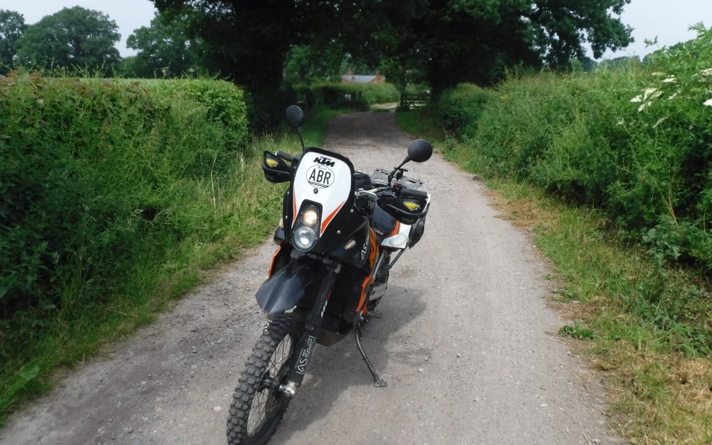
Leave the tarmac road and head down a single-track lane which has a hard compact base with a bit of grass growing in the middle. You have high hedgerows on either side as you head down the lane, giving an enclosed feeling as you ride.
2-3
At the junction, stay right. Left leads to a farm. The trail is well-graded here, and the hedgerows not as high as previous ones. Take care as you pass the houses on the right. The trail continues straight ahead and is not difficult at all. Continue to the tarmac road.
3-4
Tarmac section.
4-5
On an OS Map, this section is marked as a bridleway, but it is 100% legal to ride. On the council’s website, this lane is marked as a byway. The trail is easy to locate, even though on the map it looks like it starts between houses. It appears to be more of a footpath than a track, but it’s got a hard-compact base and is easy pleasant riding.
Take care as it’s obviously well used by dog walkers. The trail is easy all the way to the end. Any bike with any tyres will be fine in the dry. Towards the very end of the lane, when you see a house in front, the trail splits in two. Take the right-hand fork here. Left leads to a house.
5-6
Tarmac section.
6-7
Turn left into the lane. Proceed past some houses on the left. The lane continues straight ahead and is obvious, with a muddy base. There are bushes and trees on either side and occasionally grass in the middle. When you pass through the trees and are riding between farmers’ fields, the lane is pretty easy-going. Continue to the end.
7-8
Take a left turn straight away, don’t go onto the tarmac road. This section has a solid base and is fairly wide. Head back under trees where there are occasional muddier bits with a few ruts. Nothing too difficult. Continue to the road.
8-9
Distance: 9.3-mile route with 2.3 miles of trails
Nearest Town: Malpas
Maps: Explorer 257 Crewe And Nantwich
Start/End grid reference:SJ510434 / SJ463511
Difficulty: 1-2
Wow Factor: 3
Other Trails: Very sparse in rural Cheshire. Best using these trails when travelling to and from the Peaks or North Wales.
Tarmac section.
9-10
Turn left off the main road. The track is obvious but quite narrow. It appears more like a footpath than a legal bike trail. Once past the house access on the right, it becomes a muddy footpath beneath trees.
I enjoyed this section, it’s overgrown in parts, but the single-track is always visible and obvious. Continue to the tarmac road. Take care on the small bridge towards the end.