


Call us biased, but we reckon the UK is home to some of the best biking roads in the world. So, to help kickstart your 2021 adventures, ABR’s team of riding experts has listed a selection of their favourite roads to ride in the UK. How many will you tick off?
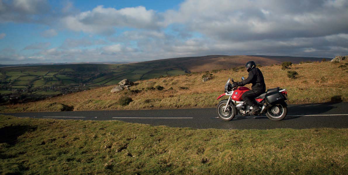
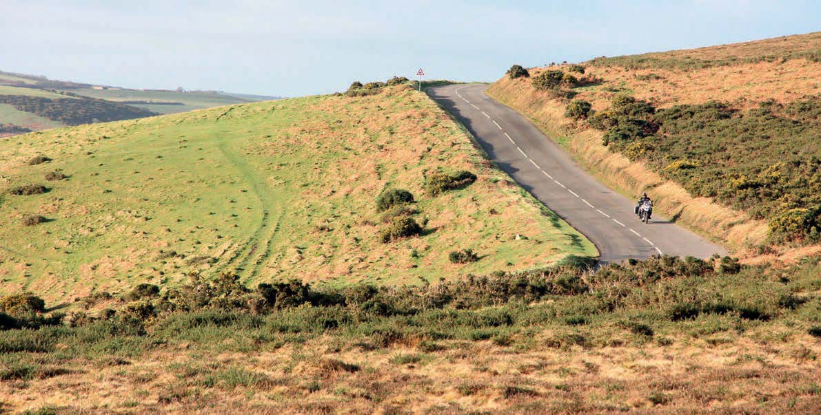
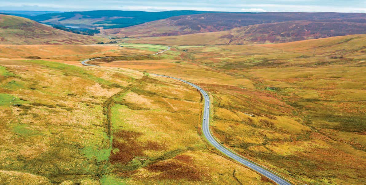
B3212, DARTMOOR, ENGLAND
James Oxley, Editor
Start: Exeter
Finish: Yelverton
Distance: 33 miles
With more than 60 million people crammed into the island, we call home, it’s no surprise it can feel frustratingly busy sometimes. This is why I treasure anywhere I can get away from the crowds. Dartmoor is such a place, and luckily for us bikers, there is a sensational road running across it.
I recommend starting on the banks of the River Exe, in Exeter. Yes, it’s busy, but I always enjoy experiencing the transition from the bustling city centre to remote moorland in just a few miles. From Exeter, pick up the B3212 and travel east for a few miles, crossing under the busy A30 and into the Devon countryside. You’ll cruise past verdant fields and along tree-lined roads until you climb more along narrow lanes up to the moor.
Once on top, the scenery opens up and you’ll thread your way through a remote moorland landscape with panoramic views of the world around you. This is big sky country. With such a great view of the road ahead, you can get into a rhythm on your bike as you carve your way around long, sweeping bends. Just keep an eye out for wild ponies and sheep wandering onto the road.
If you fancy spending a night on the moors, and you’ve packed your tent, the Plume of Feathers pub at Princetown has a campsite at the rear within staggering distance of the cosy bar. Past Princetown, you continue on the B3212 as you descend towards Yelverton which marks the end of a stunning ride.

PEN-Y-PASS, SNOWDONIA, WALES
James Oxley, Editor
Start: Capel Curig
Finish: Llanberis
Distance: 11 miles
I first travelled to this part of Wales more than a decade ago when I visited Snowdon to hike up the famous mountain. After completing my walk, I remember standing outside the hostel at Pen-y-Pass with a cold beer in hand mesmerised by the site of the road snaking its way along the valley floor, dwarfed by peaks on either side. I’ve returned many times since on two wheels and I still get goosebumps every time I crest the pass and ride through the valley towards Llanberis, humbled by ancient scenery on either side.
To ride the pass from east to west, turn off the A5 (which is another great road) at Betws-y-Coed and follow the A4086 as it sweeps along a wide valley floor. Turn right at the Pen-Y-Gwryd Hotel, home to Sir Edmund Hillary and Tenzing Norgay while they trained for the first successful ascent of Mount Everest, and the road climbs towards the summit, steadily getting steeper as it clings to the valley side.
Crest the summit of Pen y Pass, with the hostel on your right, and the valley opens up in all its spectacular glory before your eyes, providing one of the most awe-inspiring views in the UK. Every time I ride this section of road, I feel like I’m starring in an epic movie, the landscape is that breathtaking. Wind your way through the valley until you reach the town of Llanberis, where you can find a place to stay and grab a well-earned pint.
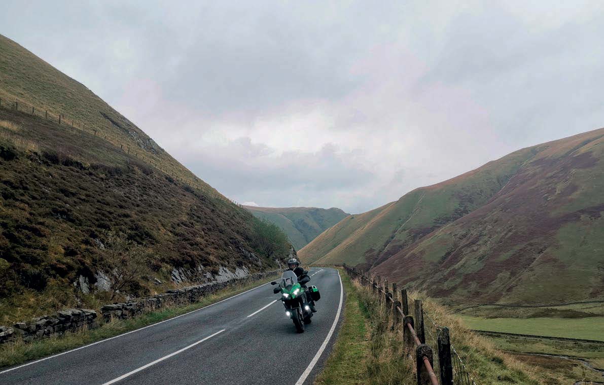
NEWLANDS PASS, CUMBRIA, ENGLAND
James Oxley, Editor
Start: Buttermere
Finish: Braithwaite
Length: 7 miles
Inside St James Church in the tiny village of Buttermere is a memorial to Alfred Wainwright, the much-loved author of a series of seven exquisitely hand-drawn books called A Pictorial Guide to the Lakeland Fells. Outside the picturesque church is a road junction which gives motorcyclists travelling from the north a dilemma. Continue on the B5289, and you’ll reach the spectacular Honister Pass. However, turn left at the church and you’ll find yourself on Newlands Pass. Ideally, you’ll ride both roads as been as you’re in the area, but if I was to pick just one to ride, it’d be Newlands Pass.
The climb up the pass begins immediately. Views of the beautifully curved Newlands valley soon open up and you find yourself riding along a narrow ledge road that looks like it has been doodled in pencil halfway up the valley side. Riding the ledge is a thrilling experience, with nothing to stop you tumbling off the edge other than good bike control.
At the summit, which stands at 333m, pull over at Moss Waterfall which cascades down the valley side. Back on the bike, you round a bend to see sweeping views of the valley ahead. Follow the road all the way to the village of Braithwaite where you can turn right to Keswick, then follow the shores of Derwentwater along the B5289, and soon enough you’ll find yourself riding the Honister Pass back to Buttermere.
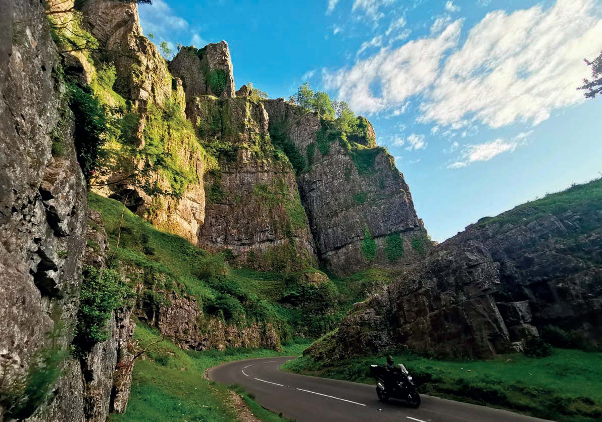
B3135, CHEDDAR GORGE, ENGLAND
Julian Challis, Bike Tester
Start: Cheddar
Finish: Junction with the B3371
Distance: 3.5 miles
Being a West Country lad at heart, my first choice has to be from the picturesque countryside and roads that are quite literally on my doorstep. And what could be better than the glorious scenery and winding tarmac of the world-famous Cheddar Gorge? If you’re coming from Bristol, it’s a spirited blast south along the sweeping A38 past the airport, before dropping down through Redhill and to Langford and Churchill. As the road climbs, a left turn takes you through Shipham and winds its way into Cheddar.
There are plenty of chances for a tea stop at the bottom of the climb among the tourist attractions and shops, but a swift blast through these will get you into the bottom of the vast limestone gorge on the B3135. Towers of rock frame the road on both sides as the well-surfaced road cuts left and right, sometimes just inches away from the millennia-old geology. It’s a popular route for both cars and bikes, which the many tyre marks on the road testify to, but who can blame them, it’s a complete joy to ride.
The road begins to level off towards the top and cuts through the lush green woodlands of the Mendips. Here you can press on towards Green Ore and then Wells or take a left and left again for another loop. You know you want to.
A39, SOMERSET AND NORTH DEVON, ENGLAND
Julian Challis, Bike Tester
Start: Porlock
Finish: Lynmouth
Distance: 11.5 miles
North Devon boast some of the most beautiful countryside in the whole of the UK, from the windswept landscapes of Dartmoor to the craggy coastlines of the north coast, and the expanse of golden sands that stretch from Woolacombe and Croyde, all the way down to the Taw estuary above Bideford.
But my favourite route starts just outside Devon in the Somerset village of Porlock. Leaving to the west, you have the option of taking the uber steep and infamous Porlock Hill, but a far better option is to take the right-hand fork as you exit the village that will lead you to arguably the best private road in the country. This wonderful route winds left and right through the picturesque woodland of the Porlock Manor Estate for a life-affirming four miles. The steep, tight turns reveal flashing glimpses of Porlock Bay below. As you approach the top, you’ll come to the tiny tollbooth to pay your £2.50 before linking up with the main A39 once more.
And from here, it’s more riding heaven as the road opens up for a glorious blast along the fast and sweeping tarmac that tracks the rugged coastline, giving incredible views across the Bristol Channel to the distant Gower Peninsula. All too quickly, you’ll be at the top of Countisbury Hill, the highest point in North Devon, before descending into the pretty seaside village of Lynmouth in time for a bag of chips on the sea wall.
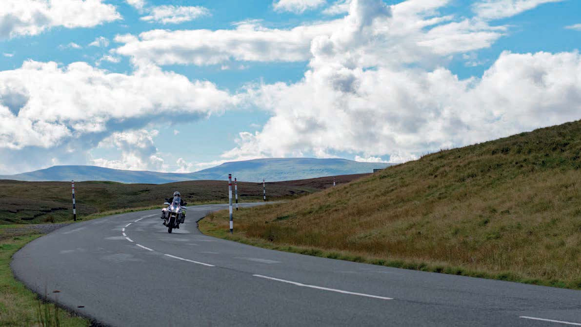
B6277, NORTH PENNINES, ENGLAND
Ollie Rooke, Staff Writer
Start: Barnard Castle
Finish: Alston
Distance: 31 miles
Nestled at the very top of England, just south of the border with Scotland, lies the North Pennines Area of Outstanding Natural Beauty, which is a haven for bikers. This rugged and remote region boasts some of England’s highest roads such as Killhope Cross and Hartside Pass. It’s no surprise that every weekend bikers can be seen carving through the countryside with smiles plastered across their faces.
However, there are plenty of lesser-known roads in this part of the North of England that are just as fun to ride but that aren’t immediately obvious to southerners like me. Indeed, it was a chat with a local biker in England’s highest pub, the Tan Hill Inn, that led to me discovering the magnificent B6277.
His enthusiasm was evident as he described an undulating road that twisted and turned through remote moorland. Wanting to ride it for myself, I convinced him to share his local secrets and he relented, scribbling some directions on a bar napkin, which I duly followed to discover a fantastic road.
Stretching from the small town of Barnard Castle to Alston, the B6277 stretches around 30 miles and tops out at just under 600m. With an ideal mix of flowing bends and brief straights, I felt that I’d stumbled onto the Isle of Mann’s iconic mountain road. This is a genuine must ride if you find yourself with some free time on two wheels in the North of England.
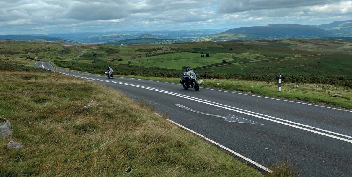
B4560, LLANGYNIDR MOUNTAIN ROAD
Ollie Rooke, Staff Writer
Start: Talgarth
Finish: Beaufort
Distance: 16.9 miles
There are few better places to ride a motorcycle in the UK than Wales. The land of rolling green hills and deep valleys is relatively easy to reach from every corner of the UK, and it’s these peaks that provide the ideal setting for some unforgettable mountain roads. In fact, it was these roads that provided the inspiration for the ABR Welsh Super Ten, a day-long riding adventure in issue 59 of Adventure Bike Rider that challenged you to ride the 10 highest roads in Wales in under 24 hours.
It was during the making of this challenge that I first rode the Llangynidr Mountain Road and, despite spending the whole day on a magnificent ride, this road lodged itself in my heart and mind. Rising to a lofty 518m, the Llangynidr Mountain Road covers 16.9 miles and places a respectable sixth in the list of highest paved roads in Wales. But these stats only tell part of the story of a textbook perfect biking road.
A ride along its length will have you climbing tight hairpins before you can pick up the pace and carve through sweeping curves that snake over the undulating countryside, like a ribbon dropped from the heavens. Then cruise along the exposed hilltops and enjoy a view that, on a clear day, provides stunning views of the surrounding Brecon Beacons mountain range. Though it’s tempting to open it up, keep an eye on your speed, as sheep and wild ponies are known to wander onto the road.
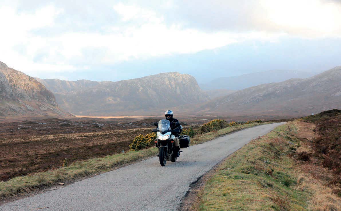
A838, NC500, SCOTLAND
Ollie Rooke, Staff Writer
Start: Durness
Finish: Tongue
Distance: 29 miles
Since the scenic NC500 was officially launched in 2015, bikers have flocked north to ride the popular Scottish route. Covering 516 miles, a journey along its length starts and finishes at Inverness Castle, after looping around Scotland’s north coast, and linking many of the spectacular sights and roads that make this region so popular. I’d recommend taking the time to ride it all but, if you’re pressed for time, the section between Durness and Tongue stands out as a highlight.
Start in Durness and take the A838 road from west to east along the northwest coast. Leaving Durness behind, you ride through an expanse of undulating moorland, catching glimpses of pristine white sandy beaches and open bays as you round each headland. You’ll then skirt around the Loch Eriboll, a vast sea loch that stretches almost 10 miles inland before the road widens into a series of flowing bends as you cut across more uninhabited moorland.
This 29-mile stretch of road offers everything a biker could want. Test your slow-speed control on tight hairpins and relax on open roads while enjoying the sheer pleasure of riding through this remote areas. After about 30 miles you’ll cross a bridge which opens up stunning views of the mountains to your right before you arrive in Tongue. Here, continue on to John O’Groats or turn off and head back down south.
A68, NORTHUMBERLAND ENGLAND
Ollie Rooke, Staff Writer
Start: Corbridge
Finish: Jedburgh
Distance: 45 miles
There are several ways to cross the border from England to Scotland. For those in a rush, the M6 in the west provides the quickest route, while the A1 is an alternative for those travelling up the east coast. However, if you’re looking for a truly memorable road to take across the border, the A68 from Corbridge to Jedburgh is the one to ride.
Starting in Corbridge, follow the A68 north and enjoy smooth tarmac and rolling hills for the first few miles. This section doesn’t demand too much attention, giving you the opportunity to enjoy the views as you cross Northumberland National Park. If you find yourself with time on your hands, make sure you make a detour along the Kielder Forest Drive, a 12-mile gravel gem of a road that runs through the forest.
Back on the A68, the road soon demands more concentration as you ride closer to the border, with the billiard-table smooth tarmac leading you into a series of flowing bends and tight hairpins. Along the way, keep an eye out for a layby on your left for a chance to grab a photo of you and your bike in front of the stone that marks the border with Scotland. Then, continue on through a series of tight hairpins, before you find yourself in Jedburgh. From here you have the choice of following the road to Edinburgh or turning either west or east to seek out even more incredible riding.
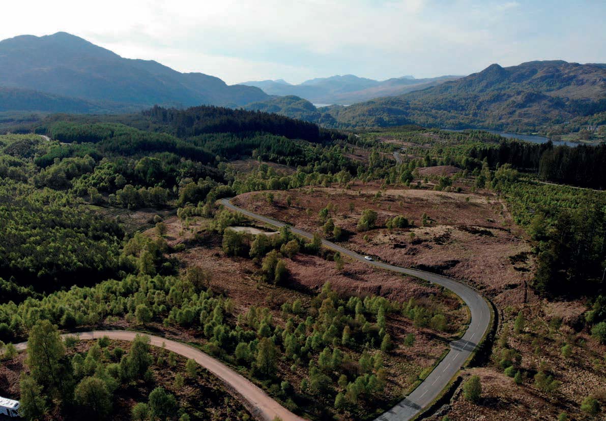
A821, DUKE’S PASS, SCOTLAND
Bryn Davies, Managing Editor
Start: Aberfoyle
Finish: Kilmahog
Distance: 14 miles
Found in the Loch Lomond and The Trossachs National Park, just 20-odd miles north of Glasgow, Duke’s Pass is a route that might as well have been built for bikers. For locals, it’s no secret, but it was only after getting fed up with riding the frustratingly busy A82 up the side of Loch Lomond that I discovered it.
As you ride through Aberfoyle and follow the signs for Duke’s Pass, you’d be forgiven for thinking you’ve made a wrong turn. The road seems like any other, but as soon as you’ve left the village, it begins to rise and the corners come thick and fast.
Built by the Duke of Montrose (hence the name Duke’s Pass) in 1885 to improve access to his estate, this section of the A821 presents a challenging and exciting ride through wooded mountainsides. OK, it might not be the highest pass (240m above sea level), but the quality of riding is worth the trip alone.
For 14 miles there’s not a single ‘boring’ stretch of tarmac. Though the riding will demand your full attention, it’s hard not to get distracted by the magnificent views that surround you. I highly recommend taking the detour down the Three Lochs Drive, a gravel forestry track that takes you further into the mountains around you and past, you guessed it, three lochs.
Once you’ve ridden Duke’s Pass once, you’ll probably want to turn around and do it again. Just look out for the occasional tourist coach that takes a wide line through the sharp corners.

LLYN BRIANNE AND DEVIL’S STAIRCASE
Bryn Davies, Managing Editor
Start: Llandovery
Finish: Beulah
Distance: 30 miles
When I think of my favourite roads in the UK, this is one that always comes to mind. It’s a 30-mile stretch of single-track tarmac from Llandovery to Beulah, via Ystradffin and Abergwesyn, and it showcases precisely why Mid Wales is such an incredible place.
A fast, sweeping route this is not. Here, it’s all about soaking up your surroundings. Starting in the town of Llandovery, the riding is pleasant as you cut through a wooded valley and before long, you reach the man-made reservoir of Llyn Brianne, which is the largest dam in the UK.
After leaving the carpark, you’ll crest a hill and Llyn Brianne will stretch out in front of you, looking wild and untamed despite its man-made origins. The reservoir was formed by flooding the valley and, on the rare occasions when the water levels drop, you’ll be able to see the rooftops of buildings engulfed during the flooding. I always take a few moments to pull up at the layby here and admire the view.
Back on the bike, the road clings to the side of the valley, tracing the outline of the reservoir. Soon, you’ll want to take a right, heading for Abergwesyn. On this road you’ll ride the infamous Devil’s Staircase, a series of super-steep hairpin bends that wouldn’t look out of place in the Alps. The rest of the journey towards Beulah.
DALVEEN PASS, SCOTLAND
Bryn Davies, Managing Editor
Start: Elvanfoot
Finish: Carronbridge
Distance: 15 miles
For many riders, Scotland’s Southern Uplands pass by in a blur as they blast up the A74(M) with the Highlands in their sights. Admittedly, on my first four trips to the country, that’s what I did. From the motorway, you’ll only get glimpses of this part of Scotland which is the country’s least populous geographic area.
If you take the time to detour off the motorway, a series of fantastic roads and big scenery will be your reward. You might even find yourself cancelling your bookings further north to stay around and play for a few days.
I could reel off more than a handful of excellent roads to ride here (there’s a great route through the Southern Uplands in issue 50 of ABR), but it’s the A702 from Elvanfoot to Carronbridge, known as the Dalveen Pass, I want to share with you here.
As soon as you turn off the motorway, you’re thrust onto a smoothly surfaced road with a series of sweeping bends. They whisk you through scenery which opens up more and more as you ride until you reach the discreet summit of the pass. Here, the road bends left and you dive into a dramatic glacial valley.
The sublime riding, little traffic, and stunning scenery make this one of my top roads to ride in the UK. The fact that it’s so accessible from the motorway makes it a great diversion on rides to the Highlands. You can then loop back to the A74(M) via Mennock Pass and the highest village in Scotland, Wanlockhead.
