

This Issue: Hell Lane circuit, West Dorset and Sunken Lane, Wales
Words and photos: John Norris and Mike Beddows
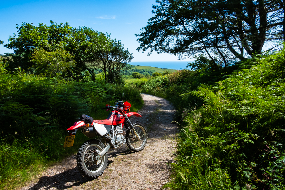
Hell Lane Circuit, West Dorset
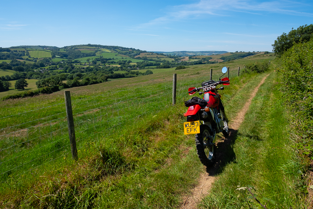
Dorset is a fabulous area to explore by green lane, although there are fewer here than in nearby counties. The lanes themselves are varied, including hard, stone tracks, muddy stream beds, and overgrown wild flower-lined single track. There are routes suited to adventure bikes and some probably best tackled on something lighter and more agile.
The great thing about Dorset is the roads connecting the sometimes short green lane routes are a delight in themselves, often only just qualifying as tarmac roads. Hell Lane, featured in this route, is one of many beautiful holloways (ancient sunken tracks) found in Dorset. The track has been cut several metres deep into the ground from horse and carts pulling limestone out as far back as the 14th century. The stone was used to build St John The Baptists church in Symondsbury where our route starts and finishes.

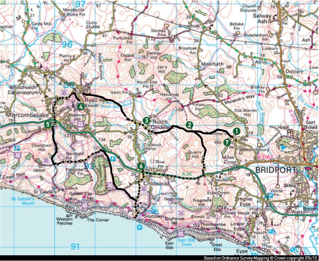
Hell Lane Circuit Map
The Route
1-2
Start at the church in Symondsbury, near Bridport. There is a track going uphill from the signpost marked as a dead end. Ignore the red and white road closed signs put there by disgruntled ramblers who frequent the lane. Continue up past a smallholding and on into the deep gorge, which features carvings in the orange stone. Pass a fork coming in from the left to a crossroads at the crest.
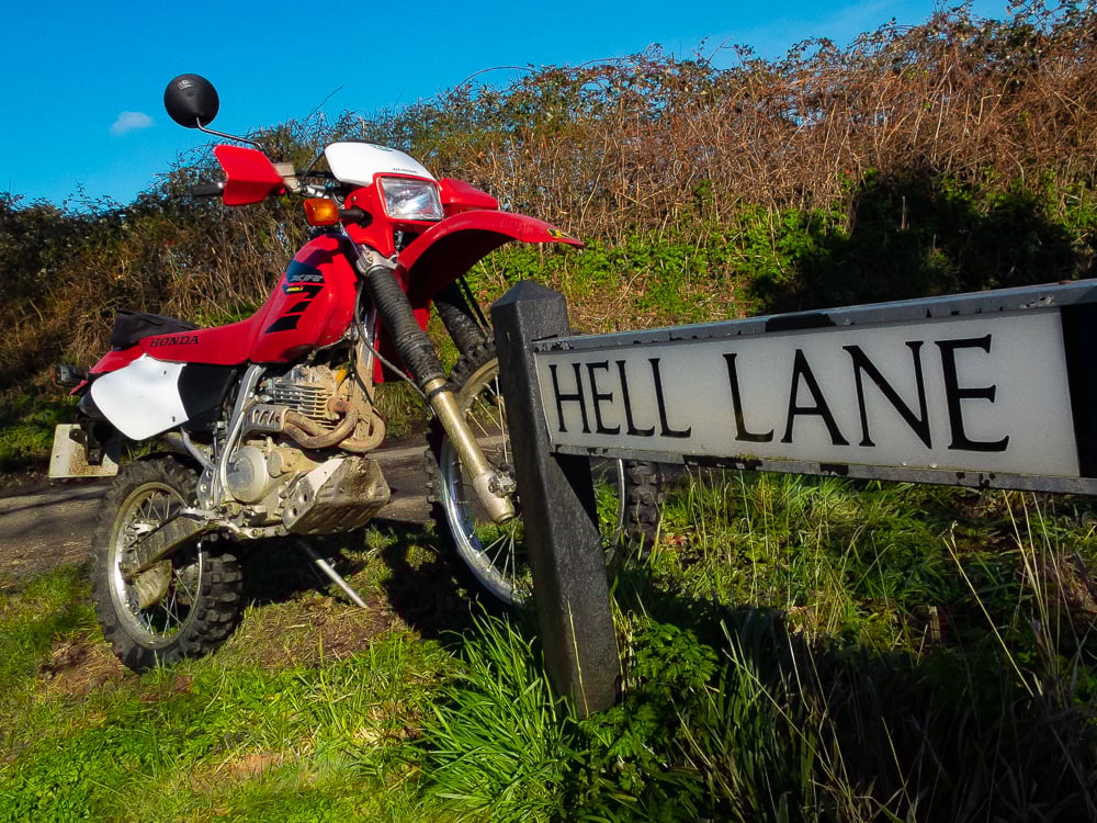
Hell Lane Sign Post
2-3
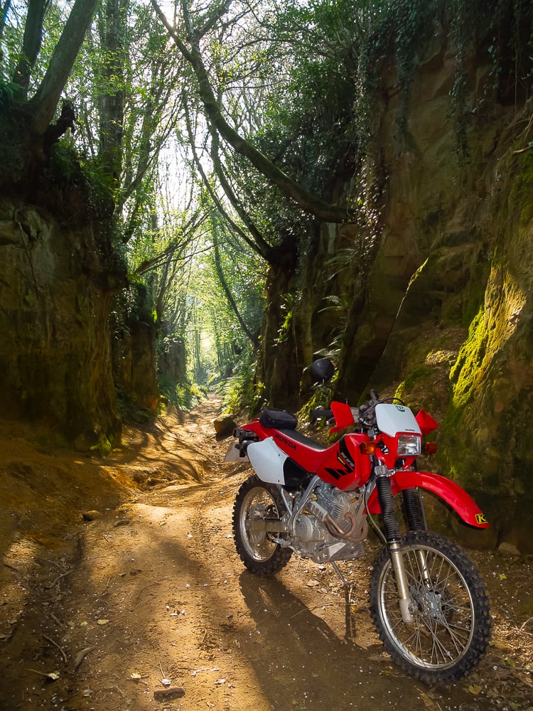
Take the lane straight ahead that drops away into a wooded sunken track. This would be the stretch that all but experienced off-roaders would struggle with on a large adventure bike. The going down here gets very deeply rutted at times and is pretty slippery and tricky after rain. There are some more intriguing carvings in the rock along the way and, in midsummer, you have to duck the branches and brambles. Pass through the double gate straight on and ride out through the stream bed past a farm on the left, to a tarmac lane. Bear left at the Hell Lane sign.
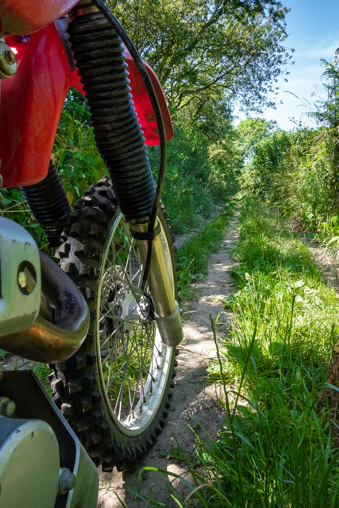
Grassy Trail on Hell Lane
3-4
Go straight ahead at the next junction and, shortly after, ignore the right-hand turn to Venn Farm, instead, following the lane left and down to where the track goes out into an open field. Follow the rising traverse across the field and past Butt Farm on your left where you join a gravel track to Ryall village. Here you pick your way left onto a tarmac road.
A Moment for Reflection
4-5
Just as you leave the village, there is a stony track on the right climbing back on yourself. This is a cut through to Morecambelake road that goes anticlockwise around Hardown Hill to the A35 major road.
Trail carved through the Landscape
5-6
Go straight across the A35 and, after a few metres, take the left-hand fork following a nice stretch of track just east of Charndown Hill. Hang a left at the next junction onto Muddyford Lane dropping down and then up towards the A35. Just before the main road, turn right towards the National Trust car park at Langdon Hill.
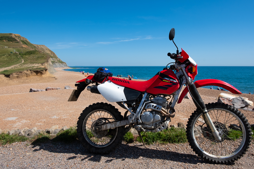
Near the car park, hang a left onto a rough track (Langdon Lane) that skirts the east of Langdon Hill and then bear left onto Petticrate Lane. After a few metres, you have two choices, I prefer the right fork. When you reach tarmac you can detour right to a fine pub right by the beach and the perfect place for a break and even a swim. The Anchor Inn sells local Palmers real ale and superb fresh seafood as well as coffee etc. Go back up Sea Hill Lane to Chideok and turn right onto the A35.
Time for a Dip
6-7
Watch out for the speed camera leaving the village and carry on to the top of the hill, being careful not to miss the left-hander at the crest. Follow the tarmac stretch to a lovely section of trail back to the climb you did up from Symondsbury.
Take the sharp right back down through the gorge to the finish in Symondsbury where you started.
Alternative options
A) At point 2, you can explore a nice track leading off to the right towards Henwood Hill. It is an easy return detour but eventually closes down into thick brambles. On your return you could then descend Hell Lane to your right.
B) If you are apprehensive about the slippery descent between points 2 and 3 due to wet weather or being on a heavy bike, you can turn left at point 7 towards the A35 and follow the main road to Chideock turning right at point 6 towards North Chideock, and rejoining our route by turning left at the T junction near point 3.
The Facts
| Distance: | 14 km |
| Nearest town: | Bridgeport |
| Maps: | Explorer 116 Lyme Regis and Bridgeport |
| Start/End Grid reference: | Circuit ride from SY 445 935 |
| Difficulty Rating: | 3 (Hell Lane descent 4 but variable subject to recent rain) |
| Wow Factor: | 4 |
| Other Tails: | Two short trails starting from around SY 414 963 |
Sunken Lane, Wales
This is a fantastic lane if you like deep water splashes, and by deep, I mean probably the deepest a bike can navigate without suffering serious damage. If you don’t like getting wet, this isn’t the trail for you. Sunken Lane makes a fantastic addition to the trails in mid-Wales. Whilst riding, I couldn’t help but compare it to the Strata Florida and its many river crossings located just 15 miles away.
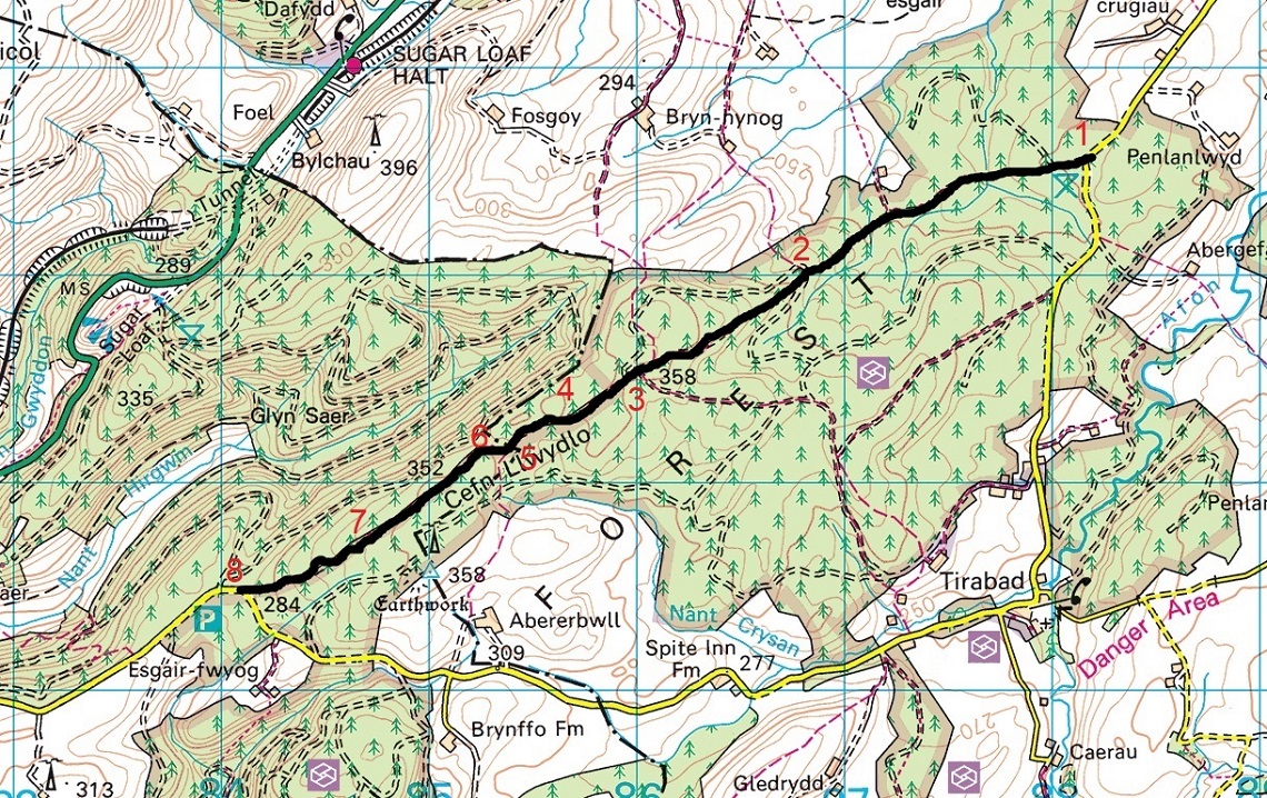
Sunken Lane route map
Ok, so Sunken Lane may not have rivers, but the puddles are just as wide and probably deeper. With this in mind, be wary of doing this trail solo. If you bin it in one of the ‘puddles’, there could be serious consequences.
The only issue I have with this trail is the four-wheel-drive damage caused by drivers going around the puddles. This is creating bypass routes which may initially seem appealing to you water dodgers out there but be under no illusion that these are easy bypasses. They are deep mud and rutty. Far easier to simply ride through the puddles. Why 4x4s insist on going around is beyond me. Stick to the legal route.
Muddy, Deep, Water-filled Ruts
If you like riding along the Trans Euro Trail (TET), take note of where this green lane is. While it’s not currently on the TET, with a bit of forward-thinking you can easily divert to this trail, and then back onto the TET with minimal effort.
The Route
1-2
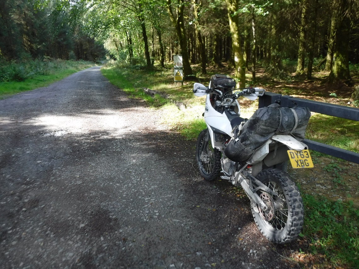
Head over the cattle grid and into the forest. You will follow a well-maintained graded forest track for this first section. Take care as it’s easy to pick up speed and this route is more than likely used by forestry traffic.
An easy start to the Trail
2-3
You will know when you reach point two. The obvious routes to the right and left have signs stating that you should not proceed. The legal off-road route ahead is the only option. I say ahead, but it really loops towards the left and proceeds uphill. This is where this route really starts to get good.
Only gets worse from here
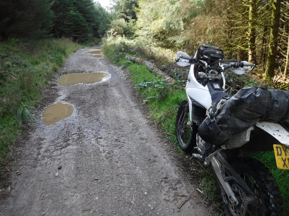
After a muddy start at the entrance, the track becomes rockier with loose stones as you proceed uphill. There are some muddier sections with some standing water but for the most part, it’s pretty solid at this stage. There are occasional ruts and washed out bits. It really is lovely riding. You are riding through the forest but you are not enclosed due to the newer trees at the side of the trail, with the bigger, more established trees further away.
3-4
This is the best part of the trail. Do not proceed past this point unless you like deep water splashes. Pass a turning to the left, and then one that appears to join from the right shortly after. Stay as straight as possible and you will stick on the route.
The going gets tougher
With stops, from here to the end takes about eight minutes to complete. There are some loose stones, but for the most part, it is a straightforward gravel track. The standing water starts to become more apparent but these are just minor puddles compared to what’s about to come.
The first large puddle soon looms and this one is the only one that I’d class as OK to go around. This is because the track appears to split. You have the option of either the water route or the bypass track which isn’t a muddy mess as the rest are. You will later see more evidence of off-piste 4×4 tracks in this area. Stick to the track.
4-5
Another track joins from the left. Keep going straight. The next puddle has a muddy cheat route going around it. I’d say, it’s easier just to proceed through the water.
5-6
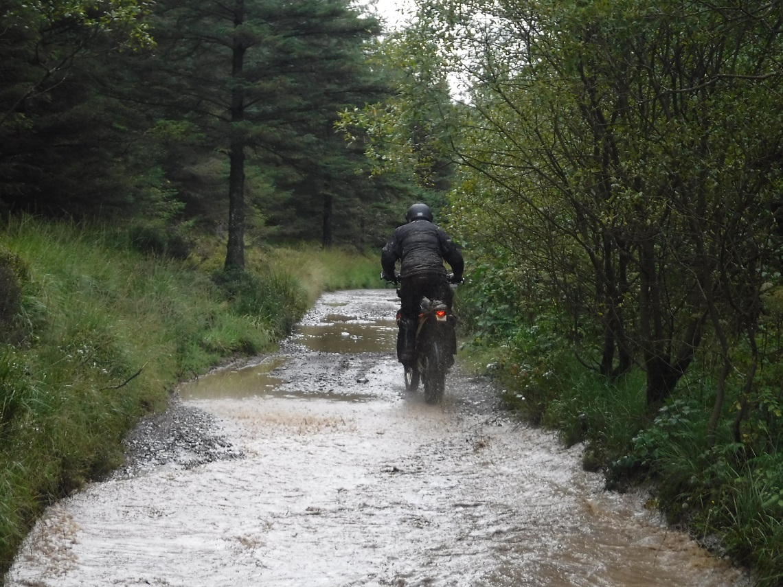
Deep waters ahead
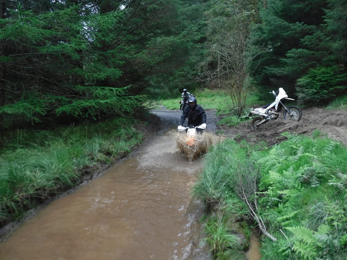
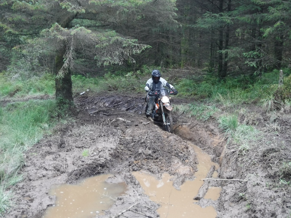
As the trail heads around to the right, the deepest crossing comes into view. This is the longest and deepest puddle on the route. Once again, there’s a very messy off-piste route to the left, but if you commit to the puddle there will be no issues. Don’t get me wrong, this is about knee to thigh deep (and I’ve got long legs). Just stick to one side, I went left, and don’t try to change ruts halfway across.
6-7
A bit of more exposed bedrock starts to appear. At the next puddle, stay on track and head through it. Do not go around (four-wheel-drive vehicles will eventually get this lane closed, I’m sure of it). From here, the puddles get easier and shallower than the previous few.
7-8
From here on, the standing water is just bigger puddles and after a while its clear of water right to the end of the trail.
Slippery when wet
The Facts
| Distance: | 3 Miles |
| Nearest town: | Llandovery |
| Maps: | Explorer 187 Llandovery |
| Start/End Grid reference: | SN882436 / SN841415 |
| Difficulty Rating: | 3 – 4 |
| Wow Factor: | 4 |
| Other Tails: | This trail is slap bang in the middle of some of Wales’ favourite trails, such as the Strata Florida and Roman Road a few miles South. its a Great Location |
