If there’s one road where fantastic riding, incredible scenery, and perfect weather come together, it’s California State Route 1. Alice Cook explains why this should be your next riding destination…
Where: United States of America, California
Length: 655 miles
Built: 1934
Ask any biker what the best route to ride in the USA is, and the likelihood is that California State Route 1 will be up there at the top of their list.
This 655 mile route runs along the majority of the coastline of the state of California, from Interstate 5 in Orange County in the south, to US Highway 101 in Mendocino County in the north, and has made it into ‘top 10 best rides in the USA’ lists time and time again, and it isn’t hard to see why.
State Route 1 (SR1) was built in numerous stages and first started in the 1930s in the Big Sur region and has become a popular route for its scenic beauty and challenging stretches of road.
To ride the entire road, seasoned bikers recommend giving yourself around three days – and with mind-blowing scenery and breath-taking stop-offs along the whole stretch, filling your time shouldn’t be a problem.
But if you are strapped for time and can only make the journey one way, then it’s worth going from north to south – this way you’ll be on the ocean-side of the highway all the way and you can actually experience the majority of the dramatic scenery within the 240 mile stretch between Monterey South to Santa Barbara.
The route consists of hundreds of hairpin turns and there are some real heart-in-mouth steep drop offs, so you need to pay attention to the twists and turns of the road as there isn’t much room for error should any oncoming vehicles veer onto your side of the highway.
The road surface is tarmacked so riding conditions are good, but there are a couple of points along the way where regular landslides and erosion can result in the road being closed temporarily in parts, or in some cases re-routed all together.

Photo: Graham Styles
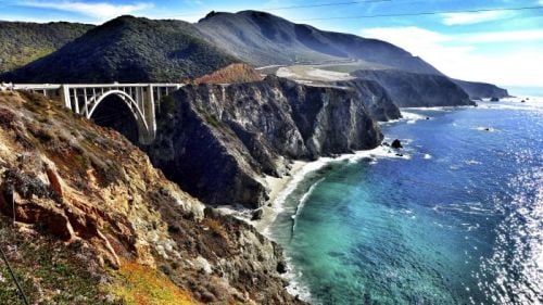
One of the ‘must see’ stop-offs along the way that any biker should make the time for is the Bixby Bridge – Big Sur’s version of the famous Golden Gate Bridge. Soaring 280ft above the Bixby Creek Gorge, it’s a reinforced concrete open-spandrel arch bridge, offering some of the most amazing panoramic views in the region.
One thing to point out about the SR1 is its lack of ‘gas stations’ and refreshment stops – so make sure you fill up where you can as there are huge areas where phone service will also drop off – leaving you all but totally stranded should you run out of fuel.
Most of the traffic along this route occurs during the months of July and August, so if you are looking for a peaceful ride without the hassle of multitudes of tourists then avoid this time of the year. Instead go in one of the quieter months to enjoy the SR1’s winding design and the daunting prospect of miles upon miles of challenging road with no guardrails and drop-off edges!
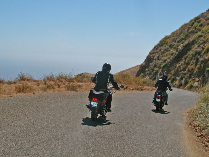
Photo: Craig Howell
The more you know…
- The Bixby Bridge cost $200,000 to build – a substantial amount back in 1932 .
- Along the way you can visit Julia Pfieffer Burns State Park where there is an 80ft waterfall that cascades from the granite cliffs down to the beach.
- The SR1 is broken into five sections, one of which is the famous Pacific Coast Highway.
- In the 1964 state highway renumbering the route was officially designated as Highway 1.
- The entire route is designated as a ‘Blue Star Memorial Highway’ to recognise those in the US Armed Forces.
- The road also takes in the world renowned wine region of Sonoma County – a must visit area for any keen wine drinker.
- It’s essential to check the weather in the area before you travel – it isn’t unheard of for fog to suddenly descend in parts, slowing down drivers and interrupting a smooth ride and unimpeded views of the scenery.

