

5 of the best green lanes in Cumbria and the Lake District
![]()
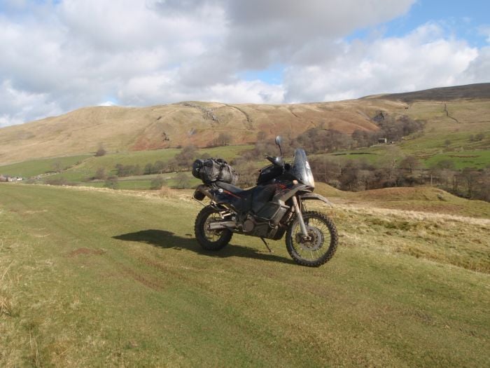
When the sun’s out there aren’t many things better to do in the UK than to hit the trails, that is, if you can find them. While our fair lands can’t offer the scale and unlimited off-road riding experiences that other countries can, we still have some fantastic routes up for offer, and some of the best can be found in Cumbria. Here you’ll be riding a variety of routes through one of the UK’s most beautifully scenic areas, and once you’ve finished with the lanes you’re in prime position to tackle some of England’s best mountain roads, like Hardknott Pass.
So, with that in mind, we teamed up with the Cumbria-based motorcycle clothing manufacturer, Knox, to discover five of the best green lanes in Cumbria and the Lake District. It seemed like the perfect way to get out and about in the company’s newest adventure offering, the beautifully styled and functional All Sports Jacket.
All of the routes are described in detail, but it’s well worth checking the Trailwise website before choosing to ride any of these so that you can make sure that they’re still open and not subject to a TRO. You’ll see that we’ve provided the Trailwise Track UID for you to check these easily before you head out.
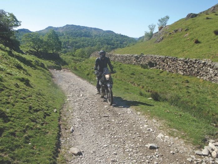
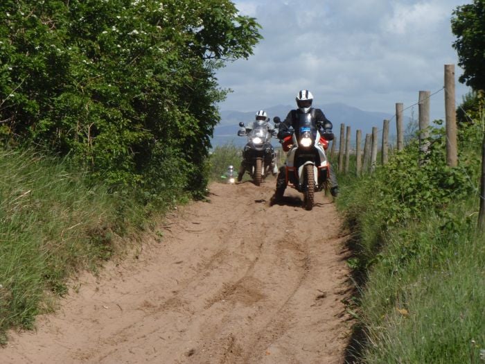
Little Langdale
Trailwise Track UID: NY3102-03
Most of the best trails in the Lake District are located around Lake Windermere and towards Coniston Water, and this trail near Little Langdale is one of the best in the whole national park. There are some tricky sections and these should only be attempted by competent riders. The trail has lots of large rocks and obstacles, and a fall here would definitely hurt.
This trail is fantastic in the dry and is a lot more difficult in the wet as there are several slippery rocks to negotiate. It can be attempted in both directions, and is 2.82 miles long from beginning to end with the optional section at 0.91 miles. After riding this route take a left at the end of the trail to head towards the infamous Hardknott and Wrynose mountain passes.
The route
1-2 Start on a single-track tarmac road. At point 1a continue straight on, do not take the right-hand turn.
2-3 Go slowly past the houses. The trail starts here. The first part of the ride is a rocky uphill section. There is a large rock step to ride up and this will be slippery in the wet. Immediately after, you will be faced with the task of negotiating some 180 degree switchbacks. Proceed through the next gate and through the woods.
3-4 Go through the gate and turn right going past Hodge Close on the left. Proceed through the next gate. This section is easier and leads you through woodland. There are some rocky steps and a few muddy puddles but nothing too taxing. Proceed through the next gate which is shortly followed by a final gate which will take you onto a tarmac road.
4-5 Turn left and continue past the houses. The tarmac will turn into a forest trail, which is easy to negotiate. At the ford, bear left.
5-6 Continue past the ford and along the lane of broken tarmac. Take it steady as you pass some houses. Go left past these and uphill. Go right past the next set of houses, continue to the gate.
6-7 After the gate the trail becomes very rocky. There are large boulders to bounce over. When you reach the intersection you will have two choices: turn left (as detailed in point 7-8 below) or go straight over (7-9).
7-8 Going left will take you down an advanced route. The trail is extremely rocky and there are a few tricky sections. To start with there are some rock slabs to ride over. These are very slippery and difficult in the wet. After this section, there are plenty of rock steps all the way to the top of the rise where it levels out. The downhill section is no easier, with lots more rocks and steps with larger drops. At the bottom, proceed through a gate and into a farmyard. To continue this trail, you will have to go back in the direction you came from – but it’s great fun heading the other way.
7-9 Continue straight on along a rocky trail. There are lots of fist-sized rocks and the going is tricky. Speed helps along this section.
9-10 Travel past the houses and over a packhorse bridge and through a gate. Continue down the access track to where the trail ends.
Facts
Distance: 2.82 miles, plus 0.91-mile optional section
Maps: OS Explorer Map OL7 The English Lakes (South Eastern Area).
Start/End grid reference: NY328018/NY300032
Difficulty rating: 4/5
WOW! Factor: 4/5
Askam in Furness Coastal Trail
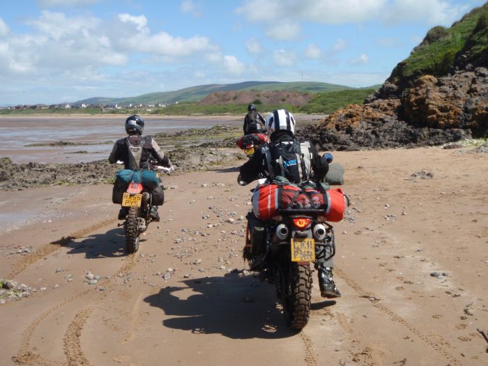
Trailwise Track UID: SD2077-01
This trail presents a rare opportunity to ride on a sand tidal byway, and there are not many places in the UK where you are able to do this legally.
This trail is only possible at low tide and it’s crucial that you do not attempt it at high tide or when the tide is coming in as you could get cut off and lose your bike to the sea. The tides in the surrounding area come in extremely quickly, so make sure you check tidal information before you ride.
Be aware that your bike will be covered in sand, mud and salt water at the end of the trail, so make sure you wash both your bike and yourself as soon as possible to prevent corrosion.
The route can be attempted in both directions. At the start of the trail is a fresh water ford, so if you do this route in the opposite direction to what we’ve proposed, you’ll have a good start to cleaning your bike here.
A lot of people raise concerns when riding through salt water and sand, bust just ask yourself, how different is it than riding through a typical British winter with grit all over the roads?
The route
1-2 Starting at a car park, take note of the tidal warning signs and proceed down this sandy path heading to the coast. You’ll be riding over loose sand which is difficult to navigate over if you haven’t experienced it before (check out our guide to riding on sand for some help). Be wary of other path users.
2-3 Proceed through a ford and continue on a four-wheel drive track which leads back into the river you have just crossed.
3-4 Turn right and follow the river towards the rocky outcrop ahead. There’ll be hard, compact sand under tyre and it’s tempting to open the throttle. Be aware of your speed though, the TRF advises a maximum of 20mph. You will cross the river one more time before reaching a rocky section.
4-5 You have a choice here. Stick to the sand or enter the rocky section. Be warned, this is not easy. The rocks are covered in slippery seaweed. As you go around the headland the rocks give way to salt marsh. The underlying mud is very deep and smelly.
5-6 The conditions change once more as you reach a pebble beach. This section soon ends though, and you’re in sand once more. Hard compact sands that stretch towards Askham Pier in the distance. Remember the 20mph advised speed limit, you are not in the Dakar and there are other beach users here, including families and occasional horse riders.
6-7 At the end of the beach you will see the way under the pier. This is above the tide line and the sand is very loose. As you go under the bridge the views to the left are amazing. Continue on this sandy trail until you see a wooden bridge – take this, do not continue to the lifeboat station.
7-8 Here you’ll find lots of loose sand and shingle. As you reach the end of the soft stuff the trail once again drops below the high tide line. This section is very muddy and slippery.
8-9 Continue to the exit point. It’s not easy to spot but look for the large post on the right.
9-10 If you view this section on Trailwise it is indicated as a no through route. The byway is supposed to end a few metres out at sea, and the obvious exit is not allowed by any mechanically propelled vehicle. I queried this with the Cumbria National Park Authority and it turns out that this is actually a valid exit to this trail which takes you to Duddon Road. There are large boulders blocking the route for cars, but bikes can get around.
Facts
Distance: 2 miles
Maps: OS Explorer Map OL6 The English Lakes (South Western Area)
Start/End grid reference: SD200756/SD210781
Difficulty rating: 4/5 (riding in soft sand can be tricky)
WOW! Factor: 5/5
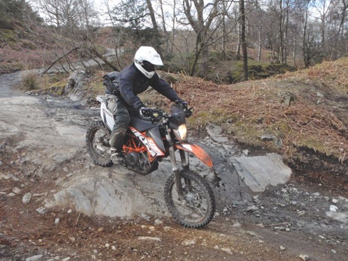
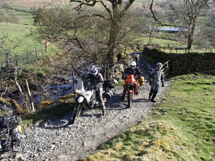
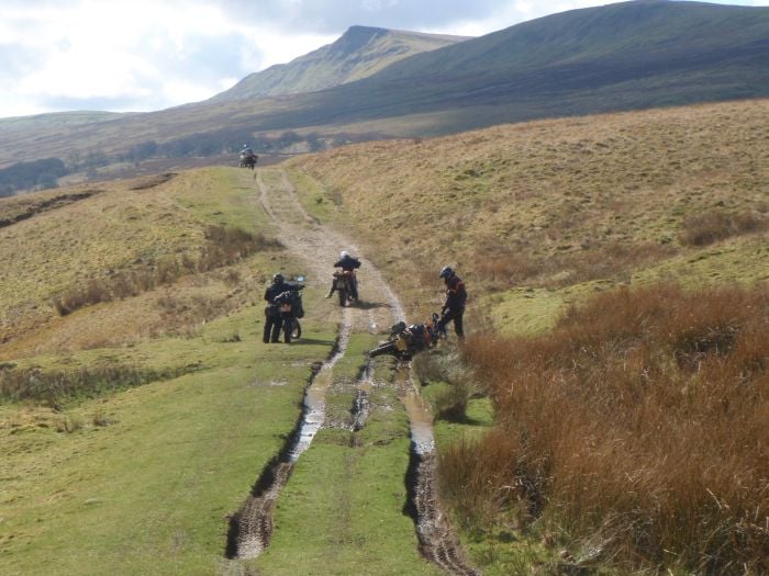
Breasthigh Road
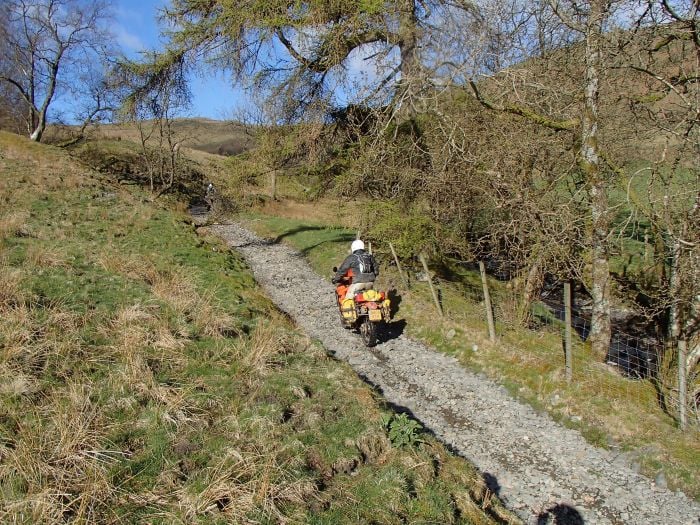
Trailwise Track UID: NY5503-01
This is a fantastic trail and is located just a few miles from J38 of the M6, making it a very accessible alternate entrance to the joys that await in the Lake District. The trail is pretty difficult and is really only suited to experienced trail riders. It is possible on large capacity adventure bikes, think KTM 950, Yamaha XT660Z, Honda Africa Twin and BMW F800GS, all of which I have seen complete the trail.
However, don’t be fooled in to thinking that if a big bike can get up then it is easy. It is far from that, but the scenery is fantastic in this area and it’s hard to believe you are only a short mile or two away from the M6. This green lane is my favourite way to approach the national park, and it’s possible to complete it in both directions. The trail is accessed via one of two points, both of which are shown on the map below.
The route
1A-2 This is a single-track tarmac road. Once you reach the right hand turn the track becomes very rocky before you reach the gate.
1B-2 This follows the edge of a field at the top of a hill, with great views down to the valley below. Once you pass through the first gate the track deteriorates and is very rutted and in wet conditions, slippery. The trail then takes you through a tricky ford with a rocky base, after which you proceed past some derelict farm buildings to the start of the trail.
2-3 Proceed through the gate and start heading uphill. The going is fairly easy compared to what is to come. If you struggle on this section it’s best to walk ahead to assess the rest of the trail and your ability to ride it.
3-4 This part is hard, especially on bigger bikes. The trail is littered with football-sized rocks all the way and if you stop, gaining momentum again is hard. Just before you approach the ruin of a building there are high rock steps – it’s best not to think about them and just power over them.
4-5 The trail starts to level out towards a gate at the top. Savour the wonderful views here.
5-6 Begin the long descent. This section is steep but it is a lot easier than the journey to get here.
6-7 Proceed through the gate and across the ford, from here it’s easy going back on to tarmac and the end of the route.
Facts
Distance: 2.74 miles
Maps: OS Explorer OL7 The Lake District, SE Area
Start/End grid reference: NY588050/NY553035
Difficulty rating: 4/5
WOW! Factor: 5/5
Kirkby Stephen Trails
Lane 1 Trailwise Track UID: NY7508-03
Lane 2 Trailwise Track UID: NY7704-01
These two trails are located close to the market town of Kirkby Stephen, the previous home of the ABR Boil Rally.
The route
1-2 The trail starts immediately on the left after a beige house. It’s a farm access track for its length and is a mixture of hard, compact shallow (and sometimes muddy) ruts. There are walls either side with a few trees to ride under. Generally, there are just two ruts a vehicle-width apart and the centre is overgrown with grass. Continue to the junction where the trail splits.
2-3 Continuing straight on will lead to the road. There is a large puddle to splash through, which isn’t deep and should cause no issues.
2-4 This section is slightly easier and proceeds towards a farm. There are plenty more puddles to splash through and the trail is more graded. Proceed to the farm where this trail ends. Turn right to leave the farm.
4-5 Tarmac section. Take care when crossing the busy A685.
5-6 Ride down the track until you reach a gate.
6-7 Proceed through the gate and the trail becomes muddy and slippery. There is a small byway sign on the gate to make sure you don’t take the bridleway by mistake. Proceed downhill to a small concrete bridge where the views to the river and over the hills are fantastic, giving a real sense of remoteness.
7-8 Continue past the bridge and the trail remains very muddy. There are shallow ruts which, once in, are not easy to get back out of. Take care and try not to use your front brake much as, if it locks the front wheel, you’ll go down with the bike (I did!). There are a few puddles to go through.
8-9 Make sure you head right at this point. There are small byway markers pointing you in the right direction and the trail now becomes less rutted and grassier. It is so easy to lose traction here. More ruts follow and the views are amazing. Towards the end the trail becomes easier, and you can proceed to the tarmac road.
9-10 Head down the single-track road to Pendragon Castle. There’s a sign for red squirrels, so keep your eyes peeled for them.
Facts
Distance: 2.22 miles
Maps: OS Landranger 91 – Appleby-in-Westmoreland
Start/end grid reference: NY755094/NY752083 and NY772046/NY780030
Difficulty rating: 2-3/5
WOW! Factor: 3/5
Winton Ford
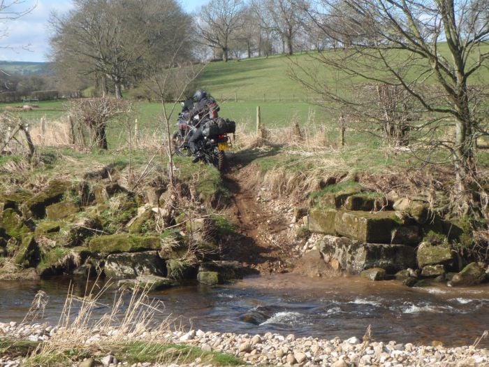
This green lane and ford is located close to the village of Winton, a few miles north of Kirkby Stephen. This is a fantastic ford with difficult entry and exit points.
Before attempting the water crossing, it’s a good idea to use the footbridge to walk to the far side and make sure you can achieve the exit, which is a steep soil/gravel bank. The entrance to the Winton ford is down a steep bank and it spits in to two parts when the water levels are low, though I assume these two sections will merge if water levels are high enough. My advice would be that if you can’t see an island between the two sections, don’t attempt the crossings as it’s likely to be too deep.
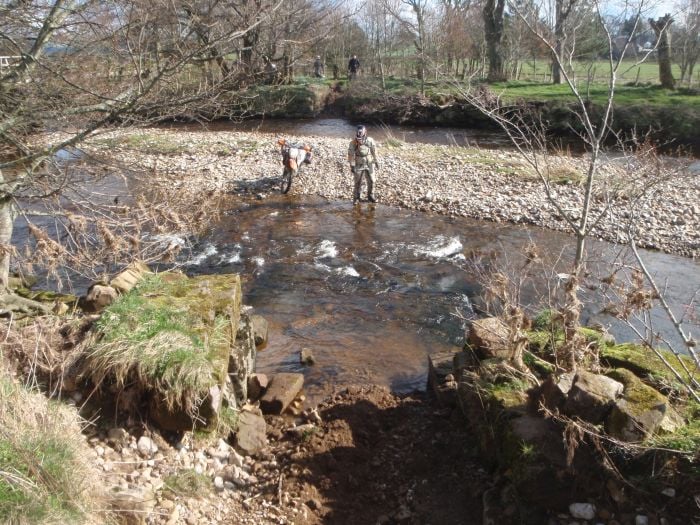
The first part of the ford is the easiest where the ground consists of small, loose stones. Take care you’re not carrying too much speed after dropping down the entrance bank. Once you reach the ‘island’, park the bike and take a look at your exit route.
The second part of the ford is roughly knee deep and fast flowing. The bottom ranges from loose stones to slab rock that’s very slippery, but it’s possible to avoid some of the larger rocks by navigating over these slabs. As always, conditions under water will change, so make sure you check it out first and pick your own line. The exit is difficult to get up, and take care not to flip the bike as you near the top.
The route
1-2 Entrance to the green lane. Continue to the ford at point two down an easy farm track.
2-3 Stop the bike and survey the ford.
3-4 After crossing the ford continue along the lane to a bonus ford that heads back across the river. I expect this is just access to a farmer’s field, so attempt it at your own risk, there are no vehicular rights here.
4-5 Trail ends.
5 Bonus ford on a legal track with a straightforward crossing.
Facts
Distance: 1.09 miles
Maps: OS Landranger map 91, Appleby-in-Westmoreland, 1:50,000
Start/End grid reference: NY77114/NY75112
Difficulty: 4/5
WOW! Factor: 3/5
So, what are you waiting for? Phone your mates, tell them that if they have plans for the weekend they need to re-evaluate them, and get out on the trails.
While you’re in the Lakes, why not pay a visit to our sponsor Knox and check out their full range of motorcycle clothing and accessories.

