

USA THE HARD WAY
The Trans-America Trail is a 4,800-mile dirt-road route from Jellico, Tennessee, to Port Orford, Oregon, on the Pacific coast, and it’s the perfect antidote to Easy Rider. In the first of a two-part feature, Paul Beattie and buddies make it to the Grand Canyon…
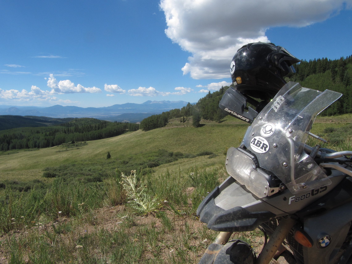
When you think of riding across America, do you imagine eating up endless straight roads aboard a nice, comfortable cruiser? Well, I’ve got news for you. There’s an alternative to tarmac that’s just made for the Adventure Bike Rider: the Trans-America Trail (TAT).
This 4,800-mile dirt route was first ridden over 25 years ago by a keen American ABR called Sam Correro. It combines farm tracks, forest roads, Jeep trails, old stage coach trails and the like to create a single, continuous route on a mix of gravel, mud, sand and dirt roads. Passing through Tennessee, Mississippi, Arkansas, Oklahoma, New Mexico, Colorado, Utah, Nevada and Oregon it runs right through the heart of America. Having completed the TAT himself, Sam set up a website – www.transamtrail.com so other adventure bikers could follow in his tracks; here’s my story of how I came to ride this incredible route…
Trail and error
Riding the TAT was my Sate-side mate Aaron’s idea. He’d asked if I’d be up for exploring a bit of his home turf on two wheels, and my initial response had been ‘Yeah! How hard can it be?’ Very as it turned out, but that’s half the fun.
After weeks of careful planning over email and studying the TAT roll charts, I flew out to meet Aaron and his mate Harold in Knoxville. From here we planned to make the short blast north to Jellico where the trail begins.
Armed with the TAT maps and roll charts we’d bought from route founder Sam’s website www.transamtrail.com, I’d spent many hours before my departure plotting out the TAT into MapSource, turn-by-turn, so that we had a GPS version we could use, and kept the maps and roll-charts as backup. This was a wise move as it turned out, because none of us had any experience of reading roll charts and the bike’s chart-holder kept tearing the paper charts.
The first couple of days were mostly pavement, which was a bit of a disappointing start. Our maps showed gravels roads winding their way around the various small towns, but these had been tarmacked over. The disappointment was short lived, however. Despite the amount of black stuff, these roads also threw up some beautiful riding through dense humid forests. I could almost hear the duelling banjos over the noise of my engine as we made our way past small settlements which looked to be straight from the set of Deliverance.
As we approached the first major creek crossing, I pulled over and waved Aaron past. He’d not read the notes on the roll charts and I had. It warned that the creek was ‘very slippery’, which was an understatement. Aaron entered the water and went down with a crash before he even got halfway. Harold and I dismounted and paddled into the creek to help him pick up the bike, only to go skating around like drunken giraffes on ice.
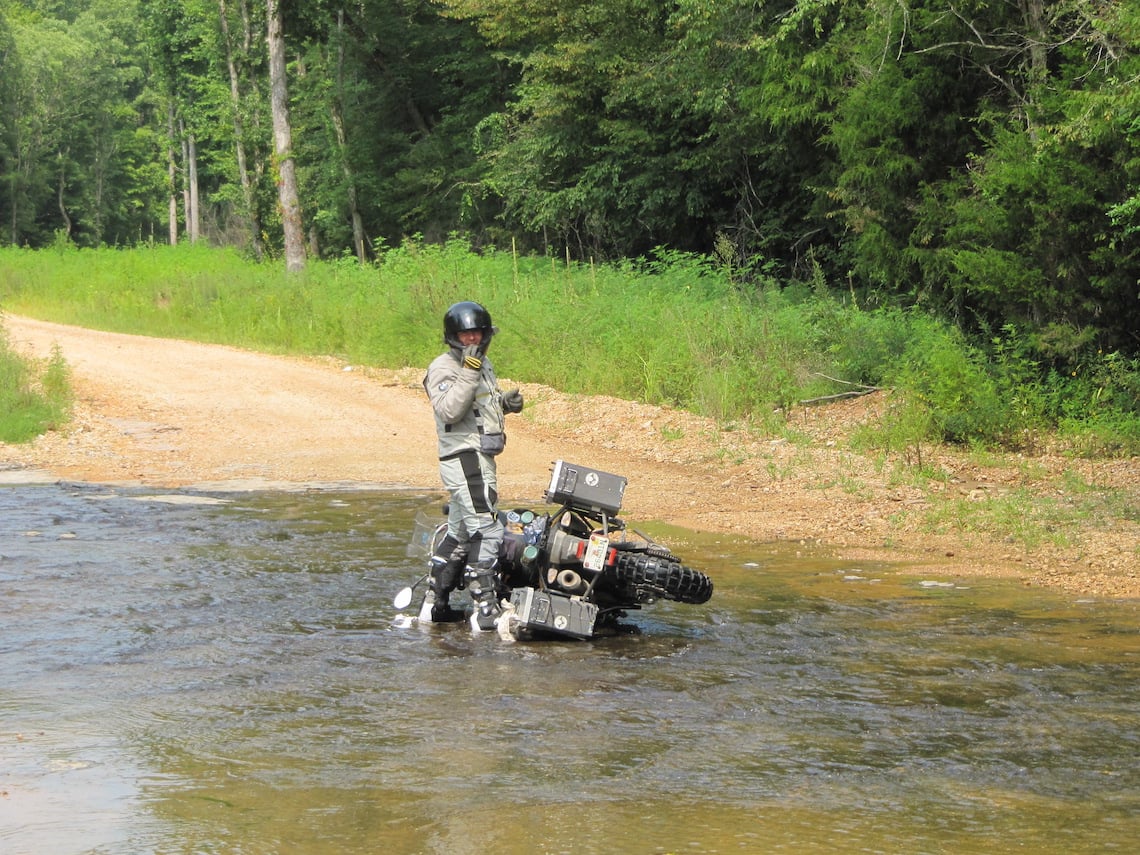
Photo: Paul Beattie
The bottom of the creek was algae-covered rock with the frictional qualities of buttered Teflon. It took all three of us to get Aaron’s bike upright, not because of its weight but because we had to support each other while lifting it.
Eventually we got it to the opposite side of the creek without falling over, and then walked the remaining two bikes across. We certainly weren’t going to risk riding over!
Further up the road we encountered our first ‘road closed’ sign. We’d read on various forums that these are put up to prevent trucks and 4x4s trying to get through the roadworks, but that often a motorcycle can pass. This was the case here and we simply rode around the signs, down a sandy bank and back up the other side, feeling very smug.
The next ‘road closed’ warned that there was also a bridge out, but as the alternative was a long detour, we figured we’d investigate anyway. After a thorough recce we chose what looked like a potential route in and out of the small creek and through the debris of the broken bridge.
Aaron made the first attempt. He got into the water fine, but on the way up the steep, muddy incline on the other side he got stuck and down he went.
No problem, we thought. Just roll the bike back into the creek to get a run up and then out he’ll get. Only he didn’t. As he tried to get going from in the creek his bike dug into the soft creek-bed and sank all the way up to the swingarm!
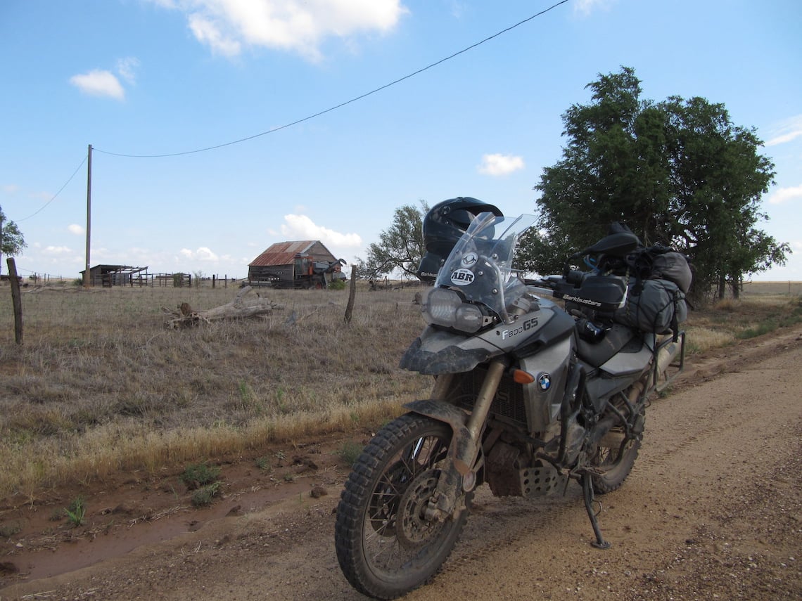
Photo: Paul Beattie
It took us a good couple of hours sweating in 37-degree heat to get the bike back out of the water, first by lifting it up onto a plank of wood, then walking it over some strategically placed bits of broken bridge before finally pushing it back onto dry land. We then abandoned any hope of getting across and resigned ourselves to taking the detour.
Mississippi mudslide
That same day we rode across Mississippi and the Mississippi River into Arkansas. The weather changed dramatically en route, going from hot and humid to heavy rains overnight. The morning dawned dry, but the roads had turned from hard-packed dirt and gravel into a mud bath.
The riding was treacherous and it wasn’t long before Harold got dumped in the mud. The whole day was spent splashing through enormous puddles as the heavens repeatedly opened, dumping deluge after deluge on us. It was great fun, though, creating huge bow-waves as we ploughed through puddles that looked more like rivers flowing across the trail.
At the end of this exhausting day we arrived in Clinton, Arkansas, and checked into our motel where the receptionist cheerfully informed that Clinton is a dry county, meaning that there was no beer to be had anywhere. Undeterred we took a 36-mile round trip to the liquor store on the county boundary to get some, reasoning that we’d earned it.
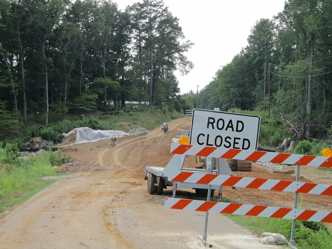
Photo: Paul Beattie
The following morning saw the mother and father of all thunderstorms hit just as we were preparing to leave. The sky turned black, the heavens opened, and the car park of the motel quickly disappeared under a couple of inches of water as thunder shook the building and lightning arced across the sky.
After a few minutes, the storm subsided a little and we rode out into the rain to continue our adventure. The trail took us into the Ozark National Forest. The riding here is superb; hard-packed mud with only a smattering of gravel. Mule deer grazed at the side of the road, oblivious to our arrival until the last minute when they’d disappear rapidly into the dense undergrowth. Occasionally we’d catch a glimpse of the scale of the forest that covered the surrounding hills through a break in the trees, mist rising from the depths of the valleys.
Having ridden all day without seeing another vehicle we weren’t too surprised when we encountered our first fallen tree lying across the trail. Being big strong lads we thought we’d simply drag it to the side of the road, but it was wedged firmly into the trees at either side and wasn’t budging. Turning around wasn’t a particularly palatable option, as the last junction was 20 miles back, so we scratched our heads before deciding to try and get the bikes over the tree anyway. There was no way we could ride them over, so we walked them up to the tree, then dumped the clutch so the front wheel wheelied over the tree, and with the bike resting on the bash-plate and centre-stand we could then manhandle it the rest of the way over. Success! Good job I was on my 800 GS and not my 1150 GSA – the 800 was heavy enough, thanks!
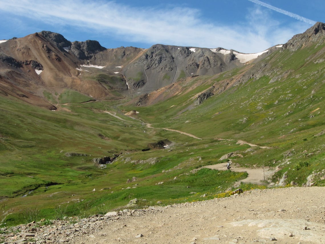
Photo: Paul Beattie
Oklahoma!
Arkansas is a great place to ride an adventure bike. The endless trails through the forests and out onto the plains provide a wide variety of challenges.
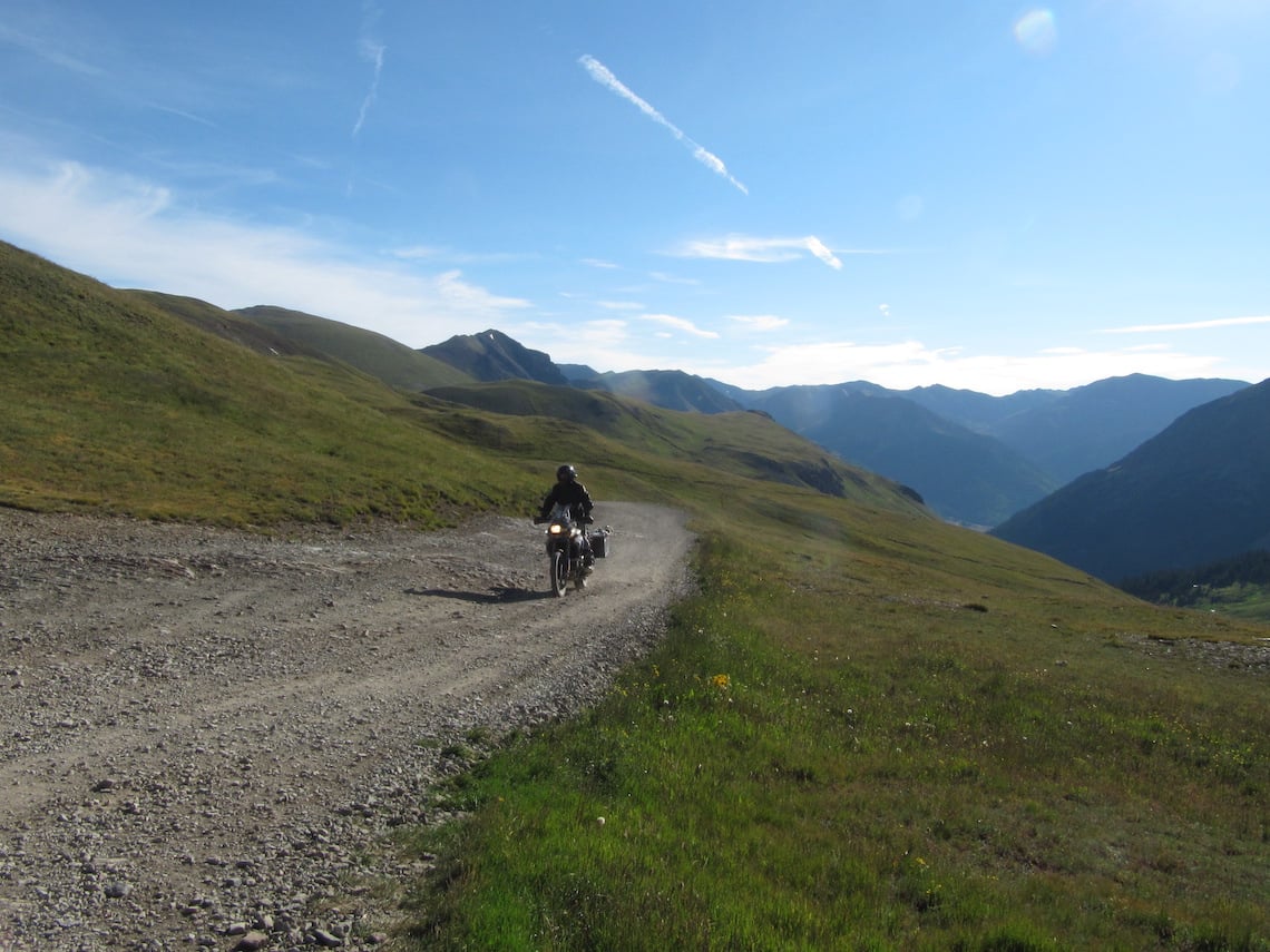
Photo: Paul Beattie
As we passed into Oklahoma we encountered several more thunderstorms, including an absolutely huge one that hit us as we rode across a high plain. Up here there were hardly any trees, and the nodding-donkeys of the old oil fields were tiny, meaning we were now the highest points and targets for the lightning we could see up ahead.
As we rode into the storm the sky went black and the rain fell with such an intensity that my boots were overflowing. Fortunately we dodged the lightning strikes that lit up the sky around us. Trying to pick a line through the deep, wet gravel with such poor visibility was difficult, but we all made it and once clear of the storm were reminded once more how desolate the landscape around us was. The only vehicles we saw all day were an enormous truck and Rick and Mike, a father and son duo from Pennsylvania on Yamaha WR250s, who were also riding the TAT.
With the stormy weather now behind us we continued across the high plains of Oklahoma and the sun made a welcome return. This is real prairie land, dotted here and there with abandoned settlements, the old wooden buildings left to fade and rot in the sun, surrounded by rusting farm machinery. The trail became straighter too, turning from hard-packed mud to light sand. Here and there were deeper patches of sand and both Harold and I were caught out. The trail was already proving to be quite challenging!
That night it rained again, once more in biblical fashion. This had the effect of turning the loose sand into thick slippery mud, but by now we’d mastered those conditions and didn’t have too many mishaps.
Gradually the sun came out and dried the roads, which were now arrow-straight as far as the eye could see. Had these been paved they would have been boring in the extreme, but these dirt roads change in an instant and the concentration needed to ride them kept things interesting. Passing a TAT mile marker, I took the opportunity to leave an ABR sticker in our wake.
After an overnight stop in Kansas, we began the next day’s ride (and my birthday) with some interesting sand dunes.
Our WR250 riding buddies caught us up here while we were flailing about in the soft stuff and ripped past us, laughing at our difficulties. The advantages of having a lighter bike were becoming apparent as we wrestled with our laden F800s which just kept sinking ever deeper into the sand. Fortunately the sand only lasted for a few miles and then we were back on the fast, straight gravel roads.
Mercifully, Sam’s TAT route doesn’t succumb to the endless ‘due-west’ approach to crossing the US and instead takes advantage of the country’s grid-system. Every 10 or so miles we’d turn 90 degrees left and head due south before turning 90 degrees right and going west again. All of this on gravel roads running through the middle of nowhere.
Dotted about this desolate high landscape were more abandoned farmhouses. We stopped at one to have a look around, discovering a pile of unopened letters from the bank on a table inside, dated 1983, and even a dress still hung in the wardrobe. Outside were the rusting hulks of long-forgotten family cars among the farm machinery. This must have once been someone’s family home, and now it was abandoned, left to gradually fade away. Walking around the ruined building and neglected land was very eerie, like walking through a graveyard.
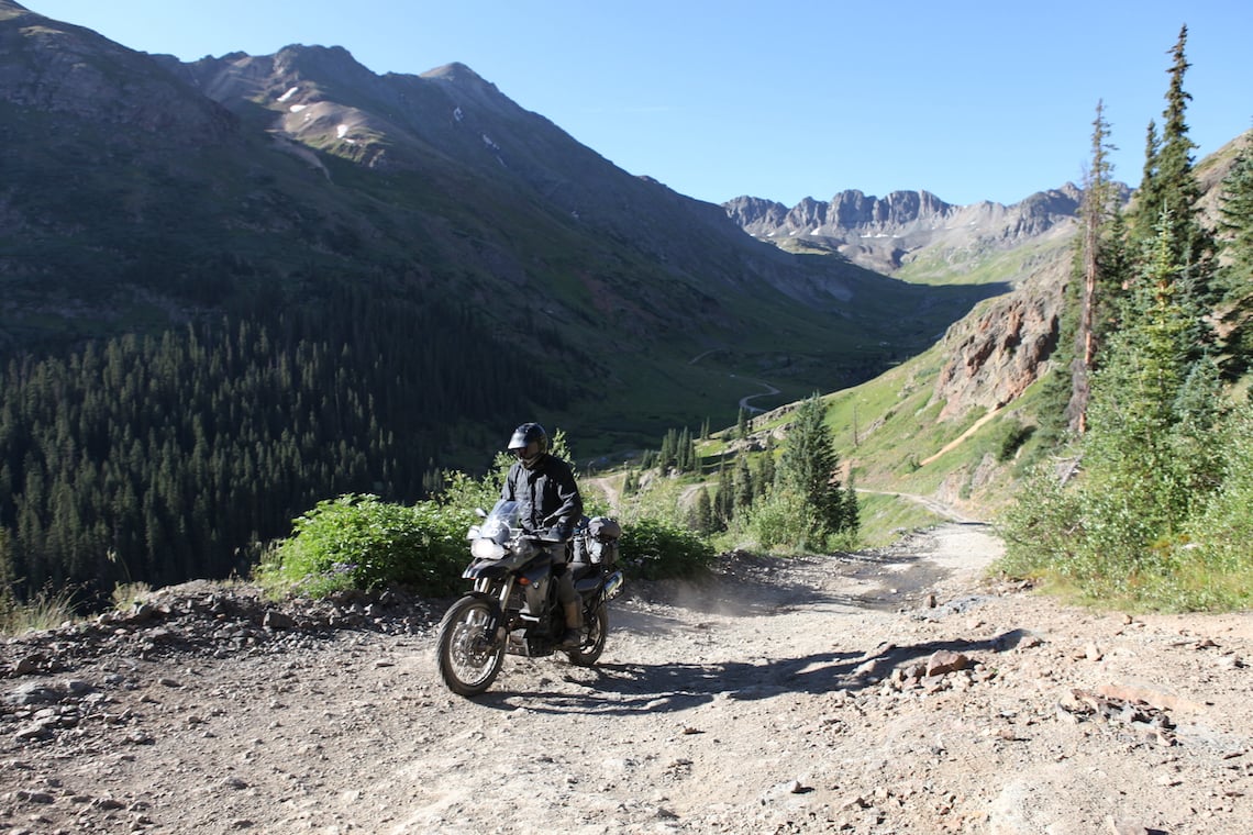
Photo: Paul Beattie
Land of enchantment
Before long we left Oklahoma and entered New Mexico. Another chance for placing an ABR sticker presented itself at the border, where the sign proclaimed ‘New Mexico – Land of Enchantment’ Within a few miles of the state border, I understood what the sign meant. the landscape had changed beyond all recognition. Gone were the desolate high plains and arrow-straight gravel roads, replaced by rolling hills dotted with scrub bushes, leading to sharp rocky mountains.
The riding got even more interesting as we rode up a steep rocky hillside, the first technical section of riding we’d encountered on the trail. This took us up and over the hills, dropping us down into Colorado and our stop for the evening in Trinidad. This being my birthday, we’d planned the next day as a rest day, so I did some research on Trinidad to find out where we could go for a few drinks. What I discovered was that it used to be the ‘sex-change capital of the world’ Surviving the stay intact was now my priority, as my fellow travellers seemed keen to buy me a birthday present I didn’t want and was sure my wife wouldn’t appreciate either!
The rest day was useful in that it gave us chance to recover from our hangovers, and for Harold to fix the puncture he picked up as we arrived at the motel, but by early afternoon we were itching to get moving again.
Back on the trail in glorious sunshine the following day the roads headed straight for the mountains. We blasted along these lightly gravelled roads kicking up huge dust clouds until the trail headed into the national park, where it started climbing up into the mountains. At one point we spotted a black bear cub in the field to our right, but with no sign of ‘mommy’ we weren’t going to hang around to try and get a photo. As the roads wound higher into the mountains the landscape took on an almost Alpine feel, with wooden houses sitting proudly in the centre of green fields amidst a backdrop of high mountains.
Photo: Paul Beattie
Ain’t no mountain…
These high mountains form the Continental Divide, which separates the watersheds feeding the Pacific Ocean to the west from the Atlantic Ocean to the east. They’re very big, and we had to cross them. The high passes through these mountains are where the TAT gets serious, following old stagecoach routes to the beautiful little town of Lake City over a series of climbs and descents. The first of these, Cinnamon Pass, tops out at 12,640ft and is clearly marked as suitable for four-wheel drive vehicles with high ground clearance only.
But that’s nonsense as it’s perfectly suited to small, light enduro bikes. And just about doable on a heavily loaded F800 GS, too!
The climb up is steep in places, the surface a mix of loose rocks and gravel. Where the 4x4s have loosened the larger rocks the going can be tricky as the rocks shift position under the weight of the bike, but apart from the odd heart-stopping moment as the bike momentarily makes a bee-line for the drop-off into the valley at the side of the road, it’s not too bad.
At the top of the pass we stopped to take a photo, feeling a real sense of achievement along with the shortage of oxygen. But if we were getting all self-congratulatory it was premature. We now had to get down again. Dropping off Cinnamon Pass to the abandoned mining town of Animas Forks was straightforward, despite the onslaught of guys on KTMs blasting up the mountain – seems we’d inadvertently chosen to ride the passes on the same day as the Colorado 500 enduro race!
The ride out of Animas Forks took us up California Pass, where my bike started to overheat. The problem seemed to be a sticking fan, but with no way to clear it I had to press on regardless, stopping wherever the steep incline would permit.
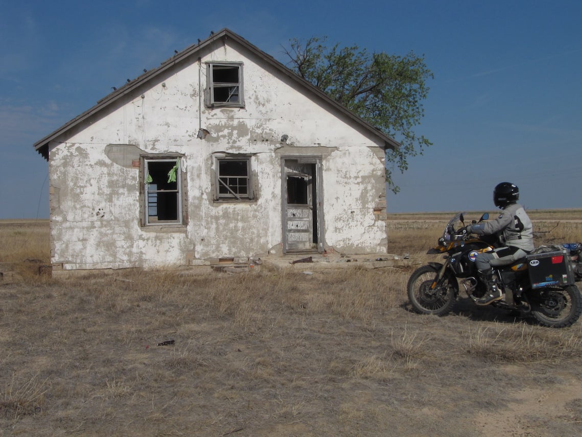
Photo: Paul Beattie
At the top of California Pass the road then drops drastically down a very steep decline, the surface coated in a dusting of gravel with loose rocks in the centre. This was getting serious now, the limitations of the F800 GS exposed themselves as the bike is simply too heavy for these conditions. Even with front and rear brakes on it slid down the slope, skipping over the rocks.
With my bike overheating I adopted a technique whereby I switched the engine off and with the bike in gear and used the clutch as a brake, so that I could use both feet to keep the bike upright. Once down California Pass came Hurricane Pass, equally steep on the ascent and descent, and equally challenging. By the time we arrived at the beautiful historic mining town of Silverton we were thoroughly exhausted. It had taken us over five hours to ride a little over 40 miles!
The afternoon wasn’t much better. The final pass, Ophir Pass, had the worst descent of all. Scree falling from the huge mountain walls had turned sections into a rocky nightmare. That day saw all three of us drop our bikes. By the time we got to the bottom of Ophir Pass we were shattered, and we still had 140 miles of trail to go. It was a quick and unanimous decision to bail out and take the highway, another pass like those we’d just done would have killed us!
Grand entrance
The following day’s ride from Monticello in Utah to Moab more than made up for the difficulties of the previous day. We rode along perfect dirt roads up into a deep forest before emerging to a view out over canyon country – as in Grand Canyon country. Here we were gifted a staggering view looking out over the massive gashes in the ground formed by these hug canyons, the landscape turning from emerald green to sandy red as the lush forest was replaced with desert.
Photo: Paul Beattie
Riding into Moab among weirdly wind-sculpted rocks was a joy, made all the sweeter for knowing we had another rest day ahead to recover from the trials of yesterday. With the bikes also getting some attention in the form of a clean, oil change and new rear tyres, we were getting set for the second half of the TAT. (To be continued…)
TAT’s the way to do it!
We get some Trans-Am Trail- riding tips from route creator Sam Correro
- I definitely wouldn’t recommend any motorcycle smaller than 400cc motor. You need a dual-sport motorcycle that you can handle through deep sand, mud, loose gravel, rocks and snow. Knobblies are best, but a very good aggressive dual-sport tyre would be okay in the eastern sections of the TAT. Check your bike’s in good shape prior to your departure, too. A tune-up and safety check is a good idea
- If you want to cross Colorado, Utah and Oregon, then your snow-window will be late June to early September. Keep in mind the desert heat in Utah and Nevada. Also, snow on the high passes of Colorado usually doesn’t melt enough to allow bike passage until later in June
- It’s essential to keep dry and warm, even in the summer months. In the high elevations of Colorado, summer temperatures can be cold, even in July and August. If caught in the high elevations after dark, the temperatures can drop significantly, so be prepared to wrap up
- The average day’s ride is about 200 miles, from 7am to 6pm. Be sure to pack extra water and bring some food or energy bars to keep you going. Matches and a flashlight would be a very good idea – and an adequate first-aid kit goes without saying
WHO’S RIDING?
 Name: Aaron Sprague
Age: 38
From: Tampa Florida
Motorcycle dealership owner Aaron met Paul riding from Alaska to Argentina with Globebusters; he met Harold when he sold him a BMW F800 GS. Aaron’s done several big two-wheeled trips including the Silk Road from London to Beijing via Tibet and across the US and Canada. Next year he’s planning to ride the Trans Labrador Highway and London to Cape Town with Globebusters in 2013. He has a passion for concerts, travel, photography and, of course, motorcycles
 Name: Harold Johnson
Age: 55
From: Tampa, Florida
Retired Air Traffic Controller Harold is now a full-time adventure-seeker. He started riding motorcycles at age 12 with the acquisition of a Sears 50cc moped! Since then, his lifelong goal has been venturing off into the unknown, or planning the next escape. Next year, he’s going to redo the TAT in a Land Rover Discovery so his wife Carmen can share the adventure
 Name: Paul Beattie
Age: 50
From: Oldham, UK
Part-time IT consultant, part-time motorcycle instructor and part-time ABR Paul got his first taste of long-distance adventure while riding Alaska to Argentina with Aaron. He has a talent for dropping his bike in spectacular locations, and is planning trips to Morocco and a loop round the Black Sea, to depart as soon as funds permit
The Bikes
They may be three of a kind, but these 2009 BMW F800 GS have some major differences…
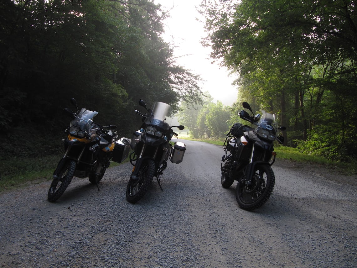
Photo: Paul Beattie
Harold’s bike The newest of the three, this bike had just 2,000 miles on the clock at the start of the TAT. Modifications are minimal and include a taller screen, Trax panniers, and HID headlight
Paul’s bike The only UK-registered among the fold, it set out with 10,000 miles on it. Modifications include Adventure Spec crash bars (which took a hell of a beating), sump guard and luggage rack as well as Metal Mule pannier rails – the boxes stayed at home!
Aaron’s bike A tried-and-tested adventure machine, Aaron’s bike had already clocked up 48,000 miles before the TAT. Modifications include Sargent seat, Denali lights, Metal Mule panniers, Wunderlich throttle lock, BMW crash bars and Ohlins progressive fork springs and custom rear shock. And lots of stickers from previous travels…

Photo: Paul Beattie
Who’s Sam Correro
We caught up with the TAT creator to find out what makes this 72-year-old pharmacist from Corith, Mississippi, tick
What’s your current ride? I have a Honda XR600R and a Suzuki DR 650; I’ve also owned a Honda XR400 and SL 350
What was your first ever bike? That was the SL350. I first started riding in 1970. I’ve wanted to ride bikes as long as I can remember…
What’s your favourite terrain? I’ve always preferred off-road riding on gravel, dirt and Jeep roads, and some back-road pavement, too
And your favourite route? I most like to ride my TAT!
What inspired you to create the TAT? I wanted to find a way to get away from cars and trucks and to enjoy the outback of the United States
What was involved in developing and devising the route? When I first started the TAT, I was just looking for a different adventure on my motorcycle. I didn’t set out to create an outback crossing of the USA. I started with just riding Mississippi (my home state) and that turned out very well; then I added Arkansas and just kept going until I ended up at the Pacific Ocean in Oregon. The ride just seemed to fall into place, state after state. The real work involved the long hours spent each day riding out the route that I had chosen from hundreds of maps, so I could find a doable route
What was the biggest challenge? Finding a way to cross rivers and interstate highways, and trying to avoid large towns and cities. I also had to find gas stops and motels that were in easy reach of the trail
Which is the toughest section to ride? That would be Colorado because of the ‘snow window’, the altitude and the rock-slides. Some sections of the original route weren’t very well cared for by county maintenance, so after some years I rerouted the trail and made it less technical but I didn’t compromise any of the beauty of the Colorado Rockies
How long did it take to create the TAT and map the route? I had a full time job, and so I could only work on the TAT on weekends and vacations. It took me about 10 years to get everything done
What did you enjoy most about creating the route? Two of the most enjoyable things are how it has opened up an avenue of new friends, both national and international, and building something new and different which hundreds of ABRs enjoy riding
What kind of feedback have you had on the TAT? It’s hard to please everyone, but I can say that 99.9 percent of my riders have all expressed how much they have enjoyed this cross-country ride and how it has opened up a part of America that they have never seen before. This has made all of my hard work worthwhile and meaningful
What’s your favourite stretch of the ride and why? From Boise City, Oklahoma to Lake City, Colorado. It has everything, from the mountains in Northern New Mexico to the foothills of the Rockies to the high peaks of Colorado. It has dirt roads, gravel, mud, sand snow and rocks. It’s wonderful open riding as fast as you care to go and the countryside is beautiful
Do you have any new routes planned? I’m in the process of building a ride from Mexico to Canada called The Shadow of the Rockies. It intersects with the TAT in Northern New Mexico; it has similar elements, too. Both are a wonderful motorcycle adventures
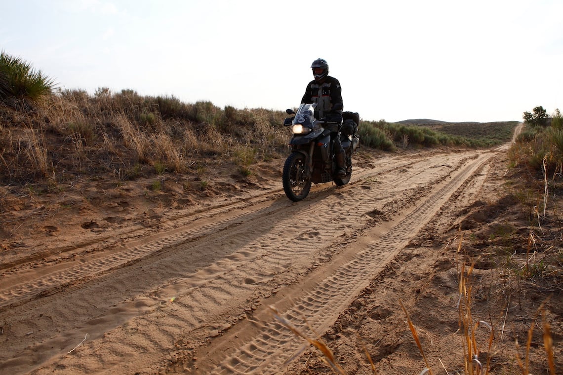
Photo: Paul Beattie
