The gorgeous Alps, home of the highest mountain in Western Europe, Mont Blanc, and thousands of other mountains that stretch out over more than 115,000-square miles. Every year, thousands of motorcyclists travel towards them to either find their thrills on the paved mountain passes or to travel along some of the most famous off-road routes in Europe.
We have ridden most of the well-known asphalt snakes during our previous travels, but too often they’re crowded with campervans and packs of motorcyclists and touring cars. The Stelvio, Gavia, Furka, Galibier and the Gotthard are all respectable and challenging paved roads with stunning views, but this year we set our eyes on the unpaved roads that few know about or care to visit.

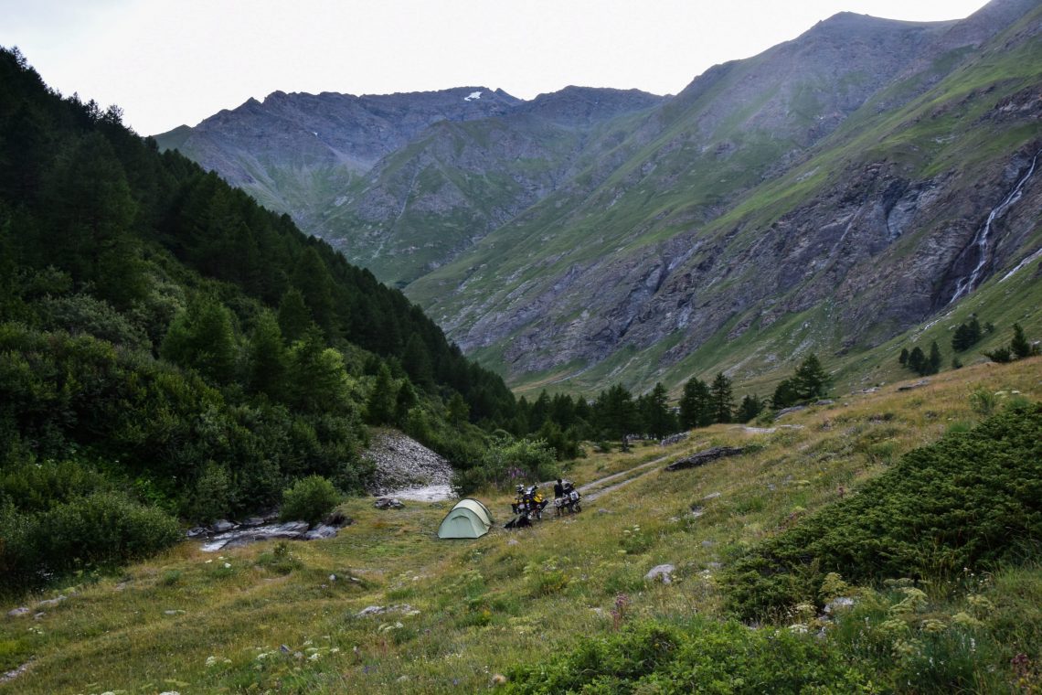
French Alps – Tignes
On the first evening of our trip we found ourselves in Tignes, France where we met up with a friend and his family. They were driving an overland truck and were planning to do more or less the same routes as us, with some exceptions where the big truck wouldn’t fit through certain tunnels. Our plan was to sleep underneath the truck as camping wasn’t allowed.
Just before calling it a night, a thunderstorm started to rage across the area, and we were invited to sleep inside their home on wheels. In the morning, we quickly packed up and hit the road, our route for the day looking promising.
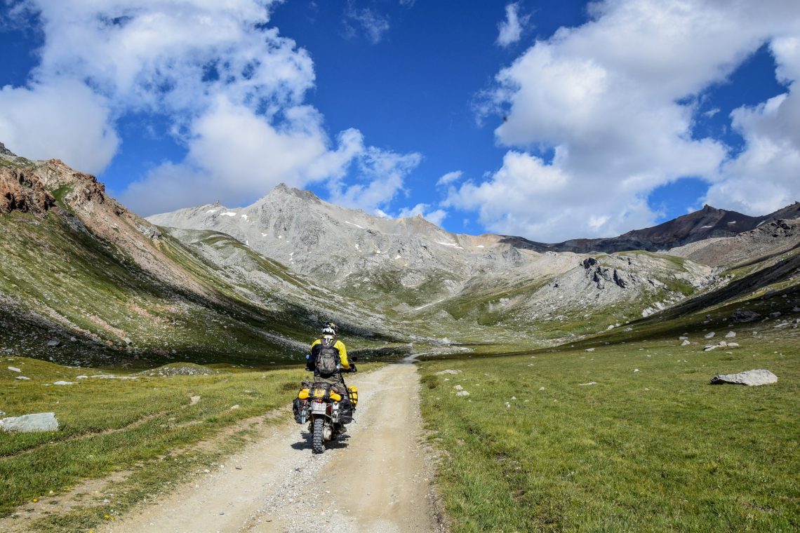
We started off with the Col de l’Iseran, the highest pass to be found in the Alps at 2,764m, and it’s not to be mistaken with the Col de la Bonette, which is the highest road in the Alps, but is not a pass. We were enjoying the many hairpins and stunning views to the max.

The Speedshop
One of my favorite border crossings from France to Italy is at Lake Mont Cenis. There are plenty of little roads to discover and ride around here, and if you’ve packed your picnic, there is a good chance that the marmots will pop out of the ground to find out who you are and why you aren’t giving them anything to munch on.
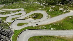
For those who have recently watched BBC Two’s The Speedshop you’ll recognise some of the trails from the route the boys took up and over the Alps. The map below roughly shows the route the team took (following the minor roads off of the main pass).
Starting in Bramans they follow the trails parallel to the main road before climbing those switchbacks up the mountains, stopping for the night at the fort (unmarked). Their route continued on the next day around the lake.

There are two roads that you can ride around Lake Mont Cenis, one paved and the other unpaved. I suggest that you take the unpaved route if you want a taste of adventure. On a sunny day, the blue colour of the water is probably the brightest I’ve seen in Central Europe, and it transforms the area into a little piece of heaven on Earth.
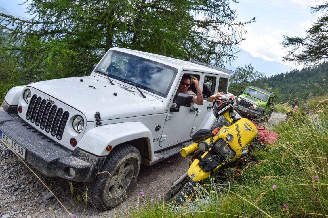
Afterwards, we took the ‘Pas du Paradis’ with some neat hairpins towards the Italian border. Our goal was to get to the campsite ‘Gran Bosco’, where a lot of aspiring off-roaders and overlanders gather because it is an excellent basecamp to leave your luggage behind, go riding a whole day and come back to your tent to chill out.
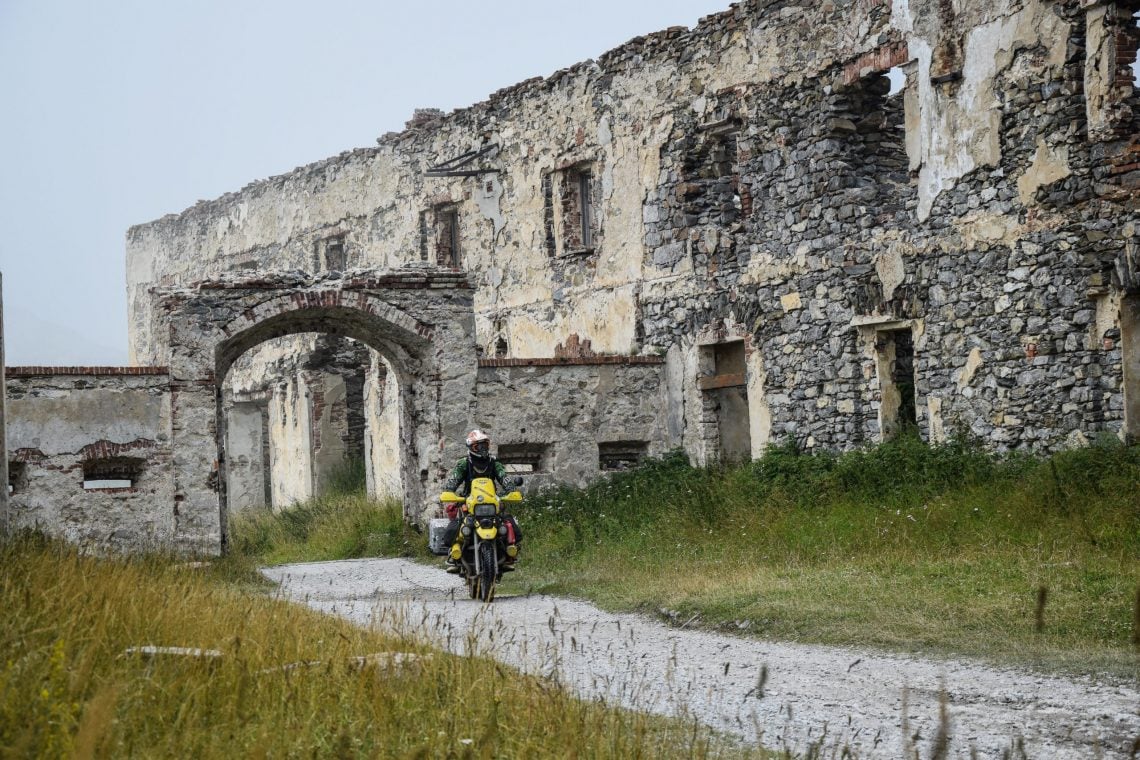
Fort di Exilles
There is a main road leading towards it, but the paper roadmap that we used indicated that there was small detour possible, featuring a ‘dangerous’ road towards Moncenisio.
We just had to check it out. As it happened, it’s a narrow single-track paved road with great views and a tonne of hairpins that’s worthy of any motorcyclist’s time. Towards the campsite, there is a huge fort, called Fort di Exilles, in the middle of the valley and, for the history lovers, it’s well worth of a visit.
After riding to the campsite we found ourselves in Gran Bosco Bart with what seemed like hundreds of other bikers, all with their own stories to share. The beer and laughter flowed until we retired back to our tent, excited for our first off-road passes in the morning.
The Italian side
Starting just a few miles away from the campsite and towards the peak of Jafferau, is the old military road which is known for its fort and majestic sights. That day, however, there was a blocked tunnel and a big sign with some markings on it in Italian which we couldn’t understand.
Strangely, our camera failed to cooperate at this point and only started to work again upon arrival at the base of the Colle del Sommeiller, home to the famous Stella Alpina rally, starting in Bardonecchia.
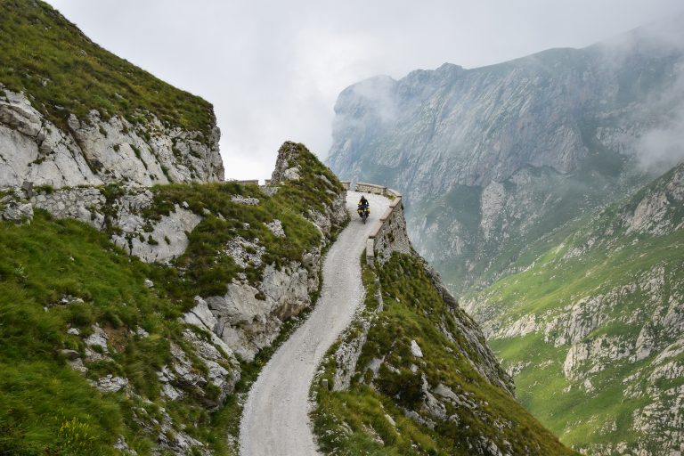
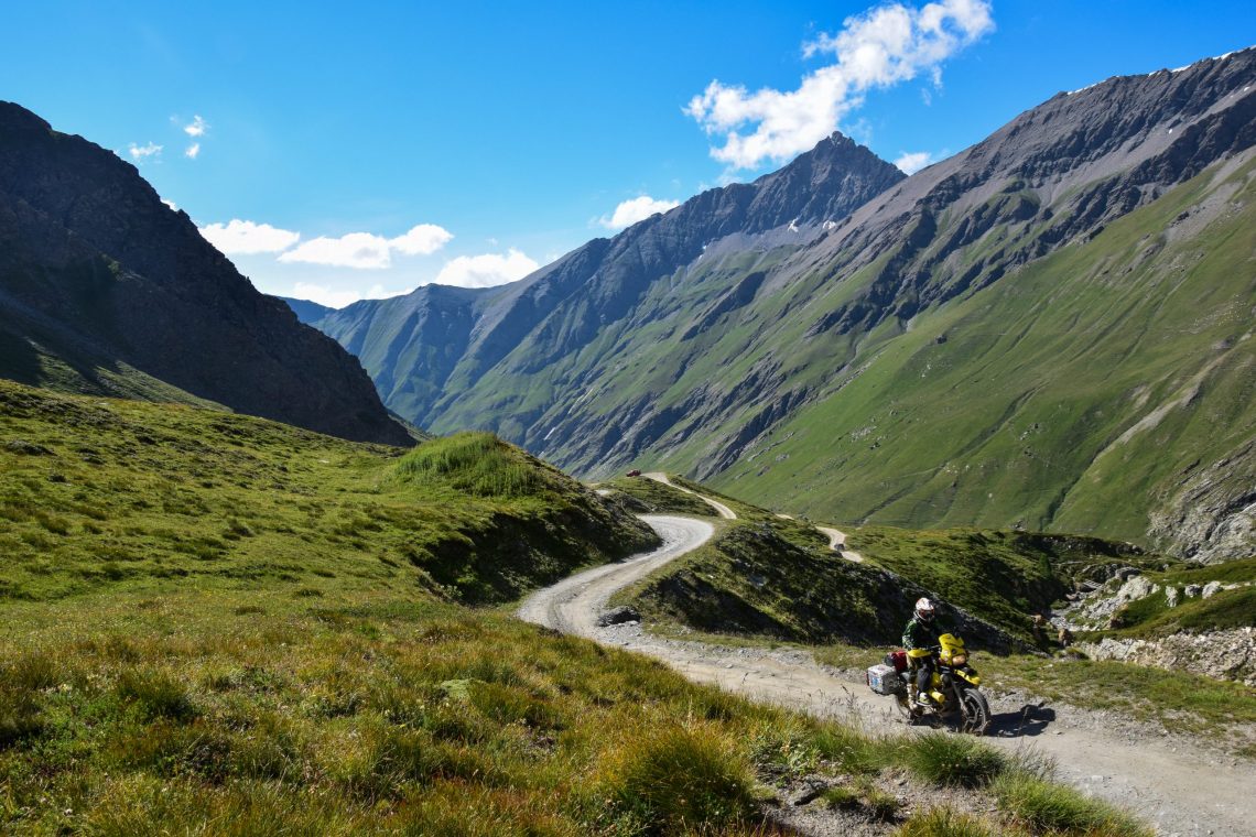
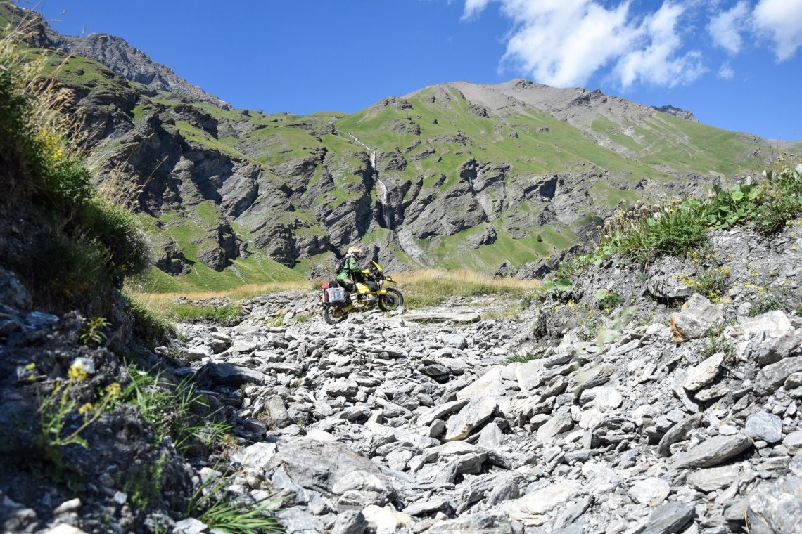
Our goal was to wild camp in the valley, but first we wanted to reach the lake at the summit. I highly recommend riding this pass later in the afternoon when most of the crowds are gone. The Sommeiller is a well-known pass and attracts many visitors, both on motorcycles and in 4x4s. Riding towards the peak of the pass can be tricky at times, especially with a bigger bike carrying luggage, but it is definitely not impossible.
Up into the snow
Our bikes danced around and over the loose rocks on a path that was just a few metres wide, with the abyss right by our side reminding us to not make any mistakes. It really is a long way down at some points! The hairpins located towards the end of the trail are particularly steep, and make it tricky to maneuver the bikes, but the sights every time you glance down make it all worthwhile.
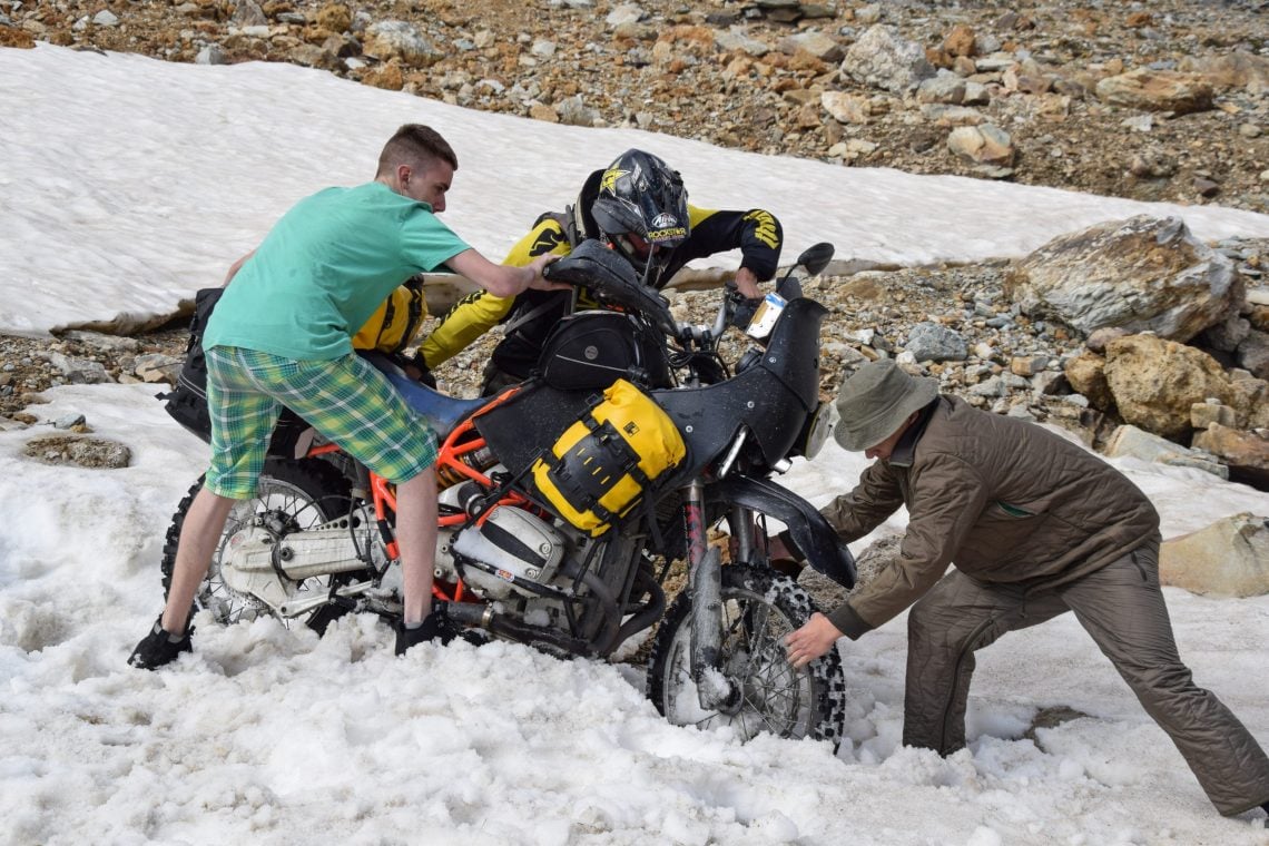
Even though it was august, we encountered snow just before getting to the summit. I was riding first, making tracks, when I heard Bart in the intercom telling me that I could just carry on through it as it didn’t look too deep. Well, that was a lesson for me in not trusting anything but your own gut! My GS decided that it was the perfect time to make a little snow angel, and flung me out of the saddle after hitting a rock buried by the snow.
Before I realised it, people had already come down to help me get the bike up and out of the heaps of the white stuff. The kind men were already watching us from above, thinking that we were probably loonies as we didn’t take the obvious detour past the hairpins and towards the summit.
A team effort
Bart’s bike got stuck too, and a poor lad that was traveling along in a 4×4 came out to help in his shorts. He promptly got snow sprayed by the rear tyre, but he was true of heart and had a great laugh at his own expense.
So, despite the difficulties and some winter fun, we finally reached Lake Sommeiller, where we took a moment to take the majestic natural beauty in. The faint mountain ranges on the horizon, the snow topped peaks and the sound of silence, it stilled my wanderlust for a moment.
Some metres behind the lake sits the border of Italy and France. Up here, in the solitude of the mountains, it seems like such a silly thing; an imaginary line that tells us which country owns what patch of land.
Having found a sense of peace after the ride up, we enjoyed the descent even more. The sun was slowly setting while we made camp in the valley near a stream. Our canned camp fire food had never tasted so good.
Flirting with borders towards the sea
It seems to be a fact of life that the early bird catches the worm, so we set off south at the break of dawn. The whole day we flirted with the French border, trying to ride as many little roads as we could.
I wanted to see Fort Centrale, I’ve seen the ruins of the military structures in dozens of pictures from fellow travellers, so it seemed only right to want to see them for myself.
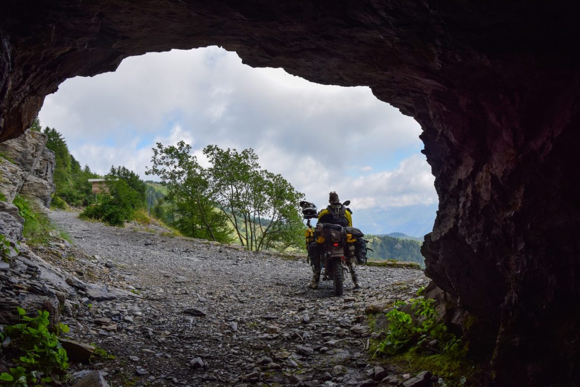
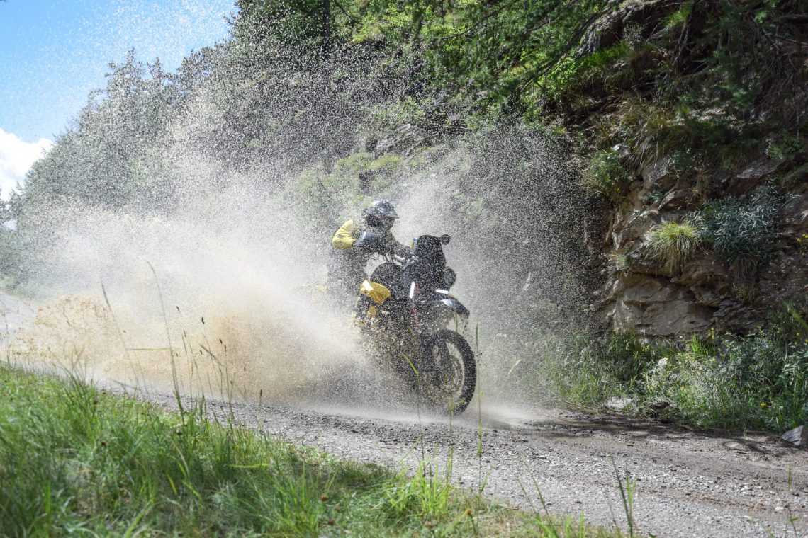
Fort Centrale is located near the Col du Tende, and since we were in the area already, we rode down and back up the pass, enjoying the few wide gravel hairpins as we went. Next up was Via del Sale, and surprise hit us when we reached the start of it at the Italian border. The route has become a toll road! Fortunately, it isn’t too expensive.
We had read that Via del Sale was not for novice riders, but in reality, it was quite the opposite. The white gravel road is easy to ride, even in the thick fog that surrounded us, and we had finished the trail before we knew it.
This Ligurian road used to be a famous salt trading route, hence the name (literally meaning street of the salt). Over the years, the road became fortified and broadened in parts, allowing the development of military roads, which connected the infrastructures in the mountains.
A dangerous route
The sun had set while we were busy riding, so before we knew it, it was time to make camp again. Since we had no intention of riding towards a campsite, we set up along the forest road for a quiet night’s rest.
After just a few hours of riding the next morning, we caught a glimpse of the Mediterranean Sea in the distance, calling to us with the promise of a refreshing swim. But first, we needed to ride some more rocky mountain roads in order to get there.
On one of them, we encountered a cow that had just given birth to the cutest little calf that hadn’t even taken its first steps. We didn’t want to startle either of them, but we had to pass them. The mother was extremely friendly towards us and even drank water out of Bart’s hands. We got through the tunnel as quietly as we could, to leave them in peace.
After the proud mother cow and her calf, what followed was the most interesting trail that we encountered on the entire trip. It leads from Pigna towards Ventimiglia on the coast, and it is also marked as a dangerous route on our map, but this time I actually agree with the rating. I wouldn’t want to take a street bike here. Big chunks of rock on steep hills made my GS dance the whole time.
Bart shouted in the intercom that he was going ahead, and that I should take my time on the trail. My reply, “I’m right behind you”, made him laugh and plead with me to slow down and be gentle on my suspension. In Ventimiglia, we found ourselves a nice camping spot within walking distance of the sea and enjoyed a day’s rest at the beach. Like real tourists.
Towards home
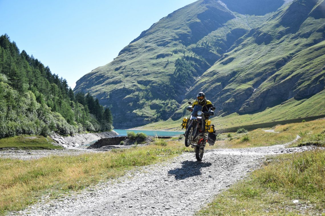
All good journeys have to come to an end, and we were also obliged to start our return trip. We mapped out some more gravel roads leading north towards the park of Mercantour, taking our time to just enjoy our last few miles in the mountains.
Heading towards Col de la Bonette, we were actually too late to ride it completely, and it would have been a shame to ride the highest road in the Alps in the dark, so we decided to call it a day when we saw a small restaurant. Later, we found out that this is the ‘Restaurant Le Pratois’, and I can highly recommend it.
After having a great meal, Bart and I asked the owner if there was any place nearby where we could sleep, but he informed us that it is forbidden to pitch a tent in the national park. Tired, we had to find another solution, so we found a shack to sleep in.
Zero-star Hotel
It’s a zero-star hotel, but it would do for us. At dawn, the door looked like a smiley greeting us with ‘good morning’, and Bart had a little surprise for me too. There was another off-road pass that we could take on our way home, the Parpaillon. Leading from La Condamine-Châtelard towards Saint-André-d’Embrun.
I have to say, I was very surprised by this route. It has everything an adventure rider would want. Steep rocky hills, smooth gravel, a great viewpoint for lunch and a cool tunnel. What more could one want, except for it to be longer and traverse continents?
As we were busy munching on our roast chicken that we bought in the town before hitting the track, we saw two motorcycles approaching from the distance, travelling really slow. By the time they got to us, we had finished our lunch and our bikes were in the company of two naked bikes, a Street Triple and a SV 650 N.
Far from the tarmac
The guys riding them were clearly exhausted from rolling their bikes in neutral down the rocky trail, and asked us how far away the tarmac was. We had to disappoint them, the way down was, for them, still a long way to go. One of them started cursing in Italian, and I couldn’t help but really feel sorry for them.
When we could no longer see them in the valley below, we set off for the final piece of the track, with a little bit more speed than before, looking for some final thrills, knowing that this would be the last stretch of gravel that our tyres would see before we got home.
We ended our trip in Dijon, where we hit the motorway home. It was almost impossible to believe that that morning we had woken up in a shack somewhere next to the Bonette, then rode an off-road pass at an elevation of 2,780 metres, and within a few hours we were back home, in our own bed and missing our little tent.
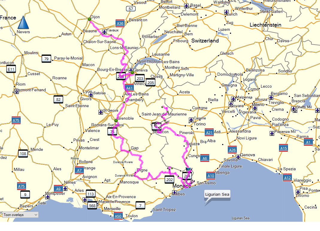 A rough map of the route