Please bare with me although I use a TomTom for work and have had one on my bikes for the last 10 years. I prefer maps but see the use in gps. I know how difficult it can be finding lanes and linking them up so doing it in a foreign country is not going to fly.
I don't seem to be able to grasp what gps unit I need, to be able to download and read from to navigate sections the TET
Emma has a tomtom rider 400 but I don't think that has much in the way of unmade roads either.
I keep hearing either Montana or smartphone app.
I don't have a smart phone and have no desire to have one either plus one drop and it could be done for. The Montana seems very expensive maybe its brilliant and is the only one that will really do the job. What about the Oregon from garmin or the gpsmap64
http://www.gooutdoors.co.uk/garmin-gpsm ... le-p305439 what about this ?
I think you can upload maps to Garmin devices for free but that only works if the device can read and display what you need.
Any helpful advise will be gratefully received
Thanks
Mike
Gps for TET
-
minkyhead
- Posts: 4343
- Joined: Tue Sep 07, 2010 2:31 pm
- Has thanked: 570 times
- Been thanked: 894 times
Re: Gps for TET
theres quite a few threads on sat navs and smartphones
ive used a few different navs nuvi road angel c60s etrex
phones are more robust than you imgine if you mount em right and have a bit of luck along the way and having a phone and a sat nav for one to back the other is a good thing
my vote would be just bite the bullet and get a montanna ..i think they are the best out there for adv /trail riding and amazingly easy to use
the 64 is a more advanced c60csx and trust me having had one they are not very easy to use stationary and the screens are small and the button scroll system a pain in the ass on the move they are near impossible to opertate with gloves on harder to work with and harder to understand if your fairly inexpierianced with sat navs it is not a easy unit to work with
..the montanna touchscreen is light years ahead in every way in terms of ease of use ..practicality on the move ...scrolling real time navigation ..screen size/resalution mounting options ..i really hated the c60
im sure a more knowlagable guy would make it work ok and they do but it was a pain in the ass to me ...probably best suted to a walking application which in fairness is what its for i think ..but its disadvantages compared to a montanna are many
at 270 your knocking on towards a montanna ..you can get gb discoverer full o/s maps for twenty quid and al euro tet maps here for nothing ..http://garmin.openstreetmap.nl/
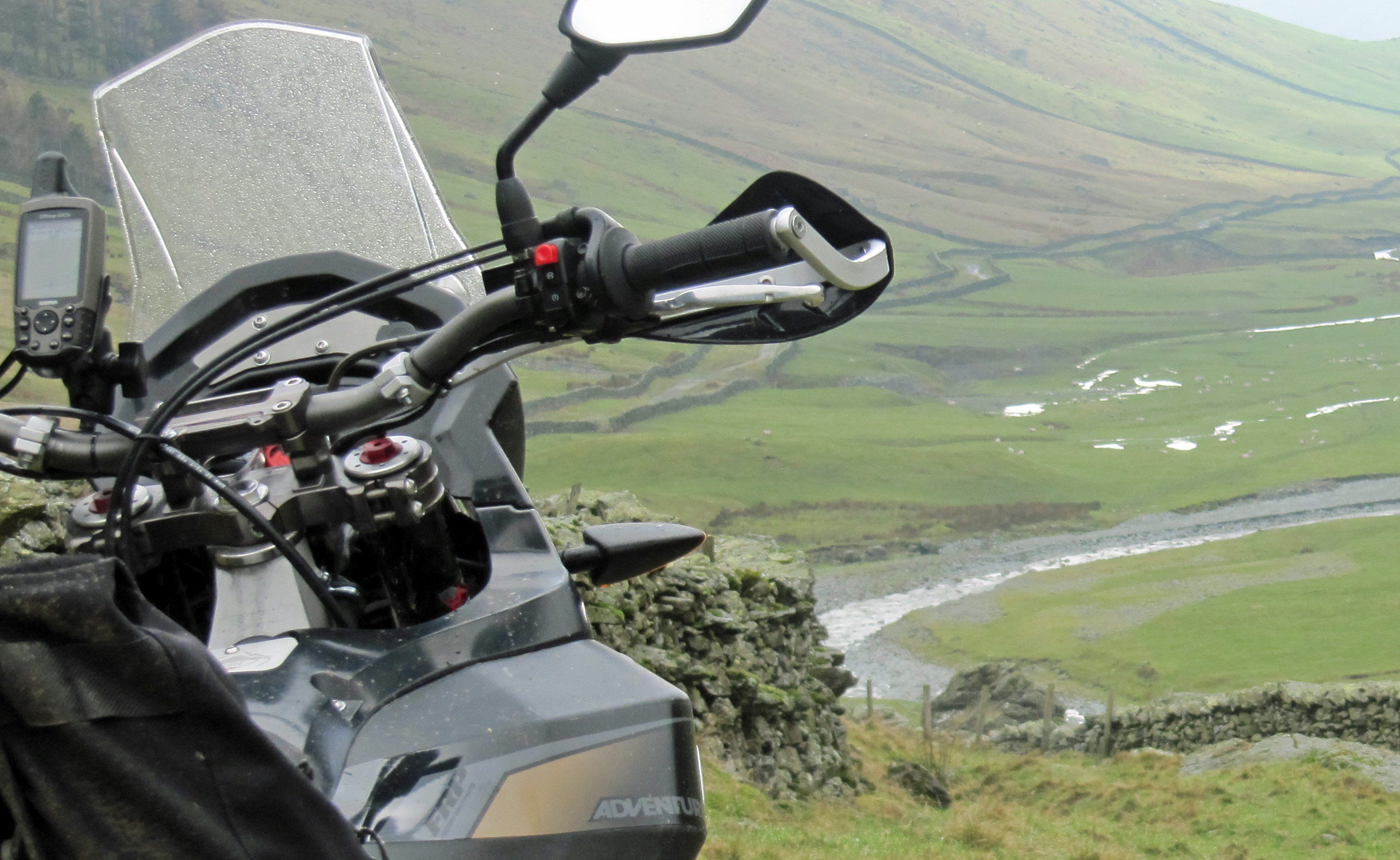 aaaaaa by minkyhead56, on Flickr
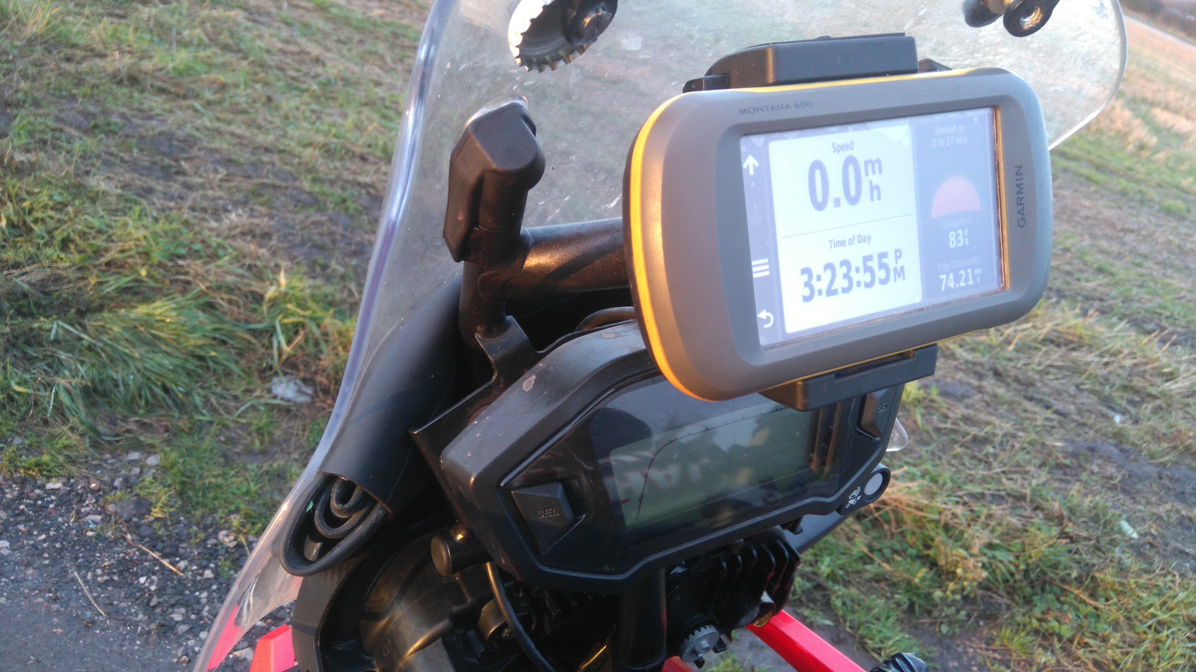 DSC_0831 by minkyhead56, on Flickr
ive used a few different navs nuvi road angel c60s etrex
phones are more robust than you imgine if you mount em right and have a bit of luck along the way and having a phone and a sat nav for one to back the other is a good thing
my vote would be just bite the bullet and get a montanna ..i think they are the best out there for adv /trail riding and amazingly easy to use
the 64 is a more advanced c60csx and trust me having had one they are not very easy to use stationary and the screens are small and the button scroll system a pain in the ass on the move they are near impossible to opertate with gloves on harder to work with and harder to understand if your fairly inexpierianced with sat navs it is not a easy unit to work with
..the montanna touchscreen is light years ahead in every way in terms of ease of use ..practicality on the move ...scrolling real time navigation ..screen size/resalution mounting options ..i really hated the c60
im sure a more knowlagable guy would make it work ok and they do but it was a pain in the ass to me ...probably best suted to a walking application which in fairness is what its for i think ..but its disadvantages compared to a montanna are many
at 270 your knocking on towards a montanna ..you can get gb discoverer full o/s maps for twenty quid and al euro tet maps here for nothing ..http://garmin.openstreetmap.nl/
aaaaaa by minkyhead56, on FlickrDSC_0831 by minkyhead56, on Flickrwhats the wether forcast ..wheres me map
-
WillS
- Posts: 584
- Joined: Sat Apr 27, 2013 10:48 am
- Location: France Pyrenees
- Has thanked: 246 times
- Been thanked: 109 times
Re: Gps for TET
Another recommendation for the Garmin Montana. Great bit of kit, easy to use on the trails, free maps from OpenStreetMaps.
You will need a PC and Garmin BaseCamp that's also free to download. Easy to add the gpx files and also to export into BaseCamp after the ride to keep.
Plenty of extras and powered mounts for the bike.
Started with the 60CSx, but as Minky says the Montana is far better, and can store 1000's of waypoints.
Would not travel the trails without the Montana.
Worth the investment...
-
RichP
- Posts: 270
- Joined: Mon Sep 24, 2012 9:14 am
- Location: Leicester
- Has thanked: 24 times
- Been thanked: 45 times
Re: Gps for TET
I agree with the advice from Minky. I went from a 60csx to a Montana about 4 years ago and find it much easier when riding. I used it for doing the TET in the Balkans earlier in the year and had no issues. Yes, they are a bit pricey but it's money well spent.
-
WIBO

- Posts: 1598
- Joined: Sat Sep 22, 2012 3:37 pm
- Location: French Pyrénées
- Has thanked: 612 times
- Been thanked: 648 times
Re: Gps for TET
Hi Mike
As Willy Spray et al state...I'm one for the Montana too.
If you have a wee peep here....? If pics don't show up use Firefox browser with an extension to see photo bucket images...it'll work then.
https://adventurebikerider.com/forum/vi ... 0&start=40
I only use base camp to store my routes on, after that I can work out anything else on the GPS itself under route planner.
The best way to get used with it is to constantly mess around with it. As you can see in the link above the nine icons I have dialled in that work for my riding situation covers everything I need at one touch.
You can stash your trails on wikiloc.com or any other similar site. What's good about wikiloc is that there's an icon just for Garmin downloads.
Open Street Maps are free and will route from one off road point to the other, generally.
I ordered mine from the USA all in for 324 euros back in the day. It's had a few tumbles and it's now on it's last legs. I'll buy another when it finally zaps.
Once dialled in to your personal taste it's invaluable....handy too, is the bluetooth transferring of routes between GPS..another rider can ping you a plan and off you go.
Mess around constantly and the penny will finally drop.
Best of luck

.
As Willy Spray et al state...I'm one for the Montana too.
If you have a wee peep here....? If pics don't show up use Firefox browser with an extension to see photo bucket images...it'll work then.
https://adventurebikerider.com/forum/vi ... 0&start=40
I only use base camp to store my routes on, after that I can work out anything else on the GPS itself under route planner.
The best way to get used with it is to constantly mess around with it. As you can see in the link above the nine icons I have dialled in that work for my riding situation covers everything I need at one touch.
You can stash your trails on wikiloc.com or any other similar site. What's good about wikiloc is that there's an icon just for Garmin downloads.
Open Street Maps are free and will route from one off road point to the other, generally.
I ordered mine from the USA all in for 324 euros back in the day. It's had a few tumbles and it's now on it's last legs. I'll buy another when it finally zaps.
Once dialled in to your personal taste it's invaluable....handy too, is the bluetooth transferring of routes between GPS..another rider can ping you a plan and off you go.
Mess around constantly and the penny will finally drop.
Best of luck
.
Will It Buff Out?
Re: Gps for TET
Thanks for the input kind people its appreciated.
So the next question is which Montana, there appears to be different numbers 600 610 650 680 with different options
any thoughts perhaps one is less complicated easier to use ??
Mike
So the next question is which Montana, there appears to be different numbers 600 610 650 680 with different options
any thoughts perhaps one is less complicated easier to use ??
Mike
Two wheels roaming. My FB page
-
WIBO
- Posts: 1598
- Joined: Sat Sep 22, 2012 3:37 pm
- Location: French Pyrénées
- Has thanked: 612 times
- Been thanked: 648 times
Re: Gps for TET
Personally I don't need a camera on a GPS so if it were I, the cheapest one you can find......all the models basically do the same thing.
Will It Buff Out?
Re: Gps for TET
Excellent thank you that's all I need to know
regards
Mike
Two wheels roaming. My FB page
