
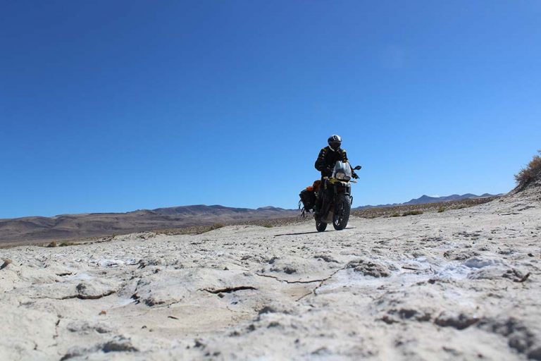
John Hax finds solitude as he rides the Utah and Nevada sections of the historic Pony Express Route
“Safety Notice:” the sign read. “Travel Ahead is through Extensive Desert Regions; Extra Fuel, Water and Provisions Recommended”.
What a beautiful sign! Most people would call it foreboding, a dire warning of danger ahead. ‘Turn around!’ It may scream to some. But to those in the adventure riding community, a sign like this is a siren song saying ‘come hither, follow me. Th is your path’. For others, it may seem like a challenge: ‘Hey, you on the fancy bike, nice knobblies. Have they ever seen any real dirt? Scared of a little heat and sand? Th ink you can go eight days without phone signal?’
Personally, the sign reminded me of a beautiful woman with a raspy voice that I met in a dingy bar, challenging me to do tequila shots at two in the afternoon. Intriguing, yes. Crazy, quite possibly. An unpredictable adventure, definitely. Ever the cautious one, I say “Let me choose the tequila and you are on!”
Founded in 1860, the Pony Express is a 1,900-mile historic mail route that follows wagon trails along the ways used by people immigrating to California. In 1848, gold had been discovered in California leading to the California Gold Rush and a population explosion. Th e eastern United States had been settled to the Mississippi River and a fast, reliable mail service was needed to ensure adequate communication between the eastern United States and California.
Starting in St. Joseph, Missouri, the Pony Express follows the valley of the Platte River in eastern Nebraska as it gradually ascends to 1,200m and the Great Plains of the upper mid-west. Think Dances with Wolves, the classic Kevin Costner movie. Passing through a low pass in the Rocky Mountains, it drops down south of the Great Salt Lake and into an area geographically referred to as the Great Basin. High in elevation and desolate, the Great Basin has some of the best adventure riding in the United States.
Why is it so good? First off is the desolation. A good adventure ride gets you off the grid. Punch ‘night view of United States’ into Google and click on the satellite image. That big dark spot on the left side of the picture; that is the Great Basin. The Pony Express runs right through the middle of it.
I started the ride outside of Vernon, Utah where there is a small diner and gas station run by three pretty sisters. Go figure. I made a final call to the Mrs. and set the expectation of one text a night on the Garmin, plus checking in when I hit a town. It’s important to set expectation on a ride like this.
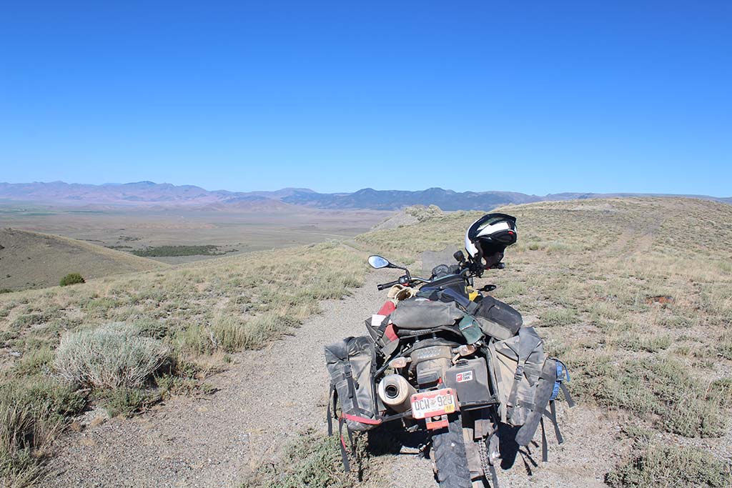
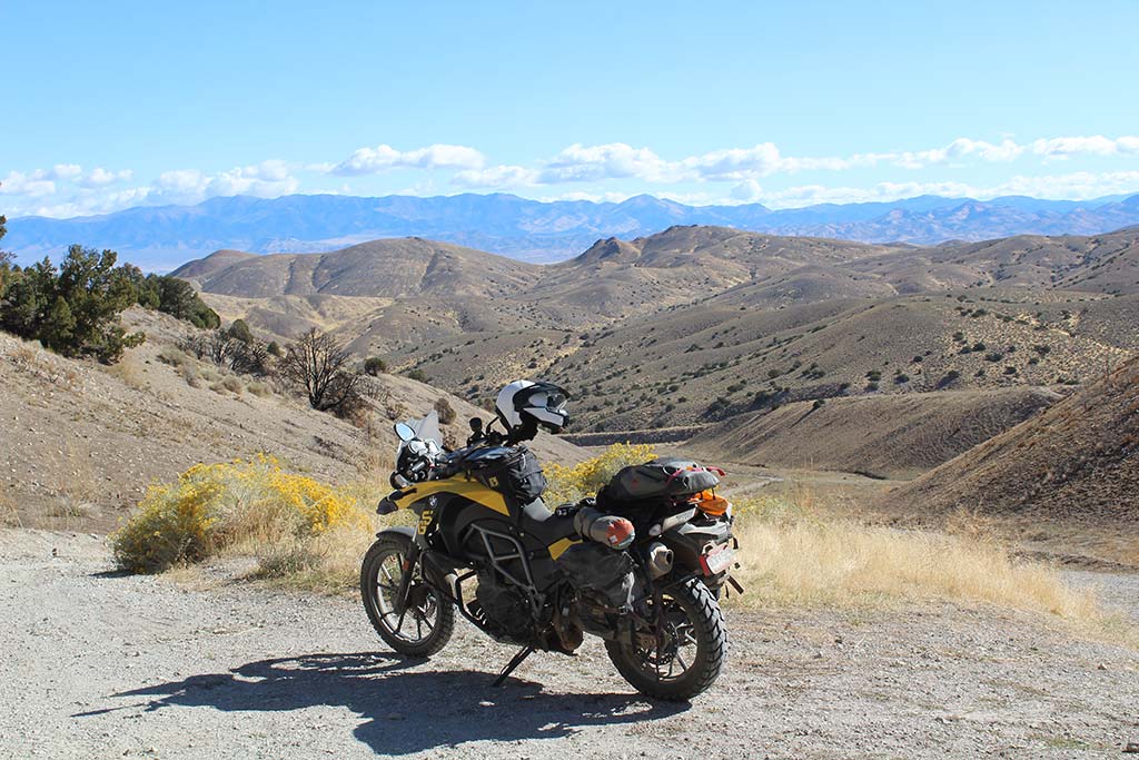
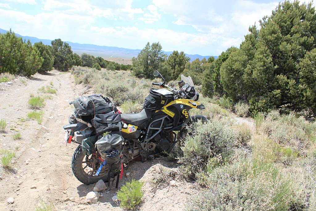
The bike, everyone always cares about the bike. I have a garage full of 2016 F700 GSs but I still prefer my 2012 F650GS Twin. One big reason; I can pick it up. Enough said! The problem with riding the western US is that there are days you wish you were on a big 1200 and other days you pine for a 250. Th e only change I made to the bike was changing the front sprocket from 27 to 26 teeth and adding a Camel Tank,
Wolfman Bags and Touratech skid plate and bars. I think we worry way too much about what we ride instead of where we ride. As for provisions, I carried 4.5 litres of water plus a water fi lter, food for a week, extra nutrition bars and, of course, a full tank of fuel plus the extra seven litres provided in my Camel Tank.
You will notice I have not mentioned GPS. To me, adventure entails uncertainty, and there is no greater uncertainty than navigating. I also once had a GPS unit fail on me in the burning oil fields of Kuwait. The resulting ‘adventure’ left me with a vehicle full of 12.7mm bullet holes and a strong dislike of certain navigation technologies.
From Vernon, the route goes due west on a graded gravel road. I had ridden the first part of this route before and was feeling good. Thirty minutes later, my bike stalled. Nothing like chasing an electrical problem in 40C heat. It was like my tequila drinking friend had offered my shot to another man. At least give me a chance to figure out how crazy you are! It was a Saturday, so four trucks hauling ATVs passed me while I tried to figure out the problem. One of them asked if everything was ok. With totally unwarranted confidence, I told him I was fine. Fortunately, the problem was as simple as an almost invisible loose battery cable.
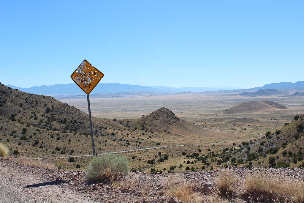
The state of Utah maintains this section of the Pony Express and so I proceeded at a good pace with occasional climbs of 300m through low passes. The Great Basin is bifurcated with low mountain ranges every 20 miles. Meaning that every 20 miles you have these spectacular views both east and west. The route is clearly visible and also well marked with bullet riddled signs. Yes, one of the great traditions of the American west is shooting road signs up with shotguns.
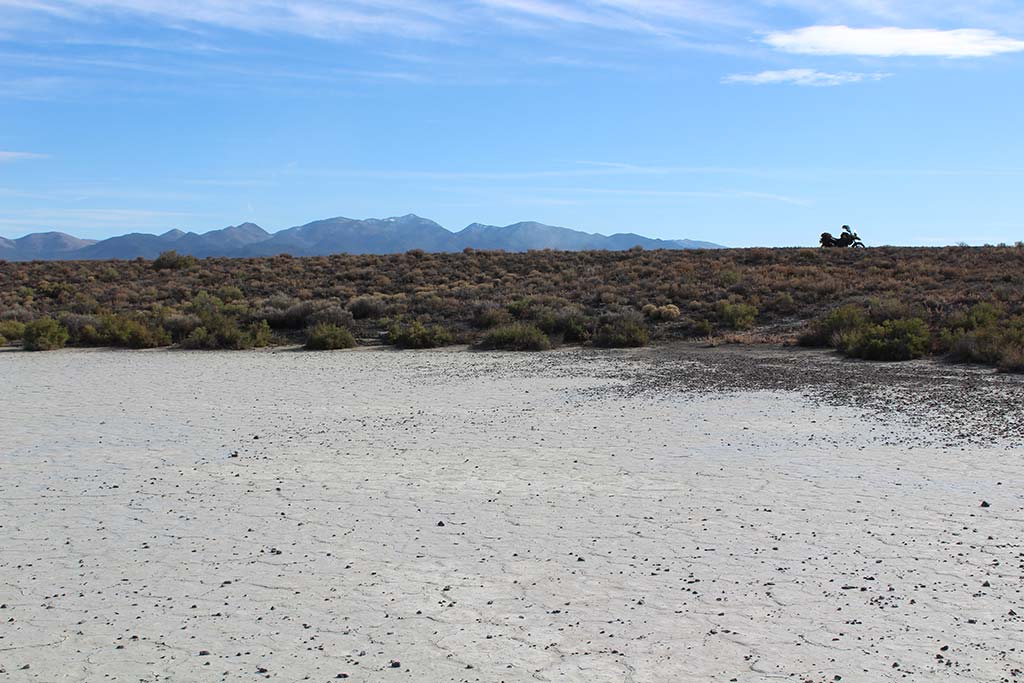
Along the way I spotted a mother and baby antelope. As soon as I dismounted my bike they took off running. Feeling like Ansel Adams with my new camera, I crept across the desert floor. An hour later, and feeling slightly foolish, I trudged back to my bike to continue to the empty Simpson Springs campground. With 35 sites to choose from, I found the one with the best view, opened a cold Upslope Ale, got out of my riding gear and threw out my sleeping bag, revelling in the utter quiet and solitude as I watched an amazing sunset over the jagged peaks.
Waking early, I explored the restored Pony Express station. There were 184 stations along the entire Pony Express Trail. The stations were often fashioned out of existing structures, several of them located in military forts, while others were built anew in remote areas where living conditions were very basic. 157 relay stations were located from five to 25 miles apart as the terrain would allow for. At each swing station, riders would exchange their tired mounts for fresh ones, while ‘home stations’ provided room and board for the riders between runs. Each rider rode about 75 miles per day and earned $100 a month.
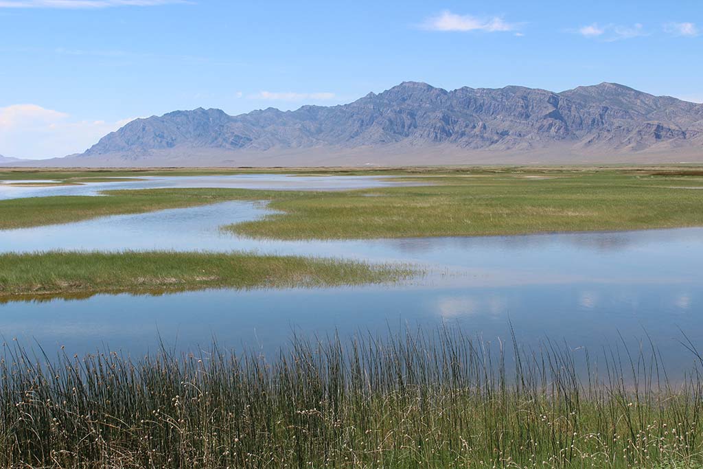
Day two would take me from Simpson Springs to Ely, Nevada. I stopped by Fish Springs National Wildlife Refuge on the way. Due to a quirk in geography, there are no natural drainages in central Nevada. Instead, the little rain that does fall is absorbed into the soil or flows to the lowest point. This results in huge natural springs and a very impressive array of birds. It’s really amazing to see the water and bird life in the 40-degree heat of the desert.
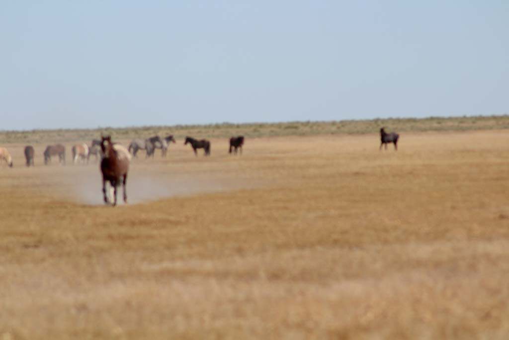
West of Fish Springs, I decided to try and get a close-up of some wild mustangs. I was about 100 yards away when the herd leader decided to charge me. I kept thinking of the guy killed by a grizzly bear in Denali National Park, where he was taking pictures of the bear charging him, without realizing how close the bear was. Surely this horse wasn’t not going to run me over, was it? When he was about 30 yards away I started backing away at a slow jog. I really had no idea what to do, but I wanted to show the horse that I had a little dignity. Seconds before I was about to find out how fast I could run in my riding gear, he stopped and decided not to trample me.
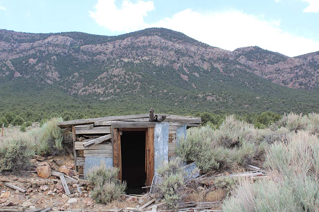
One of the amazing things about the West is that it still has ghost towns. Towns that were simply abandoned because the mine ran out or the water ran dry. One of these is Gold Hill, a collection of 12 abandoned buildings. The desert climate has preserved the buildings so well that I could almost envision re-opening the old saloon. I explored Gold Hill then headed down to Ibapeh and, just out of curiosity, further south to Goshute. There was no fuel or cell service in either town.
Entering Nevada, the Pony Express is not as well marked. I think the Goshute Indians like to mess with the signs. It’s better than killing Pony Express riders, which they were rumored to have done. To give you an idea of the remoteness of the reservation, it is worth noting that the Goshutes volunteered to have a nuclear waste storage facility opened here. In any case, they have replaced horses and tepees with pickups and mobile homes.
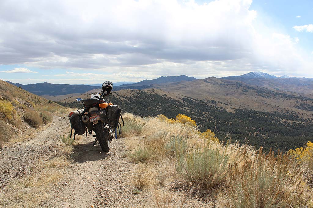
The riding was really fun and it’s nice to get away from maintained gravel and on to something a little more challenging. I climbed over Rock Springs Pass, at 2,432m the highest point on the Pony Express, and crossed one more valley before reaching an unmarked fork in the road. The funny thing about the Pony Express is that it is well marked where the route is obvious, and not marked at all where it is not obvious. The narrow, two-track overgrown road which I chose was a blast, and eventually took me down to civilization and the main road into Ely, Nevada for the night; exhausted from riding over 200 miles in 40C heat.
I stayed at the Hotel Nevada in Ely, which once boasted of being the tallest building in Nevada. The hotel is lit up with a bright neon sign and the sidewalk in front has stars showing who stayed at the hotel in the 1950s. Long ago, the place lost all of its glory and its worn casino is thinly populated with aging gamblers who seem to spring from the faded, worn out carpet. Mindlessly pumping quarters into the slots, not so much gambling as killing time. I lay in bed, bathed with the glow of red neon from the giant ‘N’ two feet from my hotel room window, contemplating the next day’s ride and wondering how much longer the riding gods would smile on me.
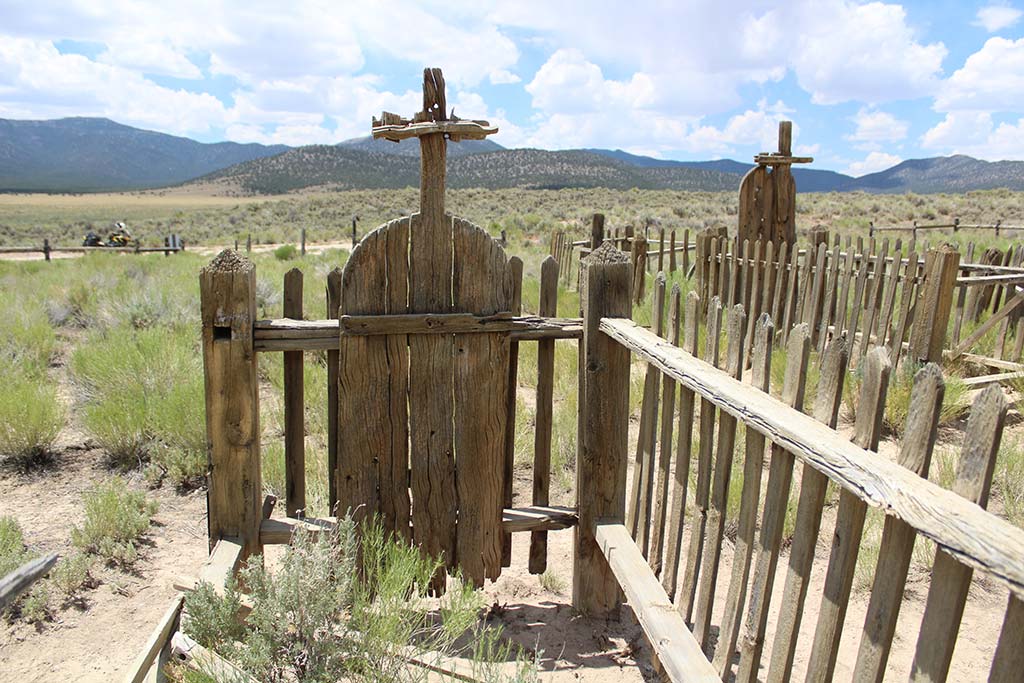
Heading out the next morning I stopped by the Ely District Bureau of Land Management (BLM) office. Besides having absolutely the best maps, many BLM districts have geologists or archeologist assigned, and fortunately the Ely district was one of them. The archeologist recommended I look for the Fort Pearce cemetery at the top of Egan Canyon. He also mentioned that, due to weather and trail conditions, the riders often had to take alternate routes. Egan Canyon provided fantastic riding, but it is impossible not to imagine being a Pony Express Rider.
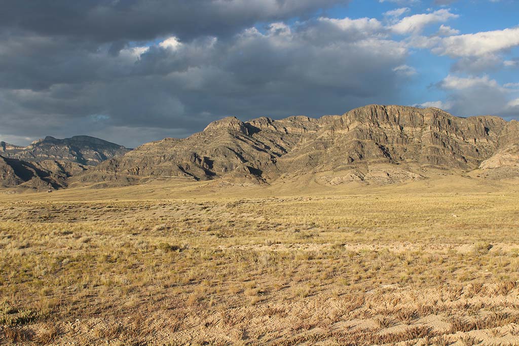
The canyon is winding and narrow, with towering black cliffs on either side, an ideal spot for an ambush, which is exactly what the Paiute Indians also thought, making this section of the Pony Express one of the most dangerous and deadly. After exploring an old abandoned mine, I topped out of the canyon and sure enough, off to the right was the old grave site. The site was from 1861 and contained three U.S. Cavalry soldiers and a Pony Express rider. 1862 is ancient history for Americans, and pre-dates the addition of Nevada and Utah to the United States. The graves were unmarked wood crosses and faded, but otherwise in good shape. I gave them a moment of silence and listened to the wind blowing through the sage before continuing up Cherry Canyon.
The road forked at the top and, without any obvious signs, I had to resort to the BLM maps. The key to navigating the Pony Express is to imagine actually riding it on a horse. The best choice is always the fastest route that takes you through the low point in the mountain range.
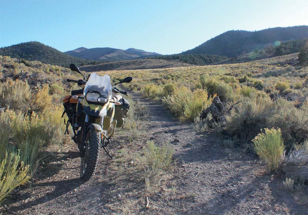
Most of the riding over the passes is loads of fun, and Cherry Canyon is no exception. Two-track and over grown in the middle with sage, I cruised along in third gear, looking for elk and wild mustangs, not having seen anyone for five hours. My sightseeing, of course, caused me to miss the small sign indicating my right turn. I tried to cut over to the other trail, but only managed to high centre my bike. The fun, and the challenge, of riding by yourself is that simple problems become difficult, and difficult problems become potentially catastrophic. In this case, the simple stayed simple and was solved by an hour of sweat as I wrestled my bike free and got it turned back around.
Most people think of Nevada as desert, and while this is true, the reality is that it is high desert divided by mountain ranges running north-south with 15-mile-wide valleys in between. The valleys have names such as Long Valley and Grass Valley, but in my mind, they should be called ‘Where Did the Trail Go Valley’. Most of them are in fact sinks, the water just pools and evaporates or soaks into the ground. They are alternately salt flats, bogs, or sandy and, on many occasions, the trail just disappears into the sagebrush.
Riding on the hard-packed mud, I was grateful that there had not been any recent rains when an antelope darted out about ten feet in front of me. He was a beautiful stag and tore off across the sage faster than I could have followed. I had once seen a wolf while riding in northern Nevada, and it always thrilled me to see animals associated with Africa while riding in the American West. The trail was rutted and sandy, and I concentrated on staying centered on the narrow rise when I finally reached the other side and stopped at the bottom of what was now a steep, loose and rocky trail.
I had been warned about this section by a couple of old cowboys I’d met earlier in the day. The hill was about two miles long and 600 vertical metres high, and after scouting the lower half I decided to give it a go. The trail curved to the right and flattened out for about six metres before getting steeper and looser. I was keeping good speed, but my event horizon was getting closer and closer. I saw the 18-inch rock step when it was a metre in front of me, and managed to crash my bike with one tyre over the step and my rear tyre spinning in the air about as freely as it was spinning in the dirt.
I like my Heidenau tyres, but there is a time and place for a TKC 80, and this was it. Still feeling confident, I wrestled my bike around, unloaded my Wolfman bags and hauled them the half-a-mile up the pass. Four hours later I enjoyed a beer at my campsite, exhaustedly gazing down on my bike at the bottom of the hill and watching three mysterious lights winking in and out on the western horizon, as I pondered the inevitability of UFOs.
After a night’s rest, I walked back to my bike, rode it back down to the flat spot and, giving it one more go, managed to get back to the spot I had just left. In disbelief, I finally acknowledged to myself that the trail had won. The more I tried the more I tore the trail up. Tired from picking my bike up roughly 20 times, and low on water, I headed back down the hill to find an alternate route.
Finding an easy route, I headed north around the Diamonds, past a massive gold mining project with cyanide warning signs and massive eight-metre high trucks, dust rising high in the air on the far side of the mountain from explosions. It was amazing that I could ride for hours and envision myself seeing the land through the eyes of a Pony Express Rider, and the next minute I was looking at billion-dollar mining operation.
I rode down to Eureka for the night and talked to the locals while enjoying dinner. Like many towns in Nevada, Eureka was a mere shadow of its former self. The downtown is full of abandoned motels and bars built in the height of the mining era. Many of the abandoned buildings are rumored to have ghosts and earlier in the year a ghost hunting convention brought 26 tourists to town for three nights. The locals and the mining companies blame the government. I listen, but choose not to mention the automated trucks I had seen that day. I left the next morning and rode for a solid five hours of enjoyable two-track trail across sage brush and salt flats. The only sign of humans was an abandoned ranch with two dead cows inside an old building.
The trail was becoming increasingly faint and eventually faded away, disappearing amongst fallen trees and rocks in the narrow canyon bottom. I could envision a horse riding through the canyon, but the trail was impassable on a big GS. I was disappointed, but since my goal is to scout the route for future tours with my company, 106 West Adventures, I know I have gained invaluable knowledge. I found an alternate route that picks up the Pony Express on the other side of the canyon, and enjoyed some technical riding before ending up in the magnificent Grass Valley. I climbed Emigrant Pass and descended into Austin, NV with its six bars, four hotels, and two restaurants; half of which were abandoned and the restaurant had a giant Trump flag waving out front. I’m pretty sure the Pony Express riders would be disappointed.
The next day was adventure riding at its best. Inaccurate maps, washed out roads, salt flats and stream crossings tested both my riding and navigating abilities. In several spots, the small twotrack road had been cut by metre-deep gullies that I was forced to either ride around or through. The trail eventually crossed a mirage of water in the salt flats before an absolutely epic ride through the Desatoya Mountains. Camping would have been great, but since my stove had broken, I opted for a lonely hotel and a cold beer. My breakfast in the diner was filled with TV images of 58 dead in Vegas and the disappointed looks of my fellow diners when they heard the shooter wasn’t of Middle East origin. Quickly departing the tragedy at the diner, I began my last day of the ride.
Day eight started with 50 miles of pavement where The Pony Express coincided with US Highway 50. Highway 50 crossed a US Navy bombing range, and the roar of their engines penetrated the vast stillness of the sage flats. Just before the trail disappeared in the salt flats, I came upon an old wooden cross right beside the route. It looked foreboding, and later I was to learn that the cross marked the grave of a cavalry soldier killed by Native Americans in 1860. The trail eventually re-emerged on a narrow bluff where it twisted and turned amongst the many gardens of lava rocks. The riding was challenging and I was thinking there was no way The Pony Express riders would have followed this route.
I descended into a narrow gully and crashed my bike into a large rock on the other side. It was slow and tiring riding, and I was very happy to finally hit a decent dirt road that brought me to Ft. Churchill. Ft Churchill was on the beautiful Carson River, and had a large fort which was home to a large contingent of cavalry. It was regarded as the end of the perilous Nevada portion of The Pony Express. Wanting to finish The Pony Express to Carson City, I followed Highway 50 and found the site of the original Carson City Station. In its place stood a modern post office with a replica Pony Express Station. The Pony Express lasted just a year and a half before being replaced by the telegraph. I hopped on my bike, put my back to the sun, and headed back east on Highway 50; America’s Loneliest Highway.
Riding the Pony Express Route
John was out scouting the Pony Express Route for his tour company, 106 West Adventures. He’s planning on running guided tours along the portion that he wrote about here, but if you’d like to tackle it yourself in the meantime, head to www.106westadv.com/news-2 for a full rundown of how to find the route, where to stay, and what to expect. If you want to ship your own bike over to Salt Lake City, ready to start the ride, at current prices airfreight from London costs from GBP £1,435 for a BMW F650 GS size motorcycle or similar. Head to www.motofreight.com for more information.
The Bike
Pretty basic: a 2012 F650 GS Twin. I have put in a smaller front sprocket and added an extension fuel tank from Camel Tank. A necessity when riding the big distances in the American West. Skid plate and crash bars are by Touratech. I’m not a big guy so I prefer the reduced weight of my Wolfman side bags. I don’t really use a GPS but carry an In-reach for safety. Because the West is so arid I also carry a good water filter.